Search Collections
- Object[273]
- no[273]
- american[273]
- armor[1]
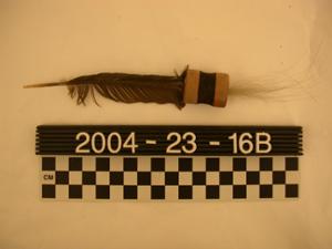
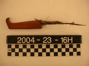
- arrow[1]
- arrow fragment[3]
- band[1]
- bar[1]
- bark[2]
- bidarka[1]
- bidarka rib[5]
- blade fragment[1]
- boat[6]
- boat model[1]
- boat part[1]
- body stamp[1]
- bow[3]
- bow drill[1]
- bow fragment[1]
- bow trigger[1]
- bowl[9]
- box[3]
- box fragment[2]
- canoe[1]
- charcoal[1]
- chip[3]
- chopped post[1]
- comb teeth[2]
- dart[1]
- die[1]
- digging implement[1]
- digging stick[2]
- dipper[1]
- disc[1]
- dish[1]
- figure four trap[1]
- figurine[2]
- finger wand[1]
- fish spear[2]
- fish trap[1]
- float[1]
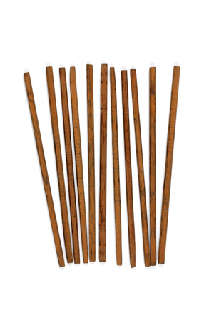
- game stick[11]
- harpoon[1]
- harpoon head[1]
- hearth[1]
- hook[1]
- house post[4]
- kayak paddle[1]
- knife[7]
- knife handle[2]
- ladle[1]
- mask[3]
- mask part[10]
- meat stick[3]
- model[12]
- mouthpiece[1]
- net float[3]
- net gauge[1]
- netting[1]
- netting shuttle[1]
- object[12]
- paddle[5]
- paddle blade[2]
- peg[6]
- pestle[1]
- pin[8]
- pin fragment[1]
- planing adze[1]
- plank fragment[6]
- point[3]
- post[3]
- projectile point[1]
- prow handle[1]
- pump[1]
- quiver[2]
- roasting stick[3]
- rod[5]
- scraper[5]
- scraper handle[1]
- shaft[5]
- sherd[1]
- shovel[2]
- shovel blade[1]
- skin stretcher[2]
- skinning knife[1]
- slab[1]
- sling shot handle[1]
- snow shovel[1]
- spear model[1]
- splinter[2]
- spoon[3]
- spoon handle[1]
- stake[3]
- throwing stick[1]
- tongs[2]
- toy[12]
- ulo[4]
- ulu[3]
- utensil[1]
- wood[40]
- wood fragment[4]
- wood fragments[12]
- admiralty island[10]
- alaganik[2]
- alaska[273]
- angoon[3]
- angoon area[10]
- anvik[14]
- blackburn[3]
- blackburn slough[3]
- british columbia[1]
- canada[1]
- chenega village[4]
- cook inlet[9]
- copper river[1]
- copper river delta[3]
- copper river valley[1]
- cordova[16]
- cottonwood creek (alaska)[1]
- daxatkanada fort[1]
- dolby[4]
- eliah sport's place[1]
- frank fox's place[1]
- ganaxcanuwu[1]
- haines region[1]
- hawkins island[10]
- hologochaket[3]
- holy cross[1]
- innoko river[7]
- juneau[2]
- kachemak bay[9]
- kaiyuh slough[8]
- kashim[4]
- kateel[4]
- kateel river[4]
- kateel village[4]
- ketintcian[9]
- khotol river[8]
- killisnoo harbor[9]
- kiniklik[1]
- knight island[84]
- kootznahoo inlet[2]
- koyukuk river[12]
- lost river[2]
- lower kaltag[1]
- lower yukon river valley[35]
- middle yukon valley[20]
- nessudat[2]
- new grayling[1]
- nuchek[1]
- nunivak island[11]
- old fish camp[4]
- old summer fish camp[1]
- old town[84]
- palu:tat[37]
- palugvik village[10]
- paul esmailka's camp[1]
- pillsbury point[1]
- prince william sound[47]
- shageluk[3]
- shageluk slough[1]
- sheep bay[1]
- tanana (alaska)[8]
- united states of america[196]
- women's fort[1]
- yakutat bay[86]
- yendestake[1]
- yukon island[1]
- yukon willow creek[2]
- yuto[1]
- yutogonodaldads[1]
- modern[8]
- old town[1]
- old town ii[21]
- old town iii[4]
- athapaskan[2]
- chilkat[1]
- chugach[31]
- chugach eskimo[3]
- dene[14]
- eskimo[23]
- eyak[4]
- haida[1]
- hologochaket[1]
- kenai[3]
- koyukuk[1]
- modern indian[9]
- prehistoric eskimo[47]
- prehistoric indian[4]
- tanana[8]
- tlingit[17]
- tsimshian[1]
- yakutat[10]
- yakutat (culture)[40]
- "mummies" cave at south end of island, d - surface[1]
- 1 mi. above and across from shageluk[1]
- 2 d, 2' - 2'6", vii[1]
- 8 mi. up blackburn slough.[1]
- b surface[1]
- beach[1]
- c - surface[3]
- c and d 1' and 4'[1]
- c and d, 1' and 4'[1]
- c and d, 1' to 4'[1]
- c surface[1]
- d near surface[9]
- d surface[1]
- d, 6" below surface[1]
- dark gray sandy midden[1]
- deserted house on other side of bay opposite seldovia[1]
- e 6" below surface[1]
- e surface[4]
- f surface[1]
- f1w - loose shell fill in large post hole[1]
- from a recently abandoned house.[1]
- hosue 12[1]
- house #7[1]
- house 13, floor[1]
- house 4[3]
- house 4, botom of pit d[1]
- house 5[1]
- house 6[2]
- house 8[3]
- house 8 fill, depth 37", dark gray sandy midden[1]
- house 8 fill, depth 48-50", in structure in subsurface pit #24[1]
- house 9[2]
- house 9, fill, depth 11"[1]
- house 9, just above floor, depth 21", tan sandy midden above rock[1]
- house 9, on floor in area of carbonized planks and wood[1]
- mound a - lower level. on yellow sand.[1]
- mound b[1]
- mound b, depth 22"[1]
- mound b, lower level[1]
- mound b, upper level, black sandy midden[1]
- mound b, upper level, depth 0-6"[1]
- near seldovia[1]
- near seldovia, abandoned house at jackeloff's place.[2]
- near seldovia, abandoned shed at jackeloff's place[2]
- northside, approx. 24" below surface behind school tool shed[1]
- scott's shed[1]
- section b, near surface[1]
- section c[1]
- section c, surface[1]
- section d[2]
- section d, near surface[2]
- section e, near surface[1]
- shiskin smokehouse[5]
- storage house[2]
- storage house - fill. subsurface pit 8.[1]
- storage house - just above floor.[1]
- storage house fill, depth 32", subsurface pit 15[2]
- storage house fill. subsurface pit #15, depth 32"[1]
- storage house, depth 38"[1]
- storage house, subsurface pit #15 probably placed between wall and floor, depth 47"[1]
- storage house, subsurface pit #15, on flooor next and under cordage[1]
- storage house, subsurface pit #15, on floor,[1]
- storage house, subsurface pit #5, fill, depth 39"[1]
- storage house, subsurface pit 15; on floor of box.[1]
- stratum iv bottom[1]
- stratum iv, 2f, level 10 and upper 11, hearth[1]
- stratum iv, 3c, bottom[1]
- stratum iv, extreme southwest corner of 2d[1]
- stratum iv, h, bottom. upright beside housepost (copper tag 1045)[1]
- stratum iv, lying horizontally near house post[1]
- stratum iv, lying horizontally under house post 1032[1]
- stratum iv, northwest corner of 1g, bottom[1]
- stratum iv,2c, level 107[1]
- subsurface pit #15[5]
- subsurface pit #15 south central part of box feature[1]
- subsurface pit #15, depth 32"[1]
- subsurface pit #15, depth 33"[1]
- tan sandy midden above rock[1]
- village site[1]

1 - 32 of 273 Records