Search Collections
- Object[278]
- no[278]
- american[278]
- body sherd[3]
- bone[2]
- bowl[2]
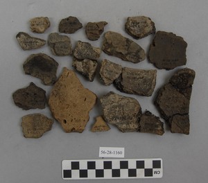
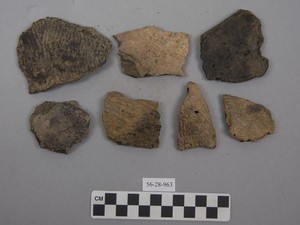
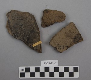
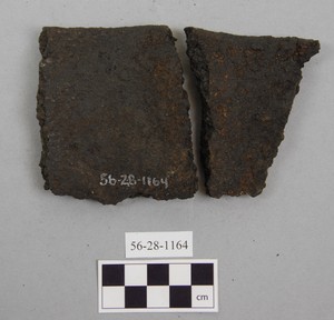
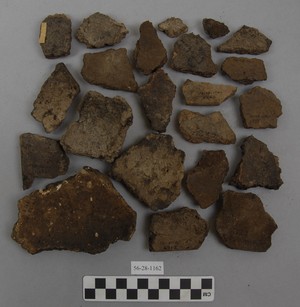
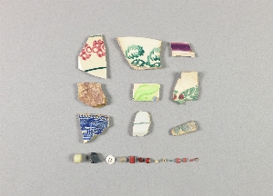
- ceramic[71]
- china fragment[2]
- china fragments[1]
- conglomerate[1]
- flake[1]
- flint[34]
- lamp[5]
- lithic[1]
- pot[1]
- potsherd[27]
- pottery[22]
- pottery fragment[20]
- pottery fragments[8]
- rim sherd[1]
- samples[1]
- saw[1]
- sherd[72]
- sherds[4]
- stone fragment[1]
- vessel fragments[1]
- adam's place[4]
- alaganik[1]
- alaska[278]
- aleutian islands[31]
- anvik[1]
- anvik point[1]
- anvik river[5]
- atnuk[13]
- attu island[20]
- bonasila[8]
- boswell bay[1]
- cape darby[14]
- cape denbigh[15]
- cape nome[112]
- cook inlet[1]
- copper river[1]
- eleven-mile village[4]
- frank fox's place[1]
- gadjujuinuk[1]
- hinchinbrook island[1]
- hologochaket[2]
- holy cross[1]
- innoko river[2]
- iyatayet[15]
- kachemak bay[1]
- kaiyuh slough[4]
- kaltag[1]
- kashim[1]
- kasitana bay[1]
- kateel[2]
- khotol river[4]
- koyukuk river[2]
- kugusugaruk[6]
- lower yukon river valley[21]
- middle yukon valley[6]
- mouth of kuskokwim river[1]
- north america[6]
- north slope borough[6]
- norton sound[29]
- okiaby[1]
- old fish camp[3]
- point barrow[1]
- point barrow region[7]
- prince william sound[1]
- shemya island[11]
- south spit[1]
- tanana (alaska)[4]
- tanana mission[4]
- unalakleet[64]
- united states of america[183]
- yukon island[1]
- yukon willow creek[1]
- birnirk[6]
- modern[2]
- prehistoric[8]
- aleut[11]
- eskimo[119]
- eyak[1]
- kachemak bay culture sub-iii[1]
- modern indian[1]
- norton[9]
- nukleet[5]
- paleo-eskimo[1]
- post-contact[20]
- prehistoric eskimo[1]
- recent eskimo[13]
- tanaina[1]
- thule[1]
- yukon[9]
- arctic culture area[278]
- "various houses".[1]
- 1 ' below surface.[1]
- 12-15" below surface[1]
- 3-6" below surface[1]
- 8-10" below surface[1]
- above floor of porch, house #1[1]
- above roof of house #2[2]
- above roof, house #1[1]
- all from midden in front of recent house ruin.[1]
- bank on e. side of stream mouth and beach[1]
- card reads "various (not given)".[1]
- chigurtaoq[1]
- depth uncertain[1]
- floor of porch, house #1[1]
- h12 / house 12[1]
- house #2[1]
- house #7[2]
- house 11[38]
- house 116[2]
- house 117[1]
- house 118[7]
- house 119[3]
- house 12[1]
- house 120[3]
- house 14[1]
- house 18[17]
- house 19[1]
- house 2[41]
- house 203[15]
- house 268[2]
- house 284[4]
- house 285[13]
- house 3[2]
- house 300[15]
- house 317[1]
- house 33[1]
- house 4[1]
- house 6[1]
- house 8[1]
- house ip[2]
- house pit[4]
- iy[1]
- iye6[1]
- iyh-7-w[1]
- iyhi uf 3[1]
- iyk-24[1]
- iype-7 up and mid.[1]
- iyr 1, 2[1]
- iyr 1,2[2]
- iyz 5[1]
- iyz5[4]
- kitchen midden[1]
- mad[1]
- midden.[1]
- mound 1[4]
- mound 2[1]
- mound 5[1]
- muller's garden and path to the beach.[1]
- n 0.25, w 0.25 - in level which is a continuation of house wall[2]
- n 0.25, w 0.75 - in compacted gravel level, which is continuation of house wall[1]
- n 0.5, w 0.75 - on compacted gravel level which is a continuation of house wall[13]
- n 0.75, w 2 - in level which is a continuation of house wall.[1]
- n 1.5, w 0.5 - in level which is a continuation of house wall[2]
- n 1.5, w 0.75 - in level which is a continuation of house wall[1]
- n 1.5, w 1 - in level which is a continuation of house wall[2]
- n 1.75, w 1 - in level which is continuation of house wall[1]
- n 2, w 0.75 - in compact gravel level which is a continuation of house wall (also associated with end blade)[1]
- n 2, w 0.75 - in compact gravel level which is a continuation of house wall. also associated with end blade.[1]
- n 2, w 0.75 - in level which is continuation of house wall[1]
- n 2.25, w 0.75 - in level which is a continuation of house wall[2]
- n 2.75, w 0.5 - in gravel level which is a continuation of house wall[1]
- n 2.75, w 1.5 - in level which is a continuation of house wall[3]
- n 3, w 1.25 - level which is a continuation of house wall[1]
- n 3, w 1.25 0 - level which is a continuation of house wall[3]
- n 3.75, w 3 - in level which is a continuation of house wall[1]
- n 3.75, w 3 - in level which is a continuation of house wall[2]
- n 4.5, w 5.75 - in floor[1]
- n 4.75, w 1.75 - in lowest level (of 3) below sand in ne quadrant[1]
- porch of house #1, level uncertain[1]
- s 9, w 3 - in middle floors[2]
- slope of terrace #2, at house #1[1]
- strawberry point[1]
1 - 30 of 278 Records

1 - 30 of 278 Records