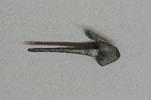
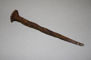
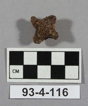
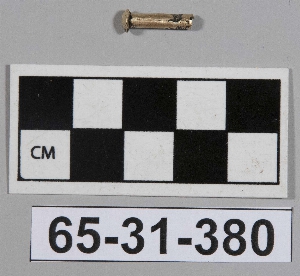
Search Collections
- Object[171]
- american[13]
- egyptian[12]
- mediterranean[37]
- near eastern[109]
- alaska[10]
- ardea[1]
- argolid[1]
- ayios ermoyenis[8]
- bahrain[2]
- bamboula[1]
- baq'ah valley[1]
- barbar temple[2]
- beth shean[5]
- billa[1]
- cabildo gramadales[1]
- cape nome[1]
- cheka sabz[1]
- crete[7]
- cyprus[9]
- dhiban[3]
- dra abu el-naga[1]
- egypt[12]
- etruria[4]
- ewing and bragdon site[1]
- fara[5]
- frenchman's bay[1]
- gibeon[14]
- gournia[1]
- great britain[12]
- greece[8]
- hancock county (maine)[1]
- hasanlu[50]
- inchtuthil[12]
- iran[60]
- iraq[24]
- israel[5]
- italy[5]
- jordan[4]
- khirbet umm ad-dananir[1]
- knight island[7]
- kourion[9]
- latium[1]
- leptis magna[2]
- libya[2]
- lost river[1]
- lost river site[1]
- maine[1]
- mediterranean[1]
- mit-rahineh[11]
- narce[2]
- nazca district[1]
- nessudat[1]
- nippur[12]
- old town[7]
- palestine[14]
- pennsylvania[1]
- peru[1]
- philadelphia[1]
- philadelphia county[1]
- qabr sheykhan[1]
- rayy[1]
- scotland[12]
- shallow river town[1]
- tepe hissar[7]
- tiryns[1]
- united states of america[11]
- ur[6]
- vrokastro[6]
- vulci[1]
- walnut street prison[1]
- yakutat bay[9]
- 18th century[1]
- billa iv[1]
- bronze age[1]
- byzantine[1]
- early arabic[1]
- hasanlu period iii[1]
- hasanlu period iv[37]
- hissar ii[2]
- hissar iib[1]
- hissar iii[2]
- i[1]
- ii[2]
- iii[1]
- late minoan i[1]
- old town ii[3]
- old town iii[3]
- pre-sargonic[4]
- prehistoric[2]
- roman period[2]
- 2[1]
- cg 25x1[1]
- court of tomb 158[1]
- dg 00[1]
- dump dirt[1]
- en 13, level vi-2[1]
- en 18, level vi, on floor[1]
- en, general, along the outside of the inside wall midway from ziggurat[1]
- found 3 1/2 to 5 1/2 m. below brick pavement dated ca. 3100 b.c. in the prehistorical settlement. between flood and royal graves. at n.w. limit of p.g.[1]
- h 27, level iv[1]
- high dbris sebbekh se of s portal[1]
- house 1 fill, depth 5", tan sandy midden.[1]
- house 1, depth 1.5"[1]
- house 326[1]
- house 8[1]
- house 9, depth 7"[1]
- house 9, depth 18"[1]
- legionary fortress of agricola[12]
- mound b, lower level, depth 38"[1]
- n of great wall[1]
- period ii b[1]
- period iii[1]
- period iii c[2]
- plot record #3[1]
- sebbakh wall north of work and north of wall os 29-82-59[1]
- south of great wall, rms 13-16[2]
- south of great wall, rms 21-23[2]
- storage house, depth 35" subsurface pit 15, in box[1]
- surface debris ne of main dig[2]
- surface debris west of dig[1]
- ta 180 viii-3[1]
- tb 207, level iv, high fill[1]
- test pit 2[1]
- tomb 1[7]
- tomb 12:8[1]
- tomb 23f[2]
- tomb 5[1]
- tomb 66[1]
- upper debris w of court 19, 544[1]
- actual citation[16]
1 - 30 of 171 Records

1 - 30 of 171 Records