Kalibangan, literally black bangles, from the sight of the countless fragments of weather-stained terracotta bangles strewn over the surface of the site, lies some 310 kilometers northwest of Delhi, along the left bank of the now-dry river Ghaggar in the northern part of Rajasthan. Anciently, the river, often identified with Sarasvati, reached to its Hakra branch in Bahawalpur, Pakistan. Although some part of this valley had been explored in 1940-41 (Aurel Stein 1942), it was in only ten years thereafter (Ghosh 1952) that as many as twenty-five Harappan sites were identified within the present-day borders of India in the “region beginning right from the Pakistan border (eastwards) up to midway between Hanumangarh and Suratgarh in the Sarasvati Valley and about 22 kilometers east of Bhadra in the Drishadvati Valley.”
Among these newly-discovered sites, Kalibangan appeared to be of potential importance. It comprised two mounds of moderate size, with the smaller one (KLB-1) located to the west and the larger (KLB-2) to the east, recalling identical disposition of mounds at Mohenjo-daro and Harappa, and thus holding out possibilities of adding substantially to our knowledge of the cultural style of the Indus Civilization beyond the Indus Valley. The next decade or so was a period of continuing explorations and discovery in Gujarat. Planned excavation at Kalibangan could he undertaken only from 1961 onwards and lasted for nine field-seasons ending with 1969 (Indian Archaeology 1961 to 1969—A Review). Among other things, the excavation brought to light the grid layout of a Harappan metropolis, perhaps truly the “first city” of the Indian cultural heritage. The significant part of the evidence, however, relates to the discovery of a nonHarappan settlement immediately underlying the occupational remains of the Harappan citadel (KLB-1). Kalibangan thus became the fourth site, after Amri, Harappa and Kot Diji, all in Pakistan, where the existence of preceding cultures below that of the Harappan has been recognized. Subsequent excavations in Pakistan added yet another site of this class at Gumla in the Gomel Valley (Dani 1971]. The present paper gives a resume of the evidence as obtained at Kalibangan (Lal and Thapar 1967, Thapar 1973a and 1973h) in the order of the cultural sequence.
Before proceeding with the evidence it would perhaps be desirable to explain the terminology adopted here for the two cultural periods, Harappan for the upper one and preHarappan or antecedent for the lower. While the former culture label is widely accepted, it is the latter which has given rise to dispute. The deposits of this culture have variously been designated as proto-Harappan, Early Harappan, pre-Harappan and Early Indus (Thapar 1965, 1973a and 1973b; Dales 1973; Moghul 1970]. Each of these labels has its own inherent drawbacks and cannot be used as a blanket term for all cultures immediately preceding that of the Harappan in different regions. A detailed analysis of the question which is intimately connected with the actual genesis of the metropolitan culture would involve considerable discussion and is not being attempted here. Suffice it to mention that in the present stage of research it would be appropriate to adopt the site-names (fully spelled] with the cultural period shown in Roman numerals. Thus, for Kalibangan the earlier period is called Kalibangan I and the later Kalibangan II. (This, however, should not be confused with KLB-1 and KLB-2 which stand for names of mounds—KLB being an abbreviation for Kalibangan, and Arabic numerals being used for numeration of sites.)
KALIBANGAN 1 (PRE-HARAPPAN)
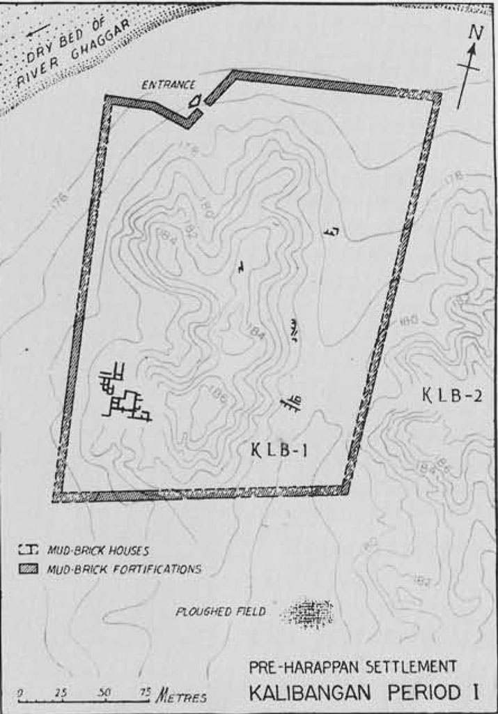
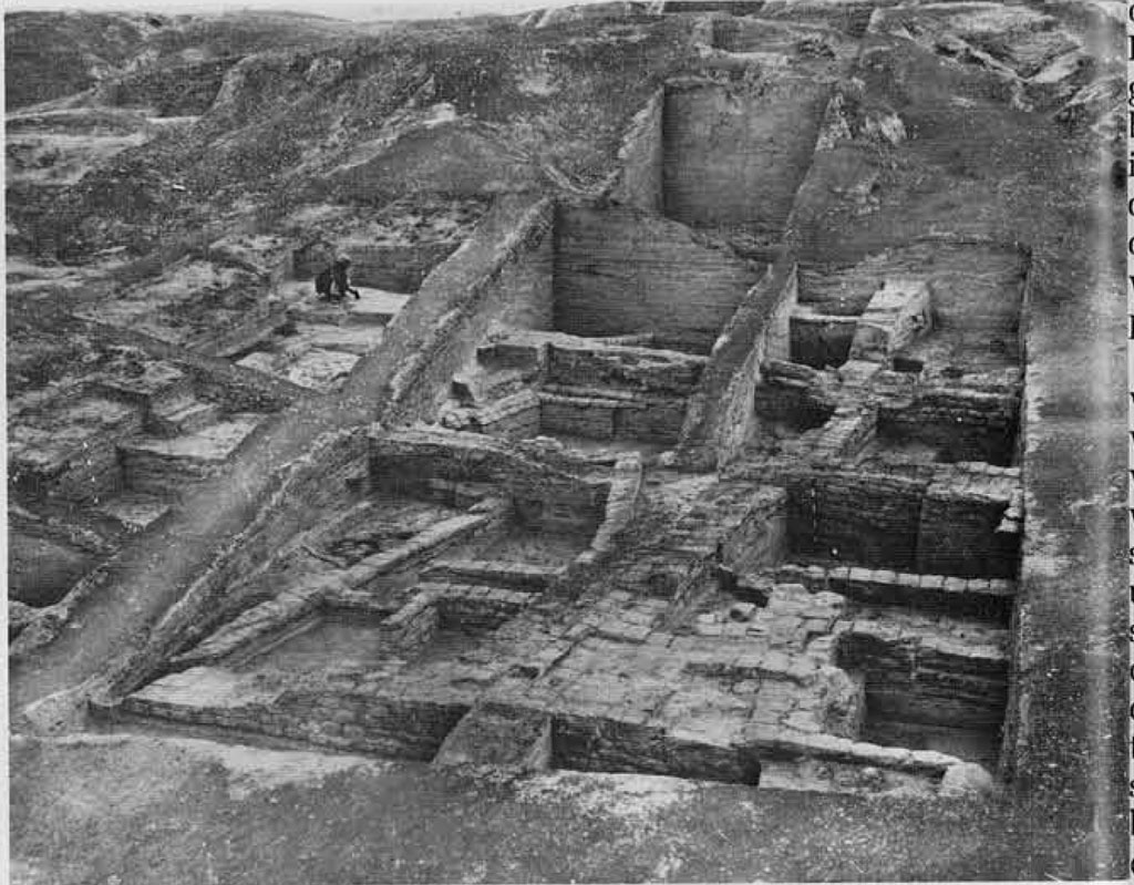
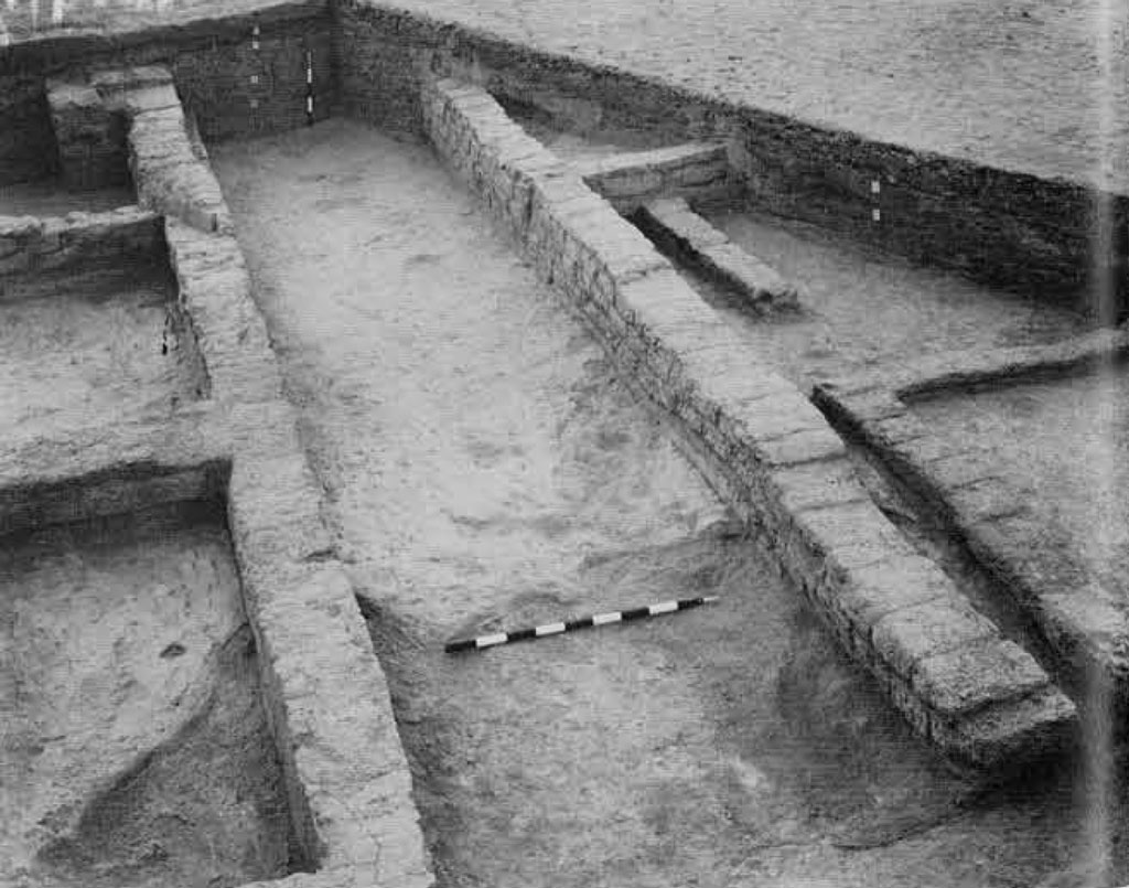
The settlement was situated on the bend of the river beyond the active flood-plain and was a parallelogram, some 250 m. from north to south and 160 m. from east to west. It was found to have been fortified from the very beginning of the occupation. The fortification wall was made of mud bricks (30 x 20 x 10 cm.; proportion, 3:2:1) and in its extant portion showed two structural phases. In the earlier phase, the basal width was 1.9 m. while in the latter, it measured 3 to 4 m., the extra thickness being added on the inner side. Both the inner and outer faces of the wall seem to have been originally plastered with mud, patches of which were found preserved at many places.
Within the walled area, the houses were built of mud bricks of the same size as those used in the fortification wall, the masonry being in the English bonding technique, with alternate courses of headers and stretchers. The use of baked brick was attested by a drain, the size of the bricks being the same as that of mud bricks, In the limited area of the excavation (largely on the slope of the mound) it was not possible to expose complete house plans. Nor was it feasible to dig at other places, for it would have involved removal of the superimposed Harappan deposits. Nevertheless, it was apparent that a house consisted of three to four rooms with a courtyard.
The excavation also brought to light part of a 1.5 m.-wide lane running in the east-west direction. From the width of the walls (some of them only a single brick length) it could be inferred that the houses were single storeyed. Interesting evidence regarding cooking practices was revealed by the presence, inside the houses, of ovens both of the underground and above-ground variety, closely resembling the present-day tandoors in the region. The former had mud-plastered walls with a slight over-hang near the mouth and the latter, also made of mud walls with bridged side opening for feeding fuel, seem to have been periodically plastered. Equally noteworthy was the existence of cylindrical pits lined with lime plaster, possibly for storing drinking water. The alignment of the houses no less than the size of the bricks used was significantly different from those of the succeeding Harappans.
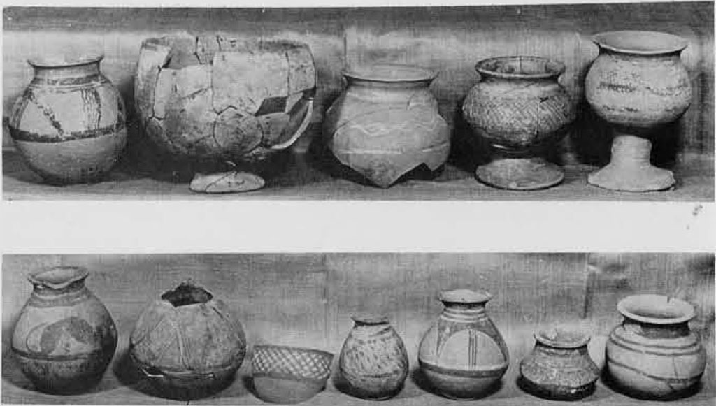
The distinctive trait of this Period, however, was the pottery (Thapar 1969) which was characterized by six fabrics, labelled A, B, C, D, E and F. Of these, fabrics E and F, distinguished essentially by surface color (E for buff and F for grey], did not show marked individualities either in shape or in painted design, their main features being shared by other fabrics. Furthermore, in frequency they were somewhat uncommon, the latter being particularly scarce.
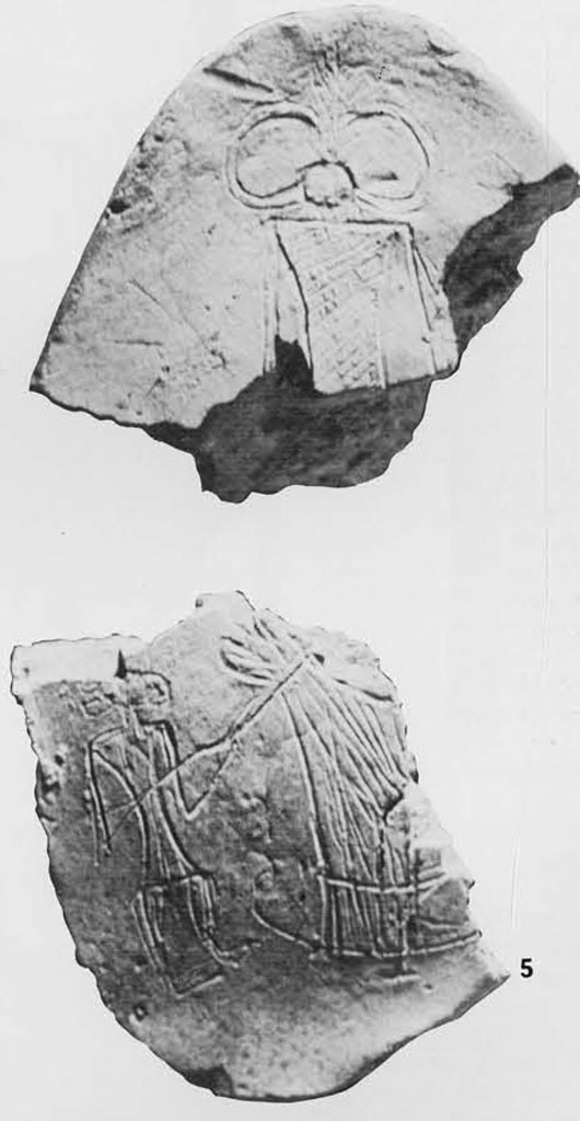
Fabric A was marked by an individuality which isolated it from the other fabrics. This was the most commonly used pottery. The vessels of this fabric, although made on the wheel, were carelessly potted, showing un-skilled handling with tell-tale traces of irreglar striations. It was drab red to pinkish in surface color and painted over in light black, combined at times with white, the field of decoration being confined to the portion above the girth. The design elements, drawn in free style, included horizontal bands, loops fringed below or enclosed by horizontal bands, a criss-cross moustache-like bifold scroll within wavy lines, symmetrically joined semicircles, latticed triangles, lenticulars, segments or scallops with figures. The range of shape was, however, very limited and comprised vases with outturned or outcurved rims and disc or ring bases, and bowls with tapering or convex sides. Of unusual interest were a vase with a pedestal base and another with a hole mouth.
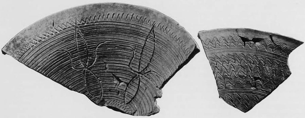
Fabric B was distinguished primarily by its paste, texture and surface treatment. The pottery of this fabric was carefully potted on the wheel and was treated with a red slip up to the shoulder, the slipped area being further diversified by black painted designs. The remaining surface of the pot was covered by a thin clayey solution and, while wet, seems to have been roughened by horizontal or wavy combings or by tortoise shell or dendritic impressions. Over this rusticated surface, naturalistic designs—floral, animal and bird—were painted in black. Only one shape, the (?), was represented in the fabric. The surface elaboration of this fabric closely resembles that of the so called “wet wares” including Khojak Parallel Striated of the Quetta region.
Fabric C was marked by a fine-textured paste and all-over smooth-slipped surface in shades of red and purple or plum red, the latter recalling pottery from below the defensive walls at Harappa. The repertory of painted designs included, besides the recurrent carefully ruled horizontal bands or loops or criss-cross, borders of plants, fish-scale, metopes, pendent triangles, etc, The shapes represented in this fabric comprised globular and ovoid vases with disc bases, lids, straight-sided bowls, dishes and offering stands. Except for a few diagnostic shapes, this fabric was the nearest in correspondence to the Harappan pottery.
Fabric D was characterized by a thick sturdy section and a slipped red surface. Common shapes included heavy jars, troughs and basins, The last named was, however, the most characteristic type. The basin interiors were decorated on the sides with sharp ridged incisions of varying pattern and on the outside with single or multiple rows of cord impressions. The shape and design of this basin are closely paralleled at Amri in Period II B.
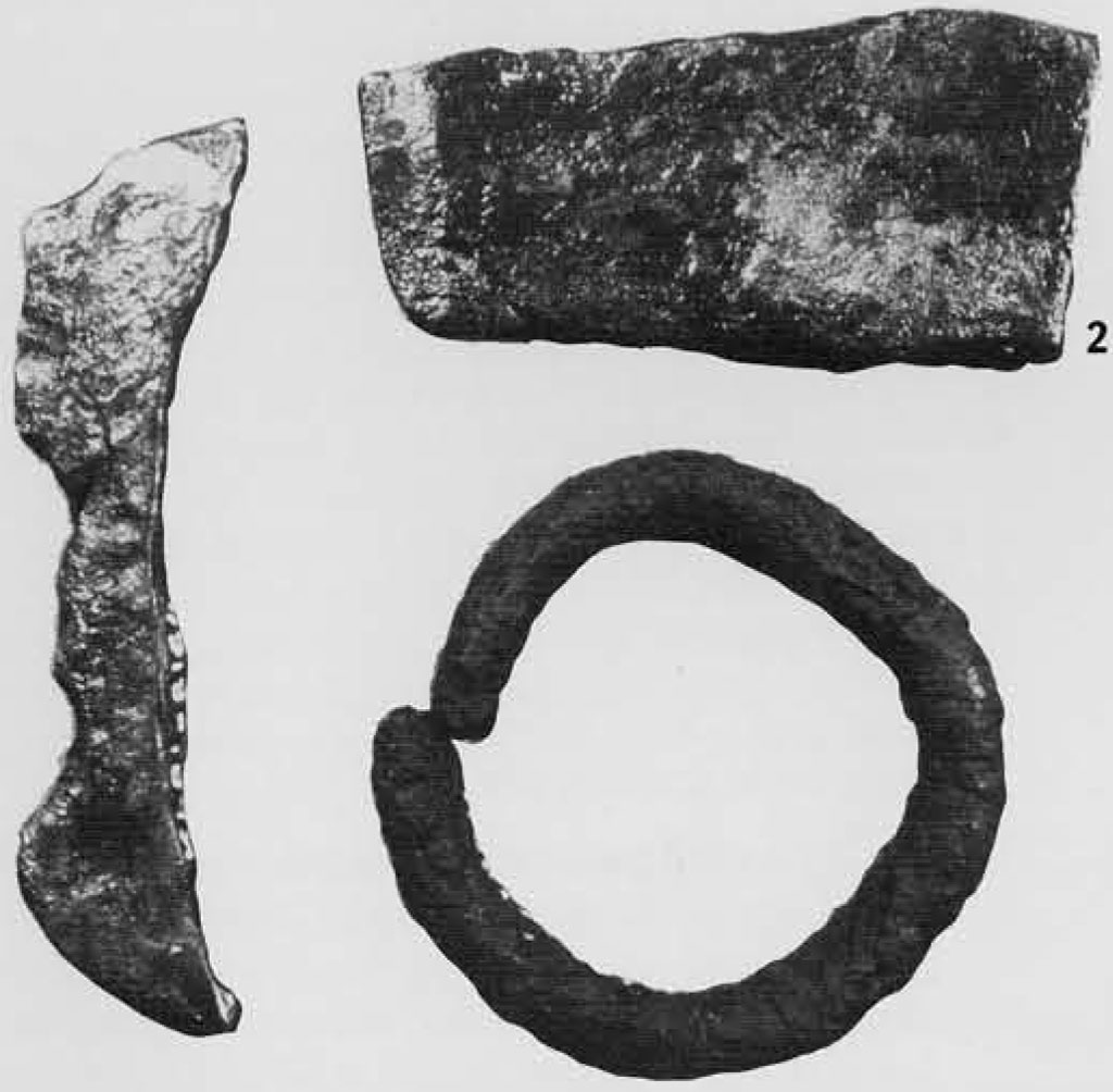
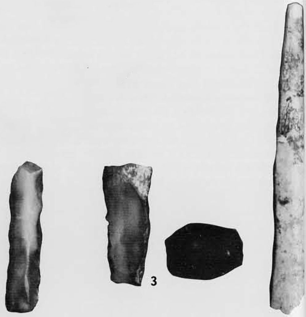
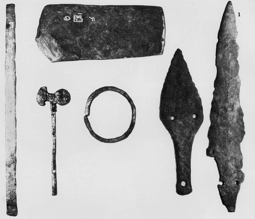
Among the other finds of this Period, the more noteworthy were: small-sized blades of chalcedony and agate, sometimes serrated or backed; beads, variously of steatite (disc), shell, carnelian, terracotta and copper; bangles of copper, shell and terracotta; terracotta objects like a toy cart-wheel and a bull; quern stones with mullers; a bone point; and copper celts including a curious axe.
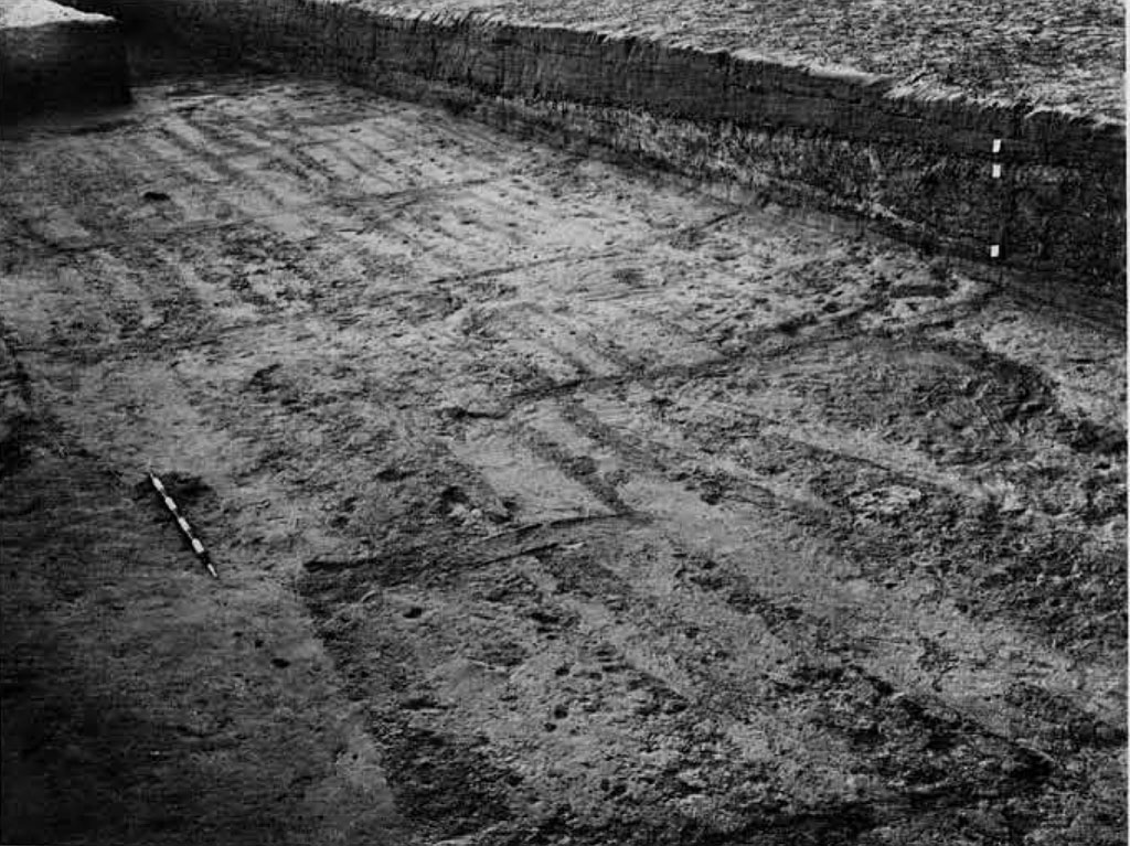
An outstanding discovery of the excavation, however, was a ploughed field situated the southeast of the settlement, outside the town wall. This is perhaps the earliest plough field excavated so far. It showed a grid of furrows with one set more closely spaced (about 10 cm. apart) running east-west and t other, widely spaced (about 1.90 m. apart), running north-south. Of these, the former seemed to have been ploughed first. Curious enough this pattern bears a remarkable resemblance to modern ploughing in the neighborhood, wherein two types of crops (pulse one direction and mustard in the other) are grown in the same field, the combination being dependent upon the size and growth behavior of the plants. No remains of either a plough or ploughshare or coulter have, so far, been obtained from the excavation. The material of which the ploughshare, etc., we made, as also its shape, therefore, still remains to be established. Since cultivation during this Period seems to have depended flood-irrigation, supplemented by seasonal precipitation, it is reasonable to infer that of the winter crop (rabi) was grown, the sowing being done in the autumn after the river flow resulting from the tropical monsoon had subsided. Although no cereals were found in the course of excavation, cereal-type pollen has been attested in good numbers in the deposit of Period I (Singh et al. 1974). The evidence points to an emergent stage, though in a fashion which could promote further transformation. The people were capable of dealing with the demands of the river.
The occupation endured through five structural phases, rising to a height of 1.6 m. above the natural soil, when it was brought to a close by a catastrophe (perhaps seismic), as evidenced by the occurrence of displaced (faulted ?) strata and subsided walls in different parts of the excavated area. Thereafter, the site seems to have been abandoned, though only temporarily, and a thin layer of sand, largely infertile and wind blown, accumulated over the ruins. During this period, the peripheral portions of the mound, particularly on the east and the west, seem to have been badly eroded and gullied.
Now to chronology: The stratigraphical position of the settlement of Period I clearly establishes its priority in time-range to that of the succeeding Period which represented the Harappa Culture. The chronological bracket of the latter (2500-1750 B.C. at Mohenjo-daro) cannot be applied mechanically to Indus towns and villages in all locations. Many of the settlements, particularly those in the Ghaggar Valley, may have been founded later than the nuclear cities of Mohenjo-daro, Harappa, etc. In the light of the available evidence, it may be postulated that the Harappan occupation at Kalibangan would have begun around 2300 B.C. and lasted up to 1750 B.C.
Turning to absolute chronology, nine samples (five from the Early, one from the Middle, and three from the Late levels of Period I) have been dated by radiocarbon determination. Except for one, the dates are all consistent and indicate an inclusive time range of 2450-1900 B.C. which suggests an apparent overlap between the two cultural Periods. No such phenomenon, however, was recognized by the excavations, except that in the lower levels of the Harappan occupation, especially in the lower city area, pottery of Period I assemblage occurred alongside of the Harappan. This suggests only that the old inhabitants remained in contact with the new arrivals. On the other hand, there is conclusive evidence, as previously stated, to suggest a break in the occupation of the site after the close of Period I. As the excavated cuttings from which the samples have been obtained for radiocarbon dating lie on the slopes of the mound with very little soil cover (Agrawal 1968), the dangers of humus contamination must be kept in mind, especially in respect to the samples belonging to the Late levels of the Period. The duration of Period I, therefore, would in fact be much shorter, and on the above showing is estimated as 2450—2300 B.C., with a margin of some years for the abandonment of the site at the upper end of the scale. The five structural phases, of which the upper three were largely rebuildings (without changes of plan), would fully support this postulate.
On the basis of the comparison of the material equipment of Kalibangan Period I with that of corresponding cultures at Harappa, Amri and Kot Diji, it is seen that while these village town cultures share a common level of economic subsistence, they are marked by regionalization with an uneven development and essentially differing ceramic traditions. However, one of the characteristic types of Fabric D of Kalibangan I is found to be closely paralleled in Amri II B (Casal 1964), thus providing a datable correlation between the two cultures on a common time scale. On the strength of a radiocarbon date, Amri IC is dated to circa 2600 B.C. Amri ITB, therefore, would fall around 2450 B.C., which agrees with the date proposed above for the beginning of Kalibangan I. Confirmatory evidence is also forthcoming from layer 5 at Kot Diji, representing the late phase of the Kot Diji Culture and dated to circa 2300 B.C. Another noteworthy analogue in both form and fabric is provided by the globular vase with short neck and externally grooved body, found at Kalibangan I (Fabric C), Sarai Khola II, Pre-Defense Harappa and Kot Diji.
The correlation of the above-mentioned assemblages would indicate that the so-called pre-Harappan communities appeared in northern Rajasthan somewhat later than on sites in Baluchistan and the Indus Valley proper, as though reflecting a “sloping horizon” of cultural level from west to east.
The dates proposed above do not take into consideration the correction factors proposed by the physicists for radiocarbon dates. According to these calculations, 500 to 550 years are to be added to the standard radiocarbon dates.


KALIBANGAN II (HARAPPAN)
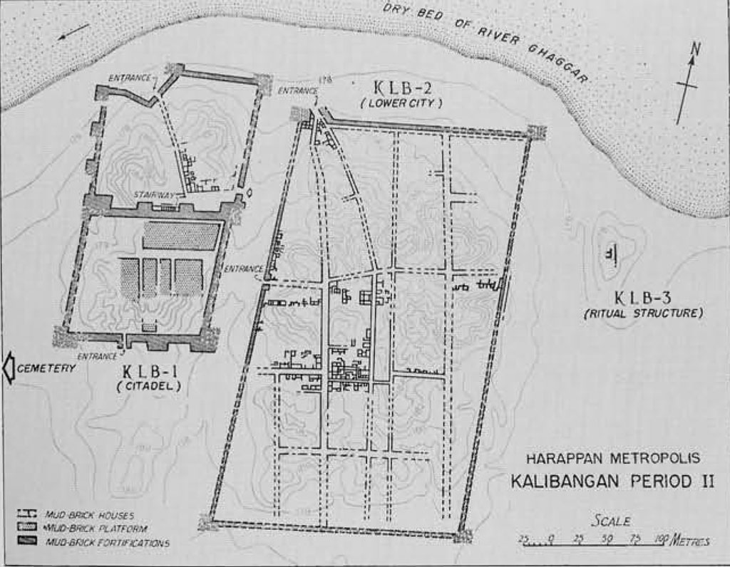
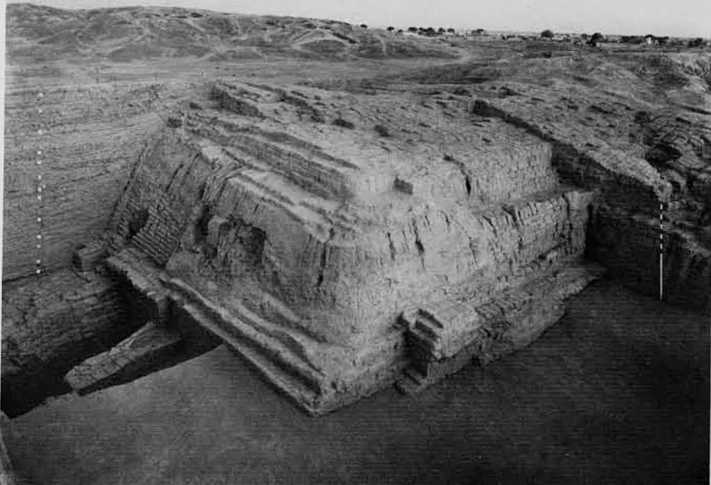
In Period II the structural pattern of the settlement was changed. There were now two distinct parts: the citadel on the west, represented by a smaller mound (KLB-1); and the lower city towards the east, represented by a fairly extensive mound (KLB-2). The former was situated atop the remains of the preceding occupation (Period I) to gain an eminence over the lower city which was laid out on the natural plain towards the east, leaving a gap of over 40 m.
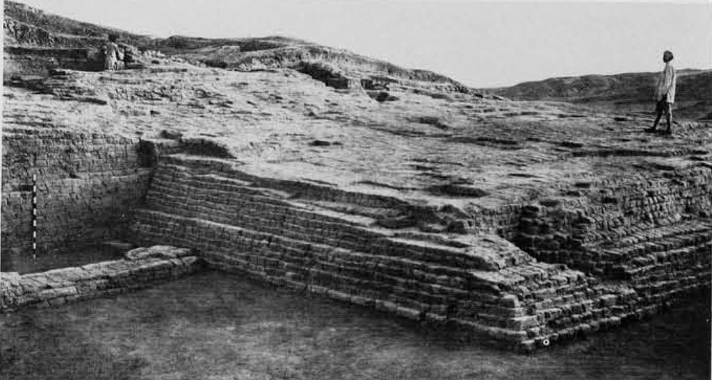
The citadel complex is roughly a parallelogram some 240 m. from north to south and 120 m. from east to west, and consists of two almost equal but separately patterned parts, rhomboid on plan. Both these parts were contained by a fortification wall 3 to 7 m. in width (on the southern sides, the width was extended to 9-11 m.) and reinforced at regular intervals with rectangular salients or bastions. The fortifications were built throughout of mud bricks; two sizes of bricks, 40 x 20 x 10 cm. and 30 x 15 x 7.5 cm. (ratio: 4:2:1), representing two principal structural phases, were used in the construction, the larger bricks in the earlier phase and the smaller in the later. On the north and the west the fortification wall overlies that of the preceding period, while on the east and the south, including the central portion (partition fortification wall), it was built on the ruins of the earlier occupation which was often dug into for foundation purposes. Both the inner and outer faces of the wall were originally plastered with mud, traces of which were available at a number of places.
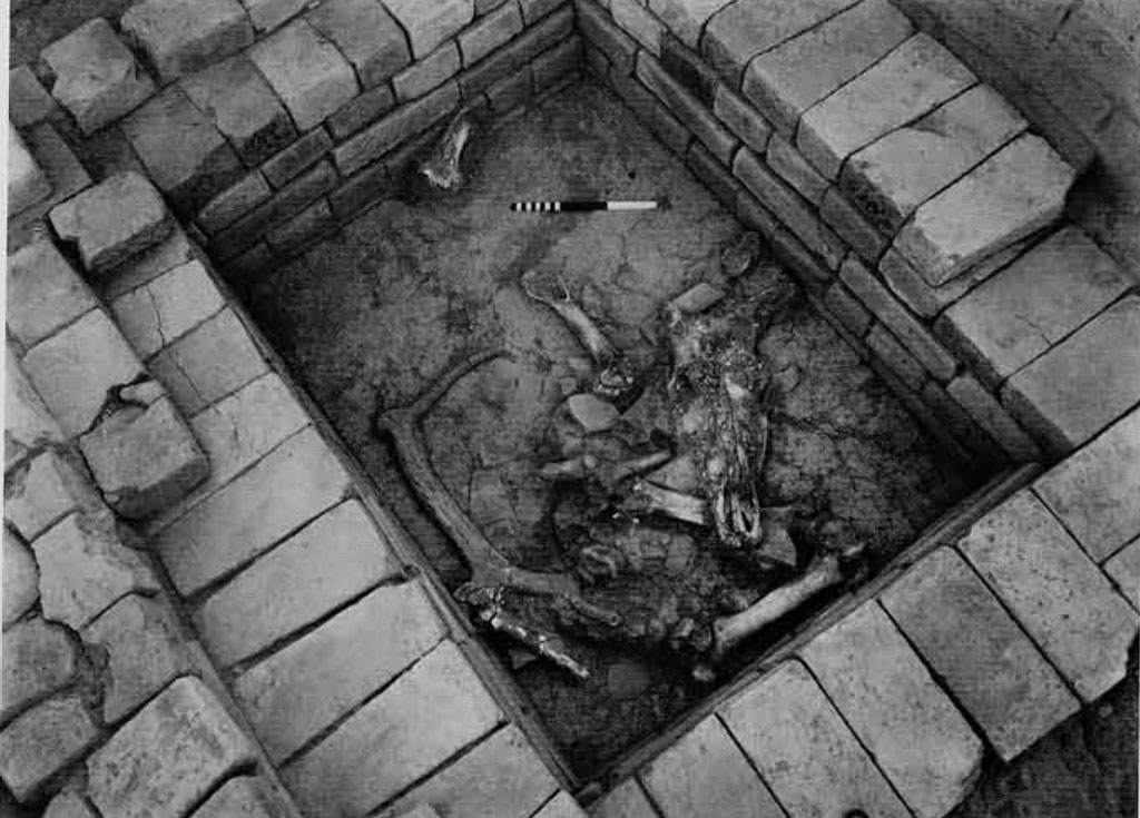
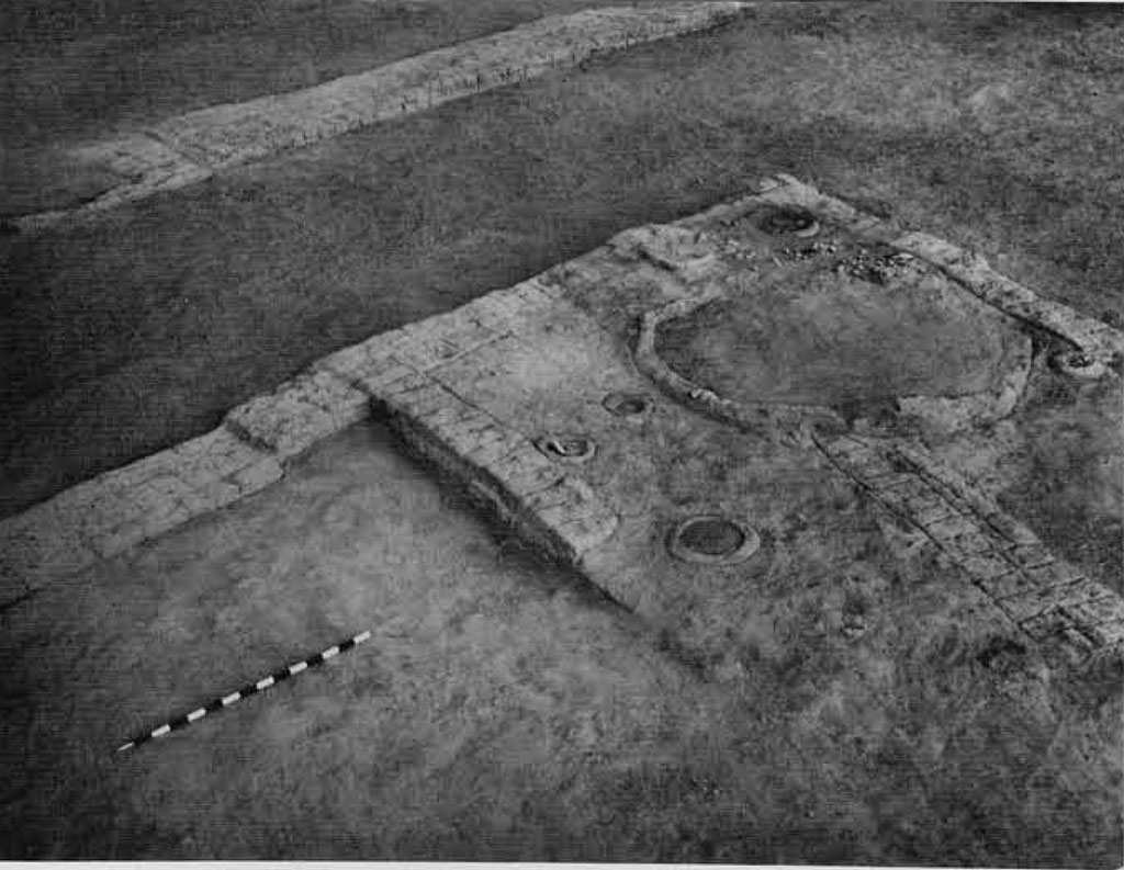
The southern half of the citadel was more heavily fortified not only with corner bastions but also with rectangular salients along the northern and southern sides. While no complete plans of the corner bastions were available, the salients projected 8 to 9 m. from the main face, and were 13 to 17 m. broad. They rose imposingly with a battered face, the taper being obtained by the coating of plaster. The enclosed area contained some five to six massive platforms of mud bricks (40 x 20 x 10 cm. for the earlier phase and 30 x 15 x 7.5 cm. for the later), each separate from the other and intended to be used perhaps for a specific purpose by the community as a whole. Of these, sizable portions of five including the complete outline of one (approximately 50 x 25 m.) have so far been exposed. All these platforms were found to be oriented along cardinal directions. While in the case of the fully-recovered one the longer axis was east-west, for the remaining three it was north-south. The size of the platforms no less than the width of the passages separating them varied. At no point, however, were these platforms joined to or integral with the fortifications. Access to the working floor of the platforms was by means of steps which rose from the passage. At one place the passage fronting the platform was found to be paved. Through the passages also ran baked-brick drains. Of the buildings which stood upon these platforms, no intelligible plans are available as they had been obscured by depredations of brick robbers. Nevertheless, the available remains do indicate that some of these might have been used for religious or ritual purposes. While on the one with the known complete outline, besides a well and a fire altar, a rectangular pit (1.25 x 1 m.), lined with baked bricks and containing bones of a bovine and antlers, representing perhaps a sacrifice, were found, atop another was noticed a row of seven rectangular “fire altars” aligned beside a well.
The entrances to this part of the citadel were located on the south and north. The southern one was situated between the central salient and the southwestern corner tower and, by virtue of its being an impressive baked-brick structure, seems to have suffered very badly from modern spoliation. The passage floor or steps along with its baked-brick flanking masonry had been ransacked for bricks with the result that only the impressions of it were available during the excavation. The passage was 2.65 m. in width, and, in the absence of well-preserved structures, could be inferred to be stepped, fronting the main fortification wall. The northern entrance comprised a stairway which, running along the outer face of the partition fortification wall between the two centrally located salients, led up to the required height at which passage across the fortification wall was provided.
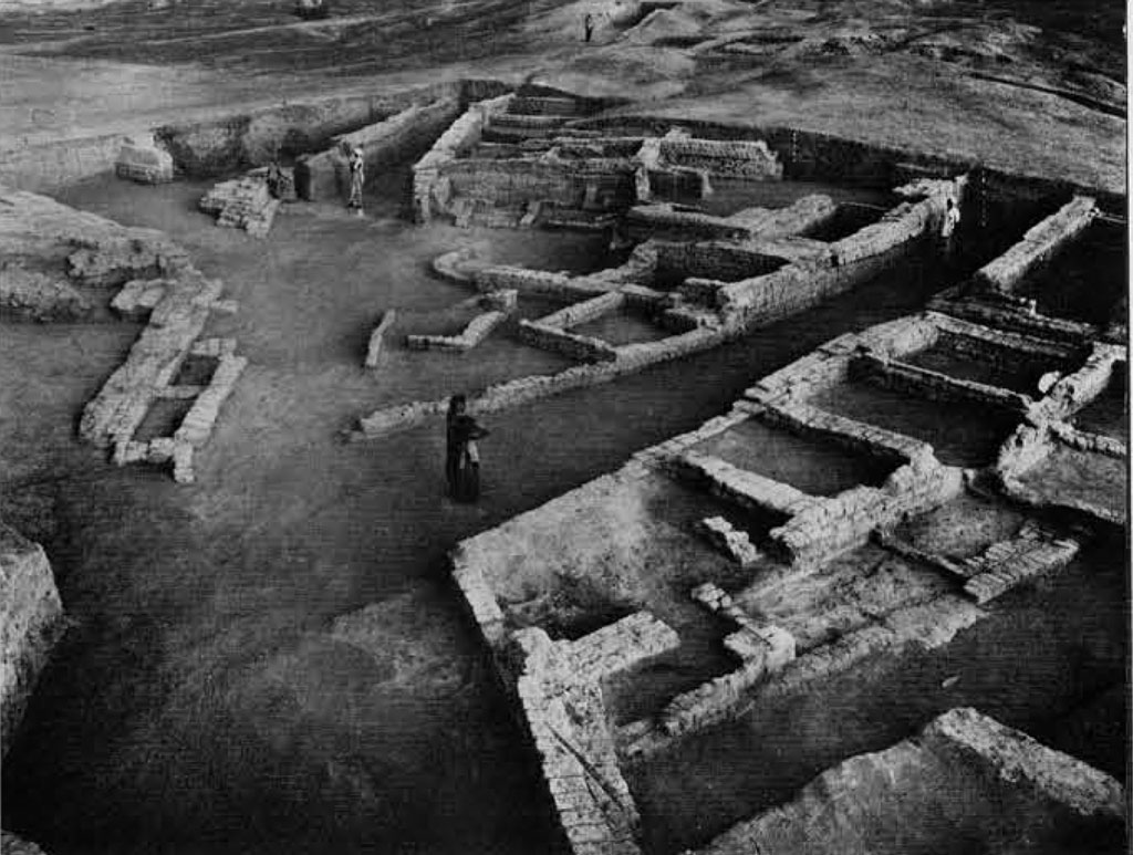
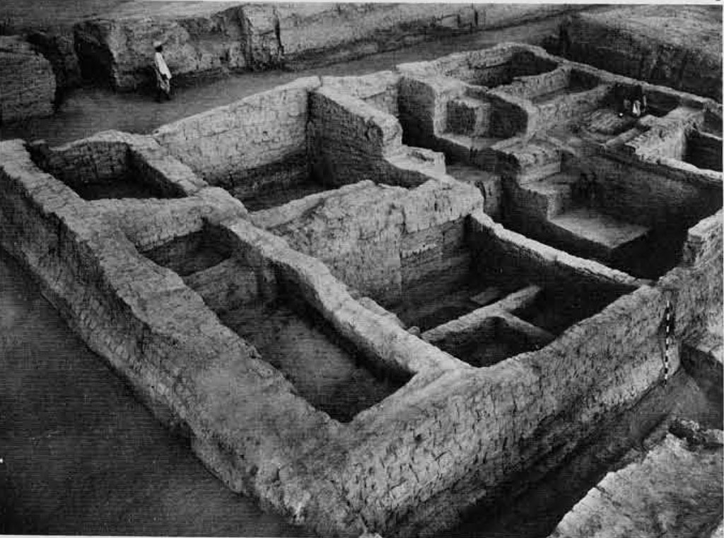
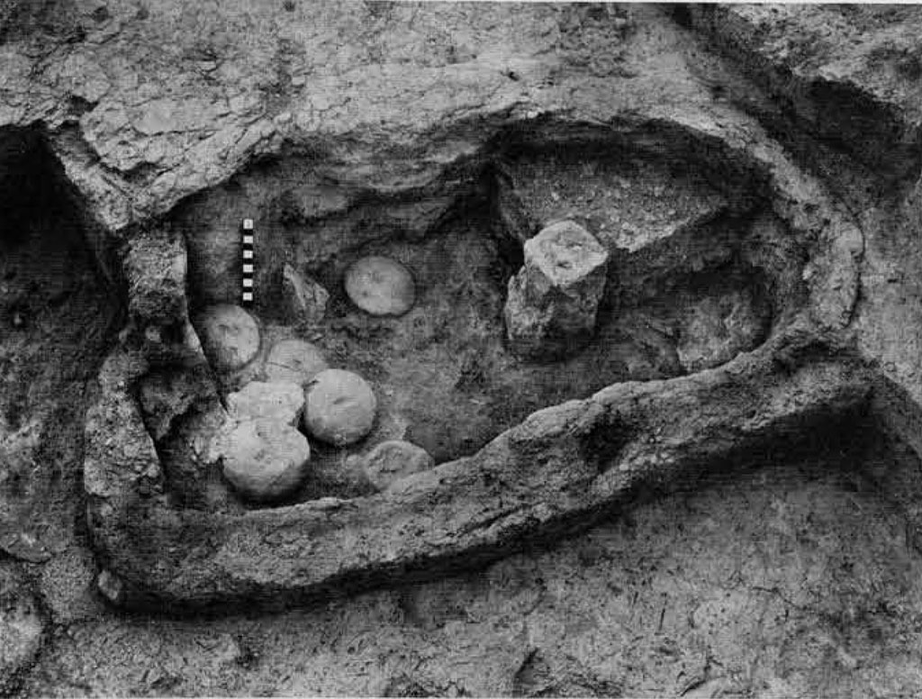
In this entrance complex again, two structural phases were recognized, of which the earlier consisted of steps built of mud bricks (40 x 20 x10 cm.) with a riser of 10 cm. and a tread of 40, and the later, perhaps of a ramp, screened by a 1.5 m.-wide wall (30 x 15 x 7.5 cm.). Lest the unwary reader carry the impression that at Kalibangan during Period II (Harappan), the small-sized bricks, viz, 30 x 15 x 7.5 cm., were introduced only in the later phases, it may be said that bricks of this size have been used right from the beginning of the occupation for domestic structures. It was only in the fortifications and massive platforms that the large-sized bricks were employed in the earlier phases and smaller ones in the later. It is significant, however, that the ratio of dimension of both sets remains 4:2:1. From the location of the entrances, it is surmised that the southern entrance may have been the main one intended for the general public from the lower city and the northern for the dwellers in the residential annex (northern half) of the citadel. The structural feature of both these entrances, however, precluded the possibility of any vehicular traffic within the enclosed area.
The northern half of the citadel, which was also fortified, contained residential buildings perhaps of the elite. Although full details of the house plans could not be recovered, it was noticed that the houses were built away from the fortification walls of the citadel, perhaps to give some privacy to these structures. The passage between the partition wall and the houses was found to be paved with brick-on-edge, extending from the northwestern corner bastion (of the partition fortification wall] to the easterly of the two central salients and perhaps reaching to the entrance stairway. There was evidence to show that this pavement was renewed at least three times during the lifetime of the citadel. The size of the bricks used in all these floorings was 30 x15 x 7.5 cm, A complete street plan of this part of the citadel has not been obtained.
Meanwhile, a thoroughfare running north-south has been partially explored to a length of 40 m. Starting from the easterly of the two salients of the partition fortification wall, it ran obliquely in the direction of the entrance on the north. There were three (one each on the eastern, northern and western sides] entrances to this part of the citadel, none of the ramp or stairway type. Inside the eastern one was the brick-on-edge pavement referred to above.
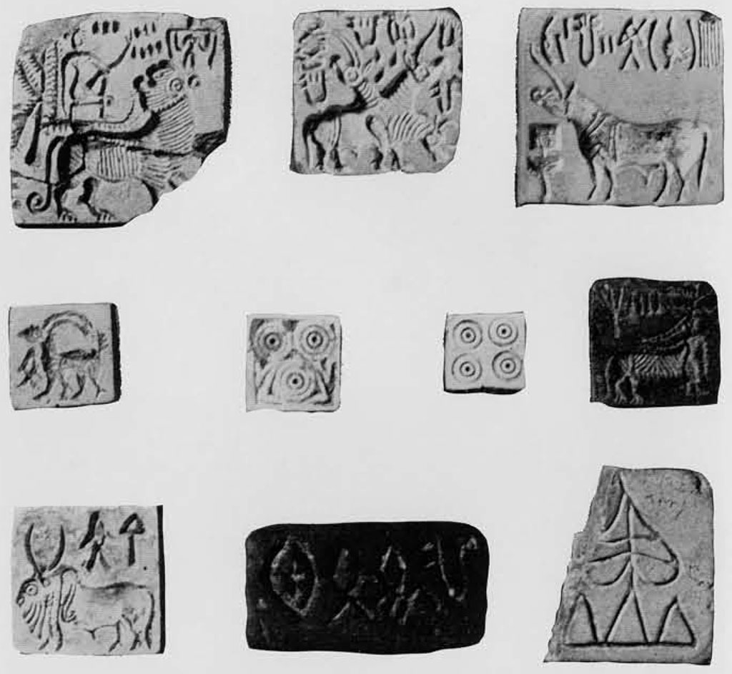
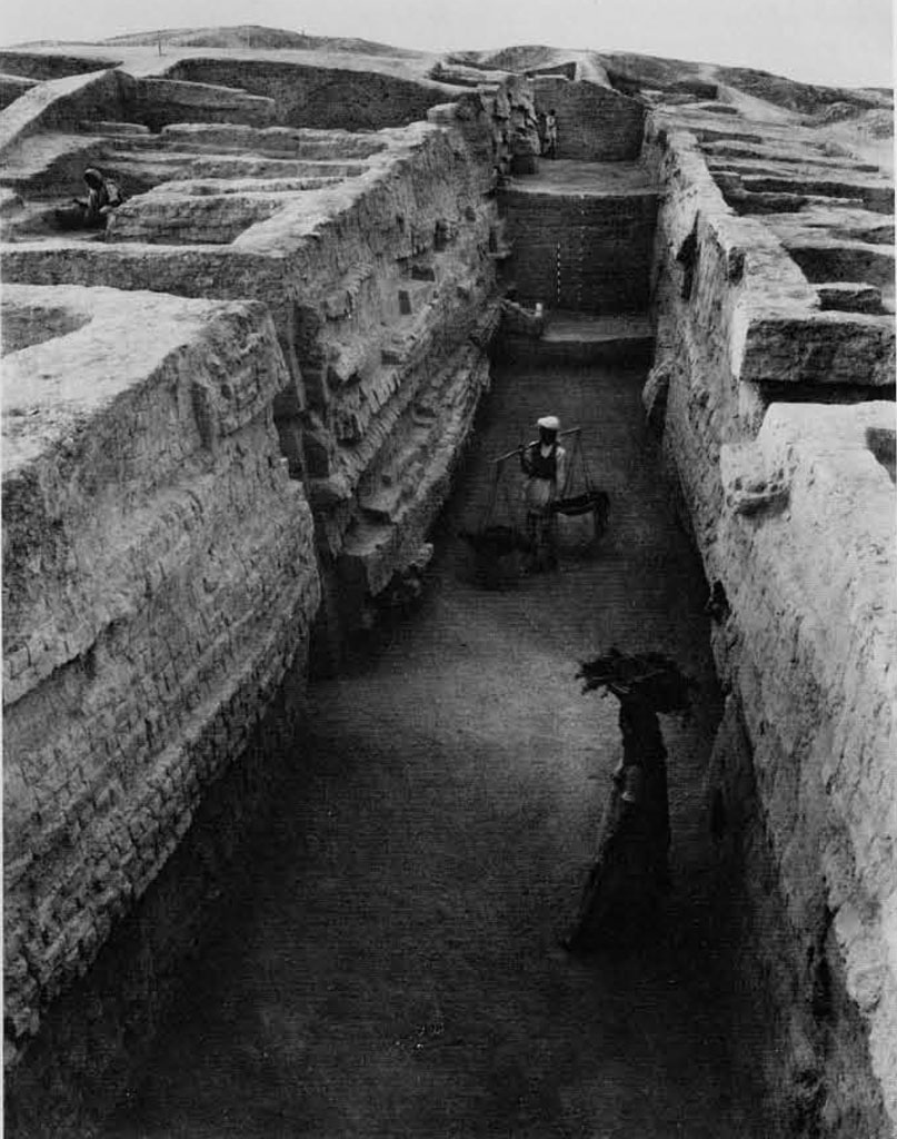
The lower city was also a parallelogram, some 240 m. from east to west and 360 m. from north to south, and lay to the east of the citadel beyond a broad space of some 40 m. It was found to be enclosed by a fortification wall ranging in width from 3.5 to 9 m. (involving three to four structural phases). It was made of mud bricks of similar sizes to those used for the fortifications of the citadel, viz, 40 x 20 x 10 cm. for the lower phase and 30 x 15 x 7.5 cm. for the upper. Within the walled city was a gridiron plan of streets running north to south and east to west, dividing the area into blocks.
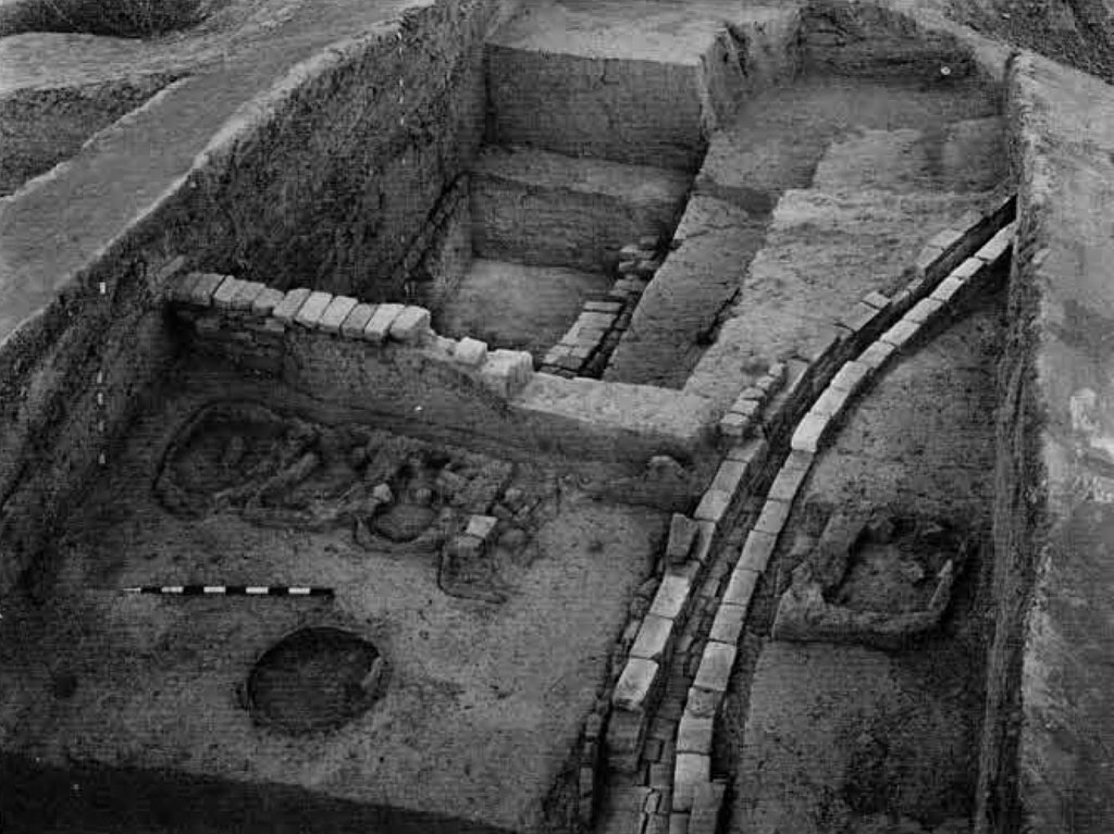
The existence of four arterial thoroughfares running north to south and three (with an indication for the fourth in the northern part] running east to west was established by excavations. While the former were found to run unimpeded, the latter did not cross the former but were staggered on plan and possibly served as delivery or entrance lanes for certain house blocks. Again, while the former were not equally spaced, the latter were situated on an average of 70 m. from each other. Besides, there were quite a few other streets which served only one or two blocks and were not thoroughfares. The width of the thoroughfares and streets corresponded to the multiple of 1.8 m, and ranged from 1.8 to 7.2 m. To avoid damage from the vehicular traffic, fender posts were provided at some street corners. The width of the thoroughfares seems to have been maintained throughout the occupation; the only structural encroachments into the streets were the rectangular platforms (of uncertain use) immediately out side some houses. The streets, except in the late phase, were unmetalled. No evidence of regular street drains has so far been encountered. House drains, which were either of wood or of baked brick, discharged into soakage jars buried under the street floor.
The existence of two entrances to the fortified area, one on the north and the other on the west, was attested by excavation. Of these, the western entrance, which was controlled by a guardroom, led to an east-west street (counting third from south upwards] and the northern, located at the northwester’ angle, communicated with the first and third (counting from left) thoroughfares which converged on this gateway. The other two north-south running streets did not open into any gateway but stopped over 5 m, short of the fortification wall, pointing to the existence o an open space between the ends of all the north-south thoroughfares and the gateway. From the situation of the two entrances, it could be inferred that the western one was used by the city dwellers for communicating with the citadel and the northern for the city’s commercial traffic.

The layout plan of the city shows that the alignment of the streets is at variance wit that of the fortification walls. While the precise reasons for this seeming deviation still remain to be ascertained it can be argued that the alignment of the fortifications was conditioned by the Period I (pre-Harappan) layout of the adjacent citadel and by later modification by the Harappans as occupation advanced. Excavation has revealed that the fortification and the streets had been planned at one and the same time, viz, the very beginning of Harappan occupation of the site. Interestingly enough, it was observed that the house walls near the fortification wall faithfully followed the alignment of the latter, while those nearer the streets followed the streets themselves.
From the very beginning of the occupation, the houses were built of mud bricks (3 x 15 x 7.5 cm.), the use of baked brick [of the same size and also the wedge-shaped type] being confined mostly to drains, wells, sills and bathing platforms. In the typical chessboard plan of the city, each house faced two. if not three, streets and consisted of a courtyard with six to seven rooms aligned on two or three sides. Entrance to the house, located usually on the lane side, was either through courtyard or through a corridor running between sets of rooms. There was also evidence of the single leafed door or a stairway in some houses. Some of the courtyards contained a well, evidently used by two or three families, Some houses had also a “fire altar” in one of the rooms.
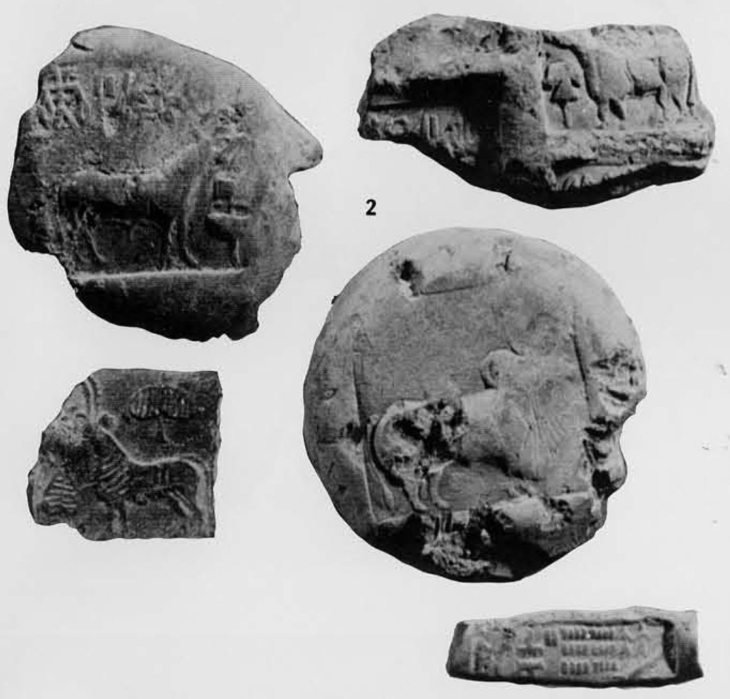
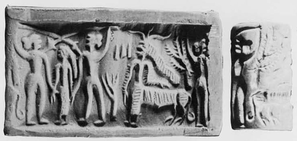
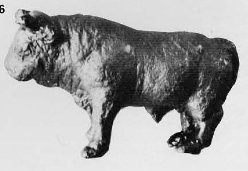
The finds obtained from the occupation of this Period were all characteristic of the Indus Civilization and need not be listed individually. Among these, the seals and the weights and measures in a graduated series of size testify to the high level of sophistication and standardization reached by the Indus Civilization. The following finds deserve special mention: a cylinder seal; a terracotta cake, incised on the obverse with a horned human figure and on the reverse with a human figure pulling an obscure object; a terracotta human head; a copper bull showing the dynamic mood of the animal and other copper objects including a pin; a terracotta feeding-cup with a cow’s head on the rim; a terracotta graduated scale (incomplete) and an ivory comb. Both wheat and barley were found in the deposits of this Period, although the remains of the former were negligible.
Barley was indeed the staple cereal. No evidence of rice was obtained. Besides the above two principal parts of the metropolis there was also a third one—a modest structure situated upwards of 80 m. east of the lower city. The structure, of which the complete outline could not be recovered, was built of mud bricks of the usual Harappan size, 30 x 15 x 7.5 cm., and consisted of an impressive wall enclosing a room containing four to five “fire altars” of the kind referred to above. No other building, residential or otherwise, existed on this small mound. The absence of normal occupation debris suggests that the lonely structure with the altars was used for ritual purposes.
Another feature of the layout plan to which pointed attention may be drawn relating to the absence of habitational remains outside the walled area, except however in the restricted area to the south of the citadel, signifying that the city never outgrew its original layout. What does that imply in terms of economic and social pattern? On the other hand there are reasons to believe that during the later phases, when the fortifications, both of the citadel and the lower city, had been neglected, the settlement itself had shrunk.
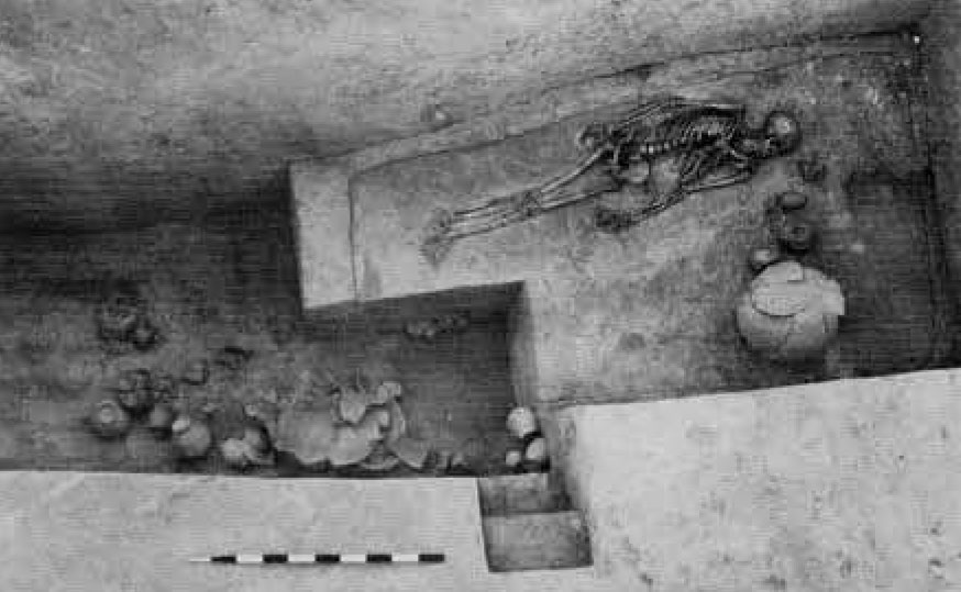
The cemetery of the Harappan Period was located upwards of 300 m. to the west-southwest of the citadel on the present active flood plain of the river. Anciently however, it must have been beyond the reach of the annual floods. Three types of burials were attested: extended inhumation in rectangular or oval grave; pot-burial in a circular pit; and rectangular or oval grave-pit containing only pottery and other funerary objects. The latter two methods were unassociated with any skeletal remains.


Of the first variety, the recurrent features were as follows: on the floor of the oblong pit, the body was laid in an extended position with the head towards the north; around the head area, the funerary furnishings comprise of pots and such objects of personal jewelry as bronze mirrors, etc., were deposited. The pit was thereafter filled with the selfsame earth. Three of the graves call for a special mention. In one of them the body was lying face down with its head towards the south, quite contrary to normal Harappan interment and showed a crouching position with folded legs. The other grave was lined with mud bricks (40 x 20 x 10 cm.) covered with approximately 2 cm.-thick plaster. The third grave showed evidence of two types of burials, one superimposed upon the other. The lower interment, consisting of pottery, was without any skeletal remains, while the upper contained the normal extended human body with pottery and one bead each of gold and carnelian around the neck. The grave in this case was quite large and had steps on the eastern side leading down to the grave floor. Useful information on palaeopathology was obtained from the skeletal material: evidence of trepanning was attested in a few cases.
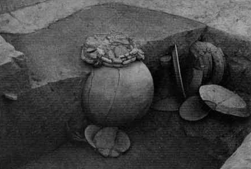
Of the second variety, the grave pit was oval or circular and contained an urn and other pots including platters and dishes-onstands clustered round the former. Besides pottery, some of the pits also contained such other objects as shell bangles and steatite beads.
Of the third variety, the grave pit was rectangular or oval in plan, with the longer axis oriented north-south as in the case of the first variety, but it was marked by the absence of skeletal remains. The grave goods consisted of pottery and occasionally of personal ornaments like beads and bangles. The striking feature about these pits was the filling which showed two stages: after the funerary deposit, the pit seems to have been left unfilled resulting in the accumulation of bands of fine sand and clay; at a later stage the remaining part of the pit was filled in by human agency with cloddy clay.
The occurrence of these three varieties of burial has posed problems of a sociological kind. Meanwhile, it may be affirmed that the grave goods obtained from each of these types are typically Indus. In their manner of occurrence the three types show a pattern, the significance of which cannot yet be appraised but is worth noting. Graves of the first and second variety occur in separate, reasonably defined, areas, the latter lying to the north of the former, while the graves of the third variety are found largely in the area of the first but occasionally also in that of the second.
What contributed to the end of the settlement still remains to be precisely determined. Meanwhile, it is sufficient to mention that one of the compelling reasons for the abandonment of the site was the drying of the river Ghaggar and the consequent denudation of the watershed by overgrazing and deforestation. The settlement must have been seriously affected by the shortage of a perennial water supply for both agricultural and drinking purposes. Environmental studies at Kalibangan (Raikes 1968) have indicated a picture of alternating captures of the Yamuna by the Indus and Ganga river systems respectively. Among the series of alternating captures there was an eastward diversion to the Ganga system around 1750 B.C. which incidentally coincides with the abandonment of the site. We may not, therefore, look to foreign invasions or repeated high floods or transmutation to sub-Indus Cultures as contributory factors for the decline or fall of the settlement.
Coming to the dating of Period II, an inclusive bracket of 2300-1750 B.C. has already been postulated. As many as twenty-four samples (six from the Early, nine from the Middle and nine from the Late levels) have been dated by radiocarbon investigation (Agrawal 1968). Of these some of the samples from the Late levels, due to the absence of adequate soil cover, were not very reliable and have in fact given very young dates. The Late phase, therefore, shows a scatter. On the whole, the C-14 dates of Period II are internally consistent.
The story of the Harappan metropolis at Kalibangan is still incomplete. This interim report on our excavations and analysis is thus a tentative reconstruction of this important settlement.
