Gordion is an unusually large and complex archaeological site, the product of its over 4,000-year occupation history. Rising 16 meters (50 feet) above the surrounding plain, it measured about 4 km (2.5 miles) across in the time of Midas. Investigating a site of this magnitude is an enormous challenge, and over the last six decades Penn’s Gordion Project has employed a range of scientific approaches, including remote sensing, geophysical survey, dendrochronology, and radiocarbon dating. The efficacy of these approaches, and consequently our knowledge of the site, has improved significantly over time as technologies and methodologies have developed and become more accessible.
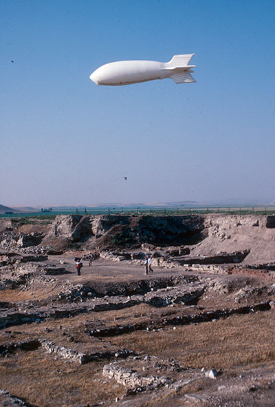
The excavations themselves have been on a huge scale, with over 600 individual trenches. Rodney Young’s excavations were the most extensive, partly because they proceeded with a kind of rapidity that is now unacceptable, although without them our knowledge would be far too limited. Later excavations have been on a much smaller spatial scale, but have been carefully designed to address a more balanced range of cultural, environmental, chronological, and site-layout questions. Completing the analysis and publication of the legacy data is a much slower process than acquiring the information in the first place, and is one of the main challenges for the Gordion team.
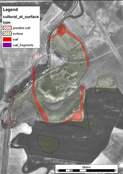
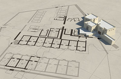
Scientific testing broadened dramatically with archaeological and geographical surveys during the fieldwork of Mary Voigt (1988–2006). On the higher ground on the western side of the valley—an area under extensive modern cultivation and thus flattened by plow- ing—archaeological survey mapped a broad distribution of ancient pottery and other surface finds, confirming the existence of an enormous “Outer Town” dating from the Middle Phrygian period (ca. 800-850 BCE). Furthermore, a geomorphological study of the natural sediments in the Sakarya basin demonstrated that the valley had been in-filled by a colossal 3–5 meters of waterborne silt, a process that began with the occupation of the ancient city, and this “sedimentation episode” ultimately buried large parts of Gordion. However, the survey also revealed hitherto undetected parts of the ancient city still protruding at the modern floodplain surface, as well as traces of Middle Phrygian fortifications in various locations. Taking these factors into account led to a new holistic model for the urban layout, with a much larger Lower Town completely encircling the central Citadel, and an Outer Town area that included a fortified circuit around its western part. The geomorphic study also confirmed that in antiquity the river had flowed through the city to the east of the Citadel Mound, not to the west as it does today.
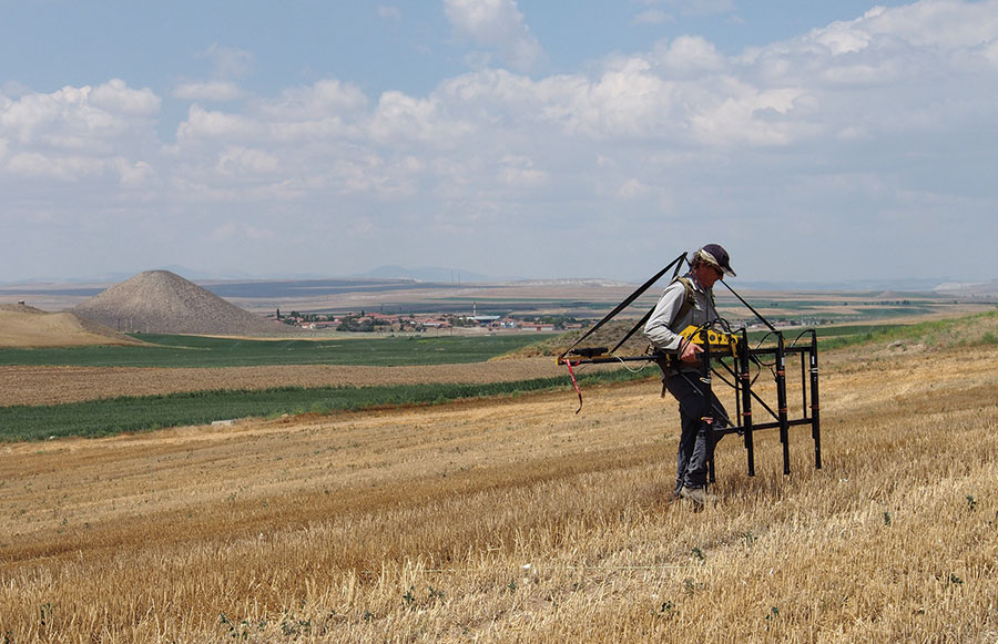
Within the last decade, the site’s morphology has rap- idly come into sharper focus through extensive geophysical surveys. Ground-based remote sensing techniques (radar, magnetic prospection, and electric resistivity) can locate buried features, such as walls and streets, by taking readings that provide a dataset from which maps and plans can be made. These ongoing surveys have confirmed that the Low- er and Outer Towns were large, distinct, fortified residential areas of similar size, and many details of their defenses have emerged, along with street networks and buildings. Tumuli have also been surveyed by magnetometry, allowing us to locate the tomb chambers inside and ascertain whether or not they are intact. All of this work raises further questions that only excavation can answer, such as the specific dates and functions of buildings, and the degree of social stratification in the various districts.


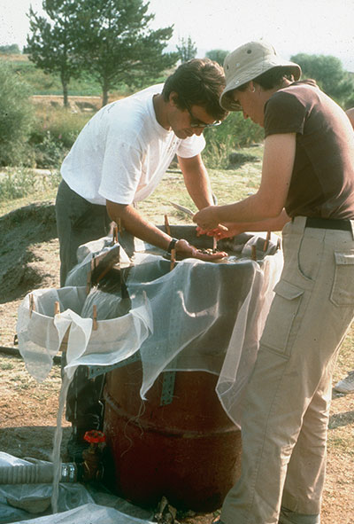
The structural timbers from Gordion, in particular those from Tumulus MM, form the backbone of the Anatolian Bronze Age and Iron Age dendrochronology, contributing an impressive tree-ring sequence of 1,028 years. This sequence does not connect with modern trees and so it has been dated by linking it to radiocarbon chronology, through a process known as “wiggle matching.” As a result, Tumulus MM can be narrowly dated to ca. 740 BCE, confirming that its occupant must have been Midas’ immediate predecessor, and not Midas himself as many had thought. Another significant benchmark derives from the high precision radiocarbon dating of organic material (seeds and reeds) from the Early Phrygian destruction level. This indicates a date of around 800 BCE, 100 years earlier than Young had thought, and again provides a new dating anchor for the associated artifact types.
Such increasingly sophisticated scientific techniques have enabled us to reconstruct both the landscape and lifestyles of Phrygian Gordion, thereby bringing the ancient city back to life.
GARETH DARBYSHIRE is the Gordion Archivist at the Penn Museum.