
Understanding the Ancient Maya
Contributions of the Penn Museum’s Excavations at Tikal
[authors color=”white”]
Over the years, Expedition has provided readers with many updates from the Museum’s research at Tikal in Guatemala. Now, more than 50 years after excavations at this site were turned over to the Guatemalan government’s Proyecto Nacional Tikal (PNT), Marshall Becker, who was on the Penn team working at Tikal in the 1950s, looks back on the extraordinary achievements of the Tikal Project and the influence of that research, published in 33 volumes to date, on Maya archaeology.
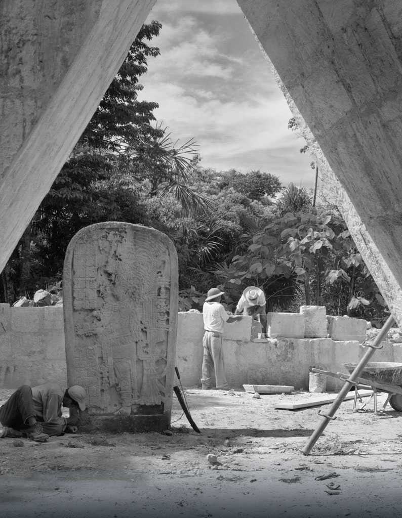
Above: Altar (for a stela) showing a bound figure lying prone. PM image 63-4-1421.
Mapping the Urban Character of Tikal
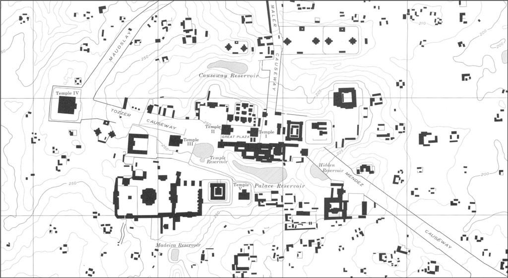
Excavations conducted by the Penn Musxeum (previously known as the University Museum) in Central America have had a long and fruitful history. From the early discoveries of Drs. J. Alden Mason and Linton Satterthwaite at ancient cities such as Piedras Negras in the 1930s to those post–World War II (WWII) studies of Drs. Alfred Kidder, Edwin Shook, and William Coe at Tikal, teams of scholars from Philadelphia revealed details of the basic story of the ancient Maya. One of the first and most important contributions from the Tikal Project researchers was a map created by Robert Carr and James Hazard demonstrating the urban character of this ancient city that had been so long hidden beneath a thick forest canopy. Among the other discoveries at Tikal was the recognition of architectural patterns among the different groupings of structures, and the identification of specific functions of these “plaza plans.” Many of the plaza plans recognized at Tikal now can be identified at other sites, allowing us to make comparisons and explore ancient Maya culture change through time and space.
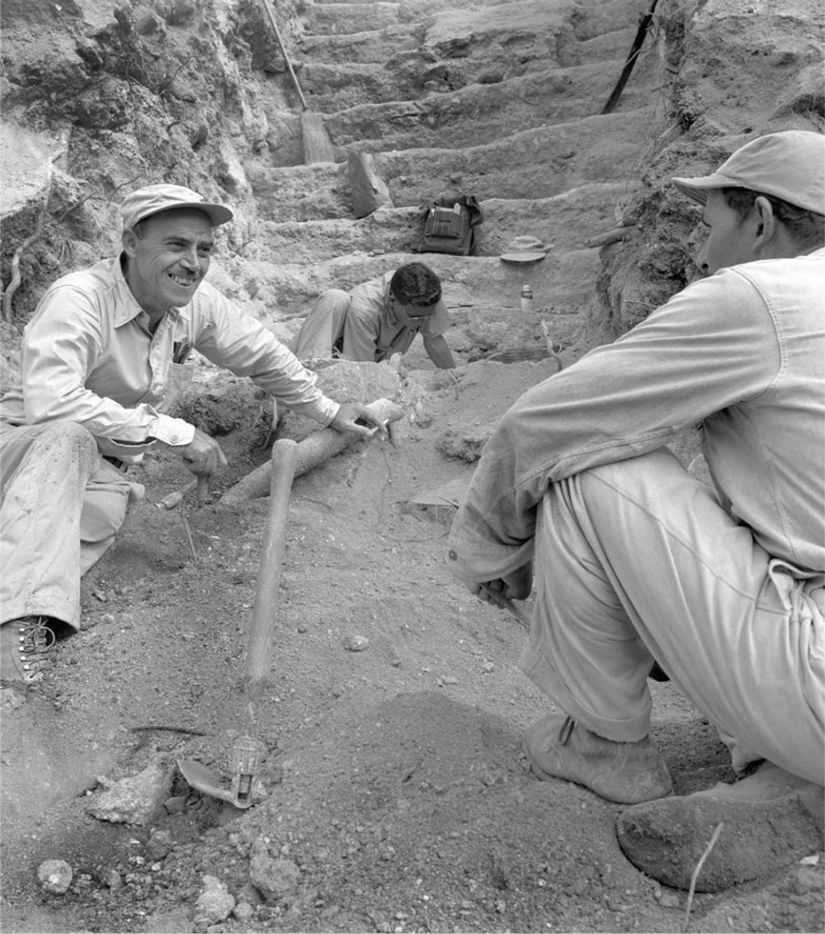
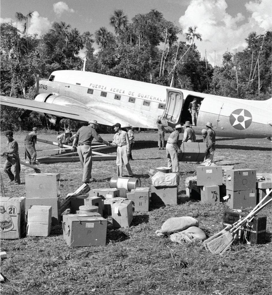
The earliest phases of Maya research explored specific cities that had been covered by dense tropical rainforests for centuries. Later explorers focused on clearing and photographing the largest temples at major Maya sites, but the Penn teams had a more modern strategy. They planned extensive mapping and systematic testing of a diverse range of structures, some of which had been recognized by the earliest explorers. Before WWII, most of these sites were accessible only by mule trains, essential for bringing scholars, laborers, and all their provisions to the targeted location. After WWII, a dirt airstrip was cleared at Tikal, next to the bajo (intermittent swamp) at the eastern margin of the ancient city. The airfield was designed to facilitate the transport of chicle blocks (raw chewing gum harvested from wild trees in the forest) to Guatemala City for sale to chewing gum companies. This strip also provided a means by which an extensive project could be supplied entirely by air.
Dr. Edwin Shook began work in the Maya region in 1934, joining the Carnegie Institution of Washington team at Uaxactun (1926–1937), some 20 km to the north of Tikal. Shook convinced Penn Museum Director Froelich (Fro) Rainey that a major, multiyear project at Tikal could be established and sustained completely by air. In 1955, with the permission of the Guatemalan government, Rainey appointed Shook to direct a field project that would have a number of very different scholarly components. Each was to be led by one or more of Penn’s noted archaeologists and supported by graduate students, most of them selected from the Anthropology Department at Penn.
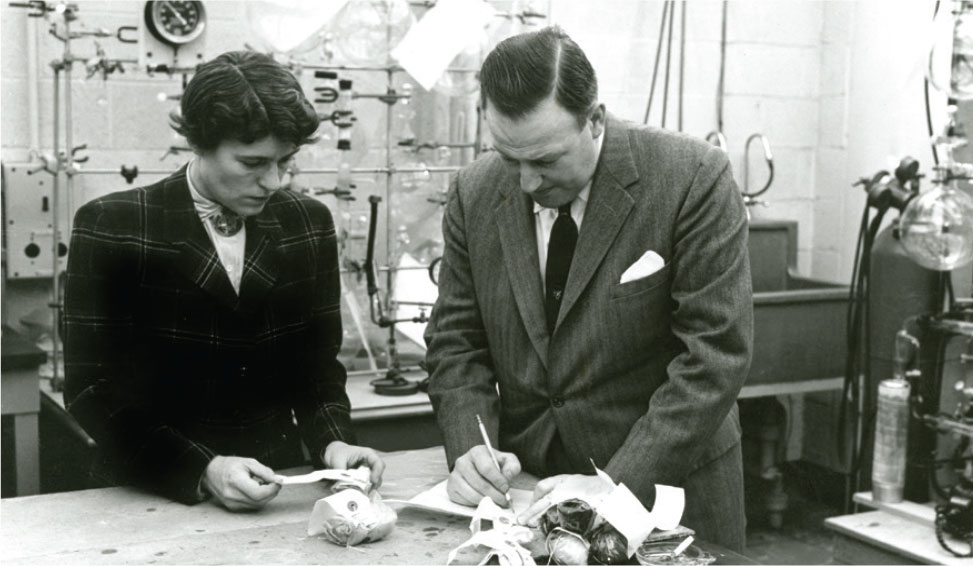
The formation of the Tikal Project at the Penn Museum took place as Americanist archaeology was increasingly refined through scientific studies. The Museum was already advanced in the application of scientific techniques, such as C14 analysis for archaeological dating—completed by the Museum Applied Science Center for Archaeology (MASCA)— and was continually influenced by new findings from anthropological research. Archaeologists had long recognized that sites throughout the Maya lowlands were much more complex than simply clusters of large ceremonial buildings. What seemed to be the “ceremonial center” of most sites is now recognized as the “core” or administrative heart of a sprawling city. A city such as Tikal includes a vast hinterland within which the residential groups including houses of the inhabitants spread for more than 10 km beyond the site’s core. Walking between Tikal and Uaxactun takes a traveler past a decreasing density of houses in the Tikal periphery until about the midpoint, where house numbers begin to increase as one passes into the suburbs of neighboring Uaxactun, a smaller city. Where the dividing point between these two ancient cities is located remains a question to be answered.
Specific-Use Structures
In 1924, Danish archaeologist Frans Blom first recognized a specific group of ancient Maya buildings that he believed served as an astronomical observatory. This cluster of buildings, a plan identified at Uaxactun as the “E-Group,” was tested during excavations in the 1930s and determined to have been used as observatories for naked-eye astronomy. Since that discovery, groups similar in layout and function have been identified at a great number of Maya sites including Tikal. These groups are all identified as generic “E-groups” after the group notation that was used at Uaxactun. Their presence at cities throughout the Maya lowlands reveals how local populations may have developed an understanding of the visible universe far more sophisticated than anything that existed at a time centuries before Europe’s famous astronomers Johannes Kepler (1571–1630) and Nicolaus Copernicus (1473–1543) were even born.
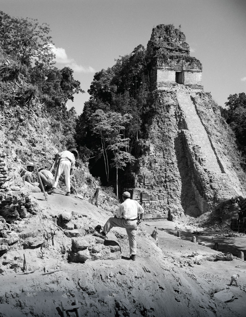
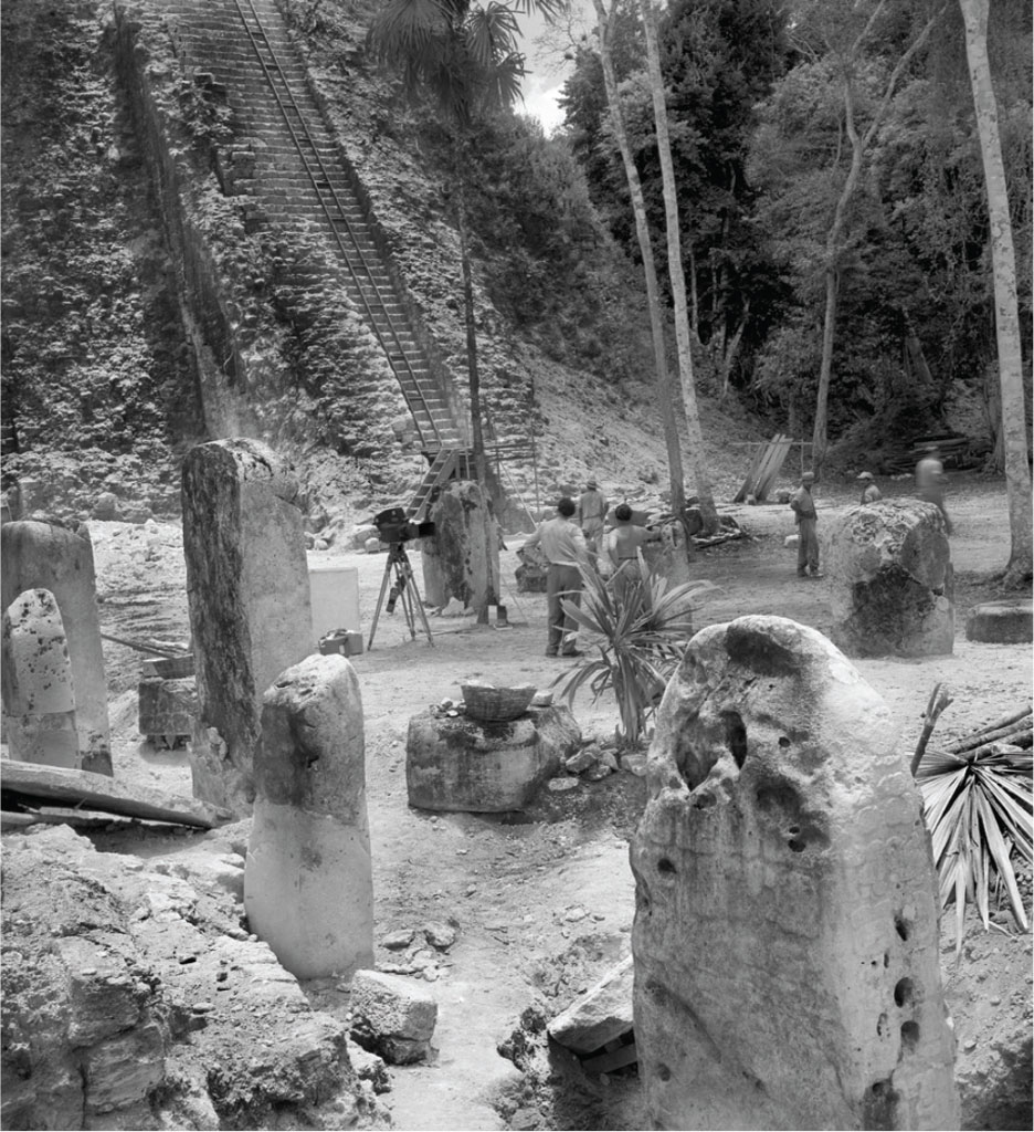
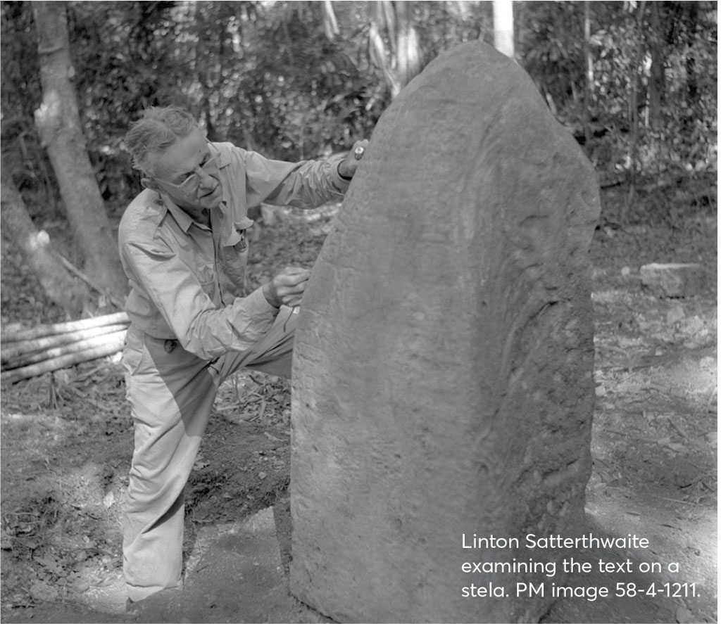
The major temples at Tikal are so tall that their tops are visible above the forest. Planes flying into Tikal actually pass below the peaks of these enormous constructions. As the 1956 season was getting under way, Satterthwaite reported that “a fine new carved stela and altar had just been discovered.” Shook, with his vast knowledge of lowland Maya archaeological sites, postulated that a “special pattern of assemblage” was represented by this stela-altar pair and the buildings with which it was associated, and that this new example of this pattern was the fifth one to be recognized at Tikal. All conform to a basic plan: a pair of tall, four-sided platforms facing each other on the east and west of a large plaza, with a long ritual building to the south and an enclosure on the north, built around a carved monument with a date marking the end of a katun, a 20-year period in the Maya calendar. Later Dr. Christopher Jones, archaeologist at the Penn Museum, recognized three more examples at Tikal. Inscriptions on these monuments indicate that these groups were erected at 20-year intervals. Shook’s “twin- pyramid” groups are now identified as Tikal Plaza Plan 1 (PP1: Becker and Jones, Tikal Report 18, forthcoming), a feature characteristic of Tikal. These twin pyramid groups provide an example of a type of architectural regularity that existed for at least 150 years. The recognition of this regular pattern in an architectural group allows us to predict form as well as function for specific sets of buildings that were scattered throughout Tikal.
Salvage Archaeology at Tikal
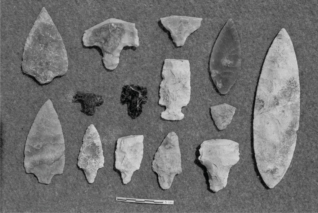
The continued search for carved monuments covered with ancient texts led to the discovery of a wide variety of smaller structures throughout the ancient city. In 1959, it became urgently important to excavate one group of small buildings as it was in the path of planned construction. During that summer, Dr. Ann Chowning directed excavations at this cluster of small structures, excavations that included a number of firsts in Maya archaeology. Chowning appears to be the first woman to direct a multiperson field team in the Maya lowlands. These were also the first archaeological excavations covering an extended group of ordinary Maya residential buildings. A third new discovery was that this work was initiated as “salvage” archaeology: the recovery of data from an area of the site that was scheduled for destruction. The targeted area was the location intended for the project’s sawmill and the planned village for workers who were brought in to maintain the project. An important question addressed by this excavation was how successfully a field team could work after the summer rains had begun. Excavations in the lowlands had been confined to the dry season, roughly between January and May of each year. Excavators also learned where the Maya buried their dead. The locations of royal burials had not yet been predicted, but, in 1959, Chowning found that almost every structure she excavated held the remains of the very people who lived in these households. Burials, as well as ritual caches of all sorts, abounded in and around these small platforms that served as the foundations for the pole and thatch buildings that made up most Maya structures. This construction style, still in use, was used to build the housing for the project as well as for the sawmill.
Mapping Tikal
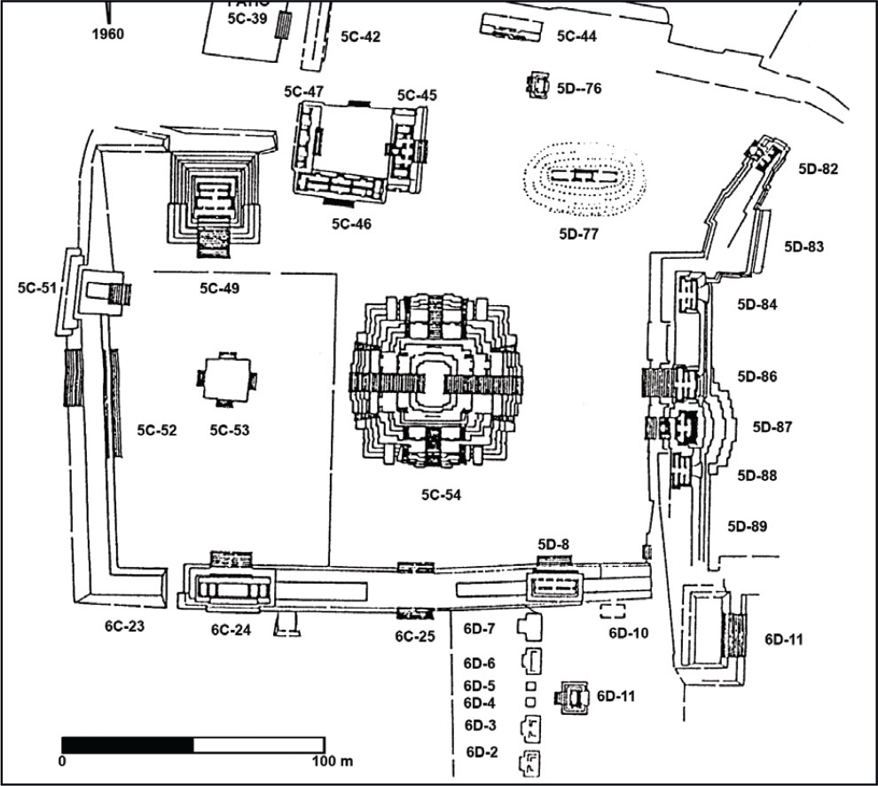
The recognition of how individual buildings or groups of structures of similar form were used allowed archaeologists to understand the composition of ancient Maya cities. One of Shook’s important innovations at Tikal was his decision to map, in detail, 9 km2 of the central portion of this sprawling Maya metropolis, later increased to 16. Shook assembled a team of mappers who devoted two years to drafting a map of every structure in this area. The initial results were then rechecked and refined. These results, a first in Maya archaeology, have been in print as Tikal Report 11 for nearly 60 years, long before LIDAR (Light Detection and Ranging—an aerial surveying method using pulsed light) became more widely available in archaeology.
The map of Tikal, using traditional labor-intensive methods, has been duplicated at only a handful of Maya sites during the past five decades. This method continues to provide an accurate basis for planning excavations at Tikal. The extensive and detailed map of Tikal revealed that there are more than 2,000 separate structures within the mapped zone, clustered into 690 distinct groups. The vast majority of these groups housed a single extended Maya family, averaging 25 individuals. Thus, the mapped central portion of ancient Tikal had a population of roughly 17,000. If all the people resident in Tikal’s vast hinterlands are included, the total population was about 45,000. These were the first calculations of the population for an ancient Maya city based on direct evidence.
Using the Map to Conduct Further Research
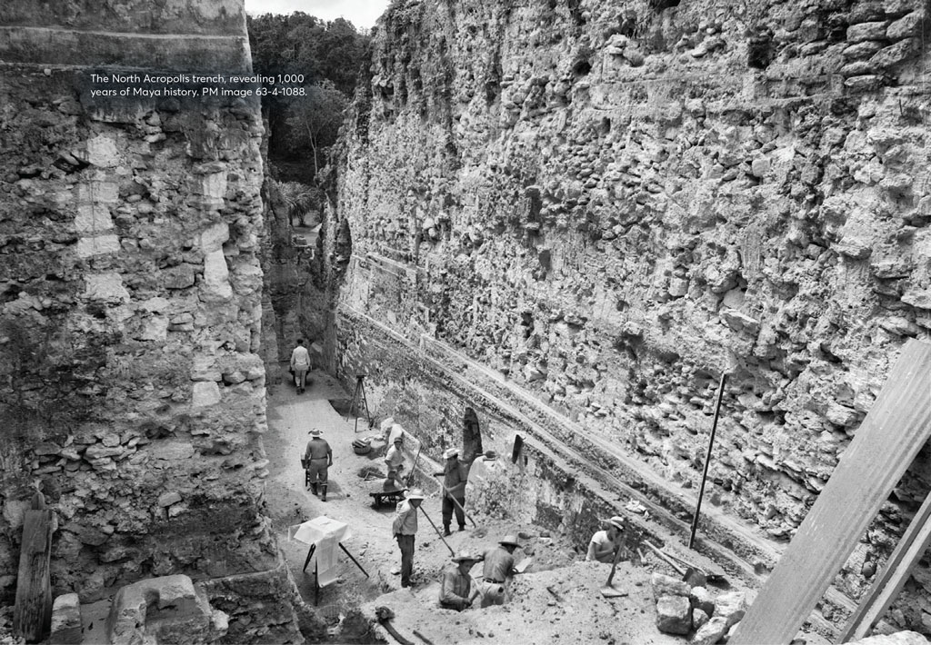
The huge temples and 1,000 years of archaeological accumulation represented by Tikal’s North Acropolis merited Coe’s 30 years of archaeological endeavor. The Tikal map enabled us to formulate a wide variety of research projects at different locations at the site. One of these early projects focused on a peninsula of land jutting into the bajo south of the Tikal airfield. This naturally defined area had nine clusters of buildings (houses) of various sizes; each group included a shrine on the eastern side. The excavation and publication of these groups and the verification of the accuracy of the map in this zone became my doctoral dissertation. The primary findings of these excavations included confirmation of the residential functions of these groups. An entire group formed a single ancient Maya residence: a house compound for an extended family. We also discovered evidence for specialized occupations for specific families, such as the production of fine painted ceramics, woodworking, and even dentistry. Perhaps the most important discovery made during this year of research was that the structure on the eastern margin of these groups was a ritual building or family shrine. Each shrine included the burials of important members of the family living within this group of structures.
When the map of Tikal is examined in detail, we can find other examples of these small shrines on the eastern side of an architectural group, structures that are diagnostic of PP2 (see below). They had been detected by the mapping team but remained to be ground tested. Each of these shrines is relatively small in plan, square in shape, and low compared with other structures in the group. Each includes a series of burials, the first of which is placed in a grave dug down into the limestone bedrock. The presence of a shrine on the east of a residential group, in which the other structures are relatively regular rectangular residential structures, aligned N-S and E-W, provided the marker for a specific and new type of plaza plan at Tikal. With the Twin-pyramid groups representing Tikal Plaza Plan 1 (PP1), groups with a mortuary shrine on the east can be identified as Tikal Plaza Plan 2 (PP2). Regular residential groups at Tikal that are similar but have no shrine on the east are identified as conforming to Tikal Plaza Plan 3 (PP3). Many other plaza plans have been recognized in recent years.
Although all the groups on the targeted peninsula at Tikal have shrines on the east, similar shrines are relatively infrequent at other parts of the site. A review of the map reveals that only about 15 percent of all the residential groups at Tikal conform to PP2. A majority conform to PP3, a cluster of residential structures with no evident ritual building. As a test of the idea that we can distinguish shrines on the east using only the map, we used the map to select a random sample of each type and then spent a summer field season excavating only the eastern structure of each. Not only were we 100 percent able to predict the group plan from the map alone, but we even found one group that began as PP2 and was converted to PP3, and another that was the reverse. Whatever cultural or religious tradition was associated with the shrines on the east of PP2 groups, some families at Tikal switched at some point in their history, showing evidence of cultural change. Excavations at other sites have demonstrated that the PP2 was more common. In at least one site in the Maya lowlands, residential groups conforming to PP2 form more than 90 percent of all the houses identified. Variations in percentages from site to site must be telling us something.
Of particular interest at Tikal is that the size of household groups belonging to the same Plaza Plan varies widely. This suggests that families using similar religious practices demonstrate wide variations in their wealth. While the functions of the various buildings forming the group were identical to all the others of that PP, the resources involved varied enormously. This reveals wide variations in economic status within the social groups that used the same housing pattern. When applied throughout the site, these finds suggest that the people called “kings” may have been very rich, and first came to lead by virtue of their wealth—an example of a “heterarchical” system. Social equality with wide economic variation helps us to understand why there are no clear concentric zones of occupation at Tikal. Wealthy and poor families both lived close to the site’s residential center and all economic classes also lived in outlying areas. The full version of the map of Tikal created by Carr and Hazard (see detail, page 28) shows that small houses of the poorer residents are found randomly distributed over the landscape, along with house compounds of the elite and various ritual structures.
Locating Tombs
Because we now know that the Tikal Maya conceived each architectural group as following a specific pattern, we can use our understanding of these cultural rules regarding each Plaza Plan to direct our excavations more efficiently, particularly when applied to locating major tombs. Unfortunately, within a year of recognizing the relationship between PP2 and burial locations, looters throughout the region of Petén used this information to locate important tombs.
The PP2 pattern at Tikal was used by archaeologists to locate Burial 116, a major tomb found beneath Temple I. Having discovered the cultural rules regarding the placement of burials within PP2 shrines, we knew to search off the axis of the huge Temple I construction and look for the previous structure into which the tomb had been dug. In effect, the area of the Great Plaza at Tikal began life with a design that was not a PP2 but was converted to one under the direction of the family of the king who was interred there.
Over the years, other Plaza Plans have been recognized at Tikal. For example, PP4 is characterized by a small square platform in the center of its plaza. These variations in the residential plaza plans reveal the degree of ethnic diversity as well as the processes of culture change that were present at Tikal. Each of these different arrangements of structures, identified with distinct PP numbers, allows us to evaluate the composition of this ancient site, all based on careful mapping. The same process, based on maps alone, has already been applied with enormous success to other sites such as Quiriguá and Copán. The landmark map of Tikal, drawn up the old-fashioned way, will also serve as a basis to test the possible uses of LIDAR in conducting future archaeological research.
Marshall Joseph Becker, Ph.D., is Professor Emeritus (Anthropology) at West Chester University. He worked at Tikal as a Penn graduate student and wrote his M.A. thesis and dissertation on aspects of the site, published as Tikal Reports 19 and 21.