After a three-decade hiatus, the Penn Museum reopened a seminal dig site in southern Iraq.
Cities first appeared, the Bible tells us, in southern Mesopotamia. Beyond such received knowledge, archaeologists and anthropologists have thought long and hard about why, how, and when this profound change in social organization took place in what was a verdant but precarious environment. Early explorations focused on the large sites of Nippur, Ur, Uruk, Telloh (Girsu), and Eridu watered by the Tigris and Euphrates rivers. Investigations focused almost exclusively on monumental structures, finding evidence for the origins of writing, monumental architecture, narrative visual arts, and organized religion. Work continued during the middle of the 20th century, by both Iraqi and international archaeologists, exploring ancient Lagash, known as Tell al Hiba, as well as sites like Fara (ancient Shurupak), and Larsa. The primary focus continued to emphasize monumental architecture, cuneiform tablets, and spectacular works of art, as well as burial grounds including the Royal Tombs of Ur, which stunned the world with unexpected treasures. Until now little attention was given to investigate why this radical transformation in social organization happened at this particular place and time. Indeed, until the 21st century, with new methods and technologies, it was not possible to do much more than speculate and hypothesize.
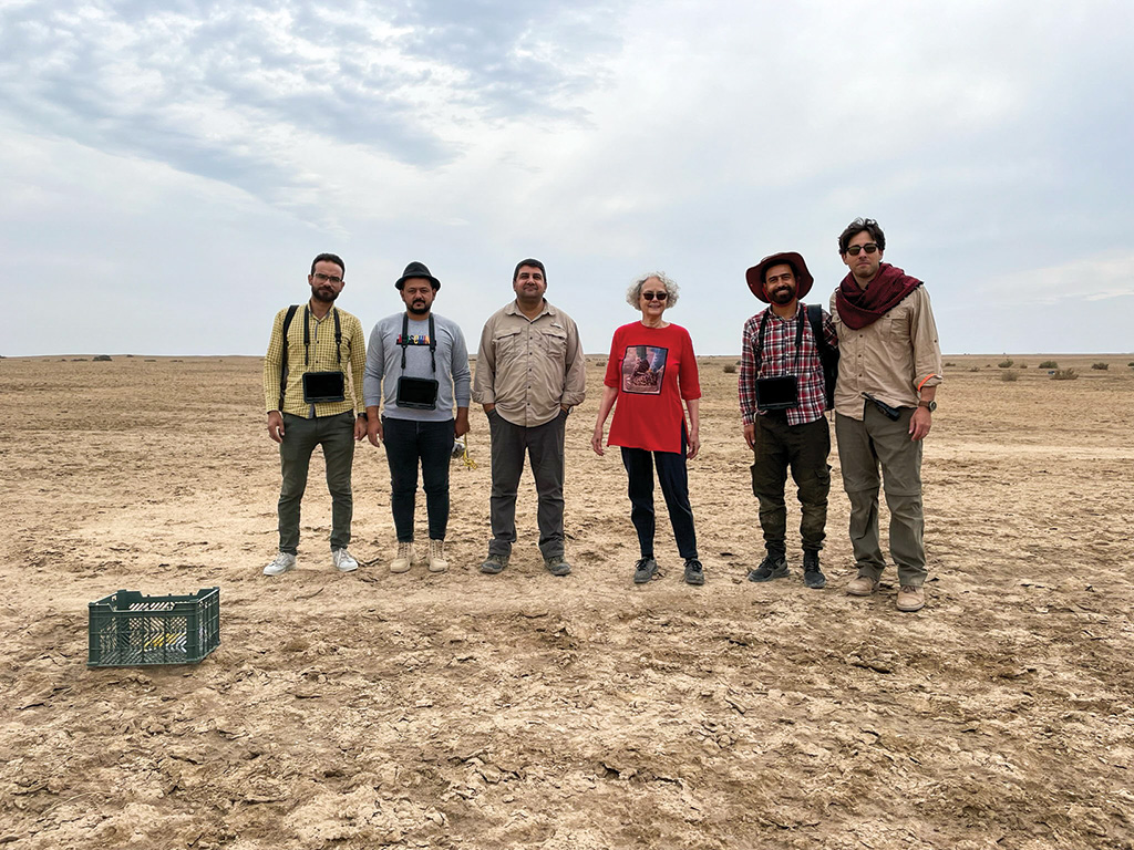
In 2018, Penn Museum got the green light to return to southern Iraq after I secured a five-year permit to resume archaeological work at Lagash. Together with the University of Cambridge, and now with the University of Pisa, the Lagash Archaeological Project has had four productive seasons of work. Building on the results of the earlier campaigns, I decided to dedicate the new work to the exploration of how the “other half” lived in the cities of ancient Sumer, looking for evidence of craft industries as well as domestic and public spaces frequented by the everyday citizens of this enormous city in ancient Mesopotamia.
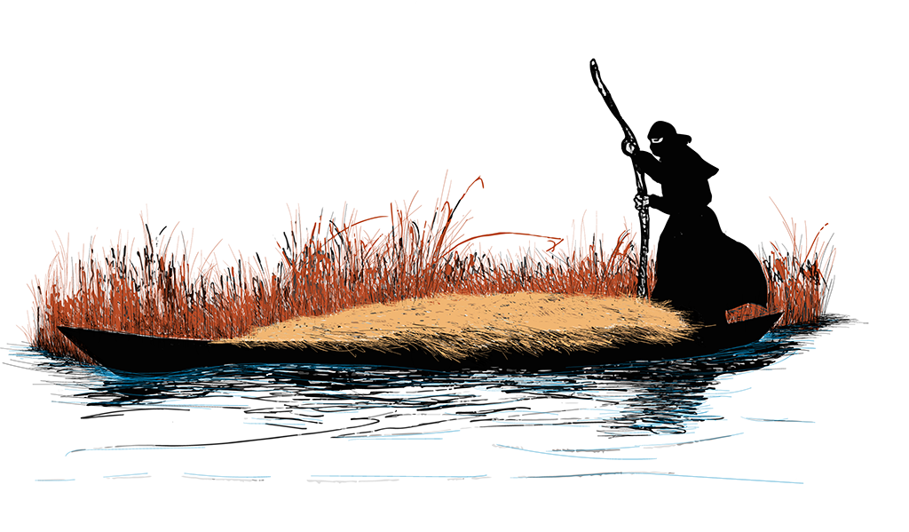
The land that was once Lagash is now known as Tell al Hiba, in the Dhi Qar province of southern Iraq. It is more than 125 miles north of the city of Basra at the mouth of the Persian Gulf, but in the third millennium BCE, it was close to the mouth of the Gulf, with marshes full of fish, birds, and reeds on one side and fertile alluvial soil to the west for productive agriculture. It also had ready access by boat to trade with resource rich communities of the Iranian plateau. Our work has shown that until the middle of the fourth millennium BCE, this region was essentially underwater, in a rapidly evolving landscape—first marine, then estuary, then delta environments—to the riverine alluvium at the turn of the third millennium. The earliest settlement was likely small and religiously significant, settled in the midst of marshes, although this is still just an unexplored hypothesis. By the beginning of the Early Dynastic period, around 2900 BCE, we know that Lagash was a large city with distinct walled neighborhoods. Lagash grew and evolved into a center of industry and agricultural wealth.
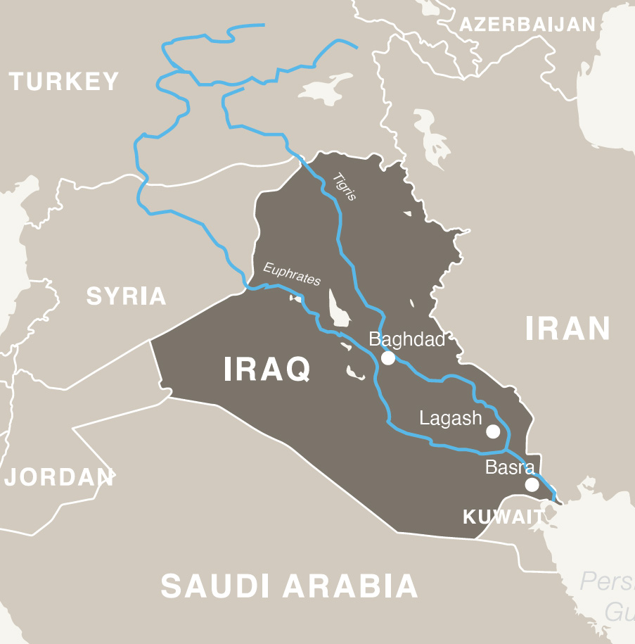
We know from texts found at Telloh that Lagash was the largest of the three cities that made up the city state also called Lagash (like an ancient version of New York, New York). The cities were strung from north to south along the “Going to Nigin” canal, which ended at the port of Guabba as it entered the Gulf. To the west of the canal were rich agricultural fields: the breadbasket of Sumer at the end of the third millennium. Every city in Sumer had its own divine resident, and every citizen— from the most powerful ruler and priest to the workers in the fields—had to care for and feed this deity. The warrior god Ningirsu, for example, was the resident god of Girsu, the religious and political capital of the city state of Lagash.
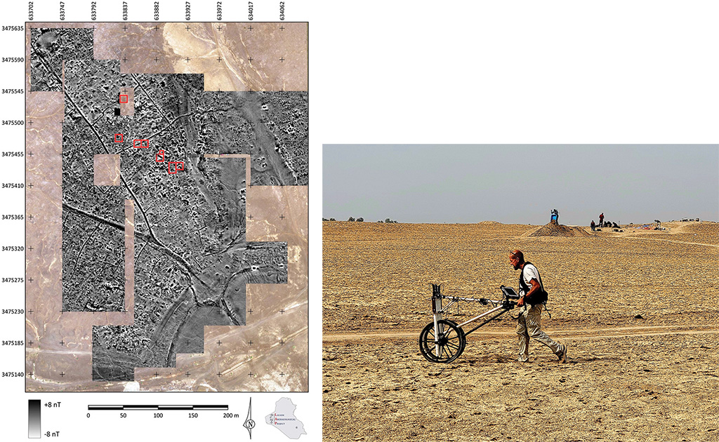
The Lagash Archaeological Project relies on a variety of methods to investigate the ways that people lived in the ancient city. The most powerful tool is remote-sensing technology, including drone photography and fluxgate magnetometry, particularly useful for a large site like Lagash, which was spared the heavy overburden of later occupation that could obscure the periods we’re most interested in. When it rains, the features beneath the surface soil of the mound dry at differential rates, and as a result, features like walls and streets pop out as different colors and textures to be captured through UAV photography. This technology is augmented and enhanced at Lagash by using magnetometry, which detects naturally occurring magnet signals of features beneath the soil. This technique allows us to “see” walls, kilns, streets, pits, open courtyards, and water features as different shapes and colors in the magnetogram. Beginning the work in 2019, we have expanded over the two seasons in 2022 to cover a large area in the southeastern sector of the city. With an expanded capacity, over the next series of campaigns we will prioritize acquiring such images over much of the site. This will allow us to identify monumental structures, as well as to characterize the built environment of different neighborhoods of the vast city: craft production zones, waterways and harbors, houses, streets, and public eateries.
Looking forward, we designed a research agenda that takes advantage of technologies and methods that weren’t available 40 years ago. Specifically, our plan is to test a hypothesis recently put forward by Prof. Monica L. Smith at the University of California Los Angeles. Smith posits that pristine urban settlement required the presence of a robust “middle class,” defined in this case as actors or communities that have economic agency who contribute to the complex economic fabric of an urban settlement. We will test this through magnetometry, as well as survey and test pits, on three or four neighborhoods across the large site. In each one we will open horizontal excavation of comparable contexts, from domestic housing to open-air public installations such as public eateries, streets, and craft production areas. Through this systematic sampling, we will determine similarities or differences and evaluate where they seem to be located on a continuum between the non-elite and elite sectors, based on what we know through earlier excavations. We will also factor in evidence such as texts and monuments. After three decades away from Lagash, we are seeing how new data and new technology can tell new stories, and how rich an interdisciplinary venture can be, combining the tools of archaeology and anthropology as well as art history, geophysics, agricultural sciences, and beyond.

We can see many throughlines from the 3rd millennium BCE to today, including water-management strategies, use of marsh resources, and mud-brick architecture. The lush greenery seen here in the garden next to the dighouse dispels stereotypes of the Middle East as a barren desert. In this quiet early morning scene, water buffalo graze under a warm sky and the drooping power lines of modern Iraq. The low ancient mound lies in the far-off, hazy distance, beyond soccer fields and the pale silhouette of a treeline.
Holly Pittman is a Curator in the Near East Section and the Bok Family Professor in the Humanities in the History of Art Department. In addition to Iraq, she has excavated in Cyprus, Turkey, Syria, and Iran.