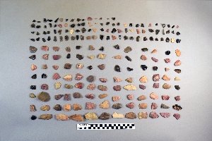
Search Collections
- Object[40]
- yes[40]
- no[40]
- american[40]
- alibates creek[1]
- anderson lake[3]
- arizona[3]
- beck forest lake[1]
- bivens estate ranch[1]
- blowout mountain[1]
- canadian river[1]
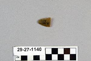
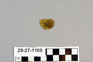
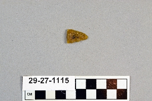
- clovis[17]
- colorado[3]
- curry county[1]
- eddy county[2]
- elgin island[1]
- elm creek[1]
- florence (texas)[1]
- gravel pit[14]
- henry gault mound[1]
- indian hill[1]
- ingleside cove[2]
- landergin[1]
- little pine canyon[1]
- live oak peninsula[1]
- near abilene[2]
- near san jon[1]
- near taos[2]
- new mexico[27]
- nueces county[2]
- polard lake[3]
- pot creek[2]
- quay county[1]
- ralph thayer ranch[1]
- rocky arroyo[1]
- salinas creek[2]
- site 10[3]
- site 8[2]
- st. charles bay[1]
- taos county[2]
- texas[10]
- united states of america[29]
- utah[3]
- basket maker[1]
- pueblo[1]
- "johnny-behind-the-deuce cave"[1]
- 2 mi. w. of gravel pit near clovis, n.m.[2]
- basin site[1]
- bottom level.[1]
- creek bed of elm creek 7.5 mi. south of abilene[1]
- first terrace surface[2]
- from 2 mi. w. of gravel pit near clovis, n.m.[1]
- from lake 3 mi. w. of gravel pit near clovis, n.m.[3]
- from old lake 1.5 mi. s.w. of gravelpit about 18 mi. s.w. of clovis[1]
- from old lake west of gravel pit about 18 mi. s.w. of clovis[4]
- rectangular pit house, 2d/2b, 15 in. below surface -- at base of humus.[1]
- surface around gravel pit near clovis, n.m.[2]
- surface site[1]
- walled cave rocky arroyo seep 50-60 miles west of carlsbad[1]
- west side of gravel pit[1]
- chipped[35]
1 - 30 of 40 Records
1 - 30 of 40 Records