Search Collections
- Object[193]
- no[193]
- american[193]
- alaska[77]
- aleut village[1]
- aleutian islands[4]
- alibates creek[2]
- aquanchicola creek[1]
- arizona[5]
- attu island[4]
- baracoa[4]
- bivens estate ranch[2]
- bolivia[1]
- bristol (pennsylvania)[1]
- bucks county[5]
- burlington county[3]
- burlington island[1]
- cape darby[3]
- cape denbigh[12]
- cape nome[3]
- charlton county[2]
- chesser's island[2]
- chickies[5]
- clovis[1]
- colorado[16]
- cook inlet[5]
- cottonwood creek (alaska)[2]
- cuba[4]
- cumberland county (tennessee)[1]
- delaware county (pennsylvania)[2]
- delaware river[1]
- delaware valley[1]
- department of alta verapaz[3]
- diamond (ohio)[1]
- dutch harbor[1]
- east tennessee[1]
- georgia[2]
- grassy cove[1]
- gravel pit[1]
- guatemala[3]
- gungnuk site[3]
- gunpowder neck[1]
- halibut cove[1]
- hammonton[4]
- hancock county (ohio)[1]
- harford county[1]
- inskip region[4]
- iredell county[1]
- ishmailoff island[1]
- iyatayet[12]
- kachemak bay[2]
- kansas[1]
- klickitat county[4]
- knight island[1]
- lancaster county (pennsylvania)[5]
- laurel hill cemetery[1]
- lehigh county[1]
- little mike point[2]
- lone wolf creek[2]
- lumberton[1]
- luquillo[1]
- mancos[1]
- markham[2]
- marquette county[1]
- marshall county (west virginia)[2]
- maryland[1]
- mercer county[8]
- mexico[1]
- middlesex county (new jersey)[1]
- moorestown[1]
- morgantown road[20]
- near englewood[1]
- new brunswick (new jersey)[1]
- new jersey[16]
- new mexico[2]
- north america[1]
- north carolina[1]
- norton sound[15]
- ohio[11]
- old town[1]
- palmyra township[1]
- panama[1]
- pechoqueolin creek[3]
- pennsylvania[36]
- philadelphia[1]
- philadelphia county[1]
- portage county[6]
- rock retreat[3]
- san pedro carcha[3]
- southeast coast (alaska)[2]
- southern illinois[3]
- texas[4]
- trenton[8]
- unalakleet[39]
- united states of america[104]
- unites states of america[6]
- utah[2]
- washington (u. s. state)[4]
- west indies[5]
- west virginia[3]
- wheeling[2]
- wheeling quadrangle[2]
- yukon island[11]
- sitio conte[1]
- aleut[3]
- ancestral pueblo[2]
- arawak[1]
- chinook[4]
- cocle[1]
- denbigh flint complex[12]
- eskimo[3]
- paleo-eskimo[3]
- post-contact[2]
- prehistoric eskimo[5]
- taino[1]
- yakutat (culture)[1]
- "bottom level"[1]
- 2 f, 3' - 3' 6", viii (ix?)[1]
- 2 g, 3' - 3' 6", vii or viii[1]
- 2 m 2', ix[1]
- 3 e 6', ii[1]
- 4 k, 11' 6" - 12', layer 1 (?)[1]
- 5 j, 12' 6" - 13', layer 1[1]
- 5 k, 12' - 12' 6", layer 1[1]
- 5 k, 12' 6" - 13', layer 1[1]
- big wall[4]
- c, 3' - 3' 9", vii[1]
- c, 3' 9" - 4' 3", vii[1]
- d, 4' - 4' 6", vii[1]
- from potato patch, #4 square, west extension.[1]
- from road cut[3]
- from roadside gutter[14]
- from roadside gutter.[3]
- from ruin along ancient ditch[1]
- gun.[3]
- h, 10' 6" - 12', i[1]
- h, 3' - 3'6", vi[1]
- house 102[1]
- house 119[6]
- house 12[1]
- house 120[8]
- house 18[2]
- house 2[7]
- house 3[6]
- ip house[10]
- iyh[1]
- iype-2 dfc[1]
- iyz-4[1]
- layer 10 ft. below surface[1]
- morales, pits a and b first dig[1]
- mound i[1]
- n 0, w 0 - on level which is a continuation of house floor[1]
- n 1.25, w 0.5 - level which is a continuation of house wall[1]
- n 1.5, w 2.5 - level with house wall[1]
- n 1.5, w 2.75 - on compacted gravel level which is a continuation of house wall[1]
- n 1.5, w 4.75[1]
- n 1.75, w 0.75 - level which is continuation of house wall[1]
- n 3.75, w 3 - in floor[1]
- nutbeam's beach[1]
- probably trench 2[1]
- s 1, w 2 - in ground below thin, greasy, black-brown layer[1]
- s 5.5, w 2.5 - in floor of second level from top[1]
- s 6, w 0 - test put (mrp)[1]
- s 6, w 3 - gravel layer[1]
- s 6.5 - w 5 - test pit in gravel layer[1]
- s 7, e 0 (mrp)[1]
- site 3[1]
- site 9, 2nd site on n edge of ridge n. of carter[1]
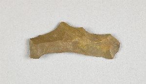
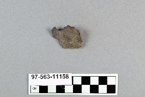
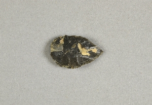
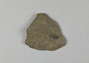
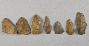
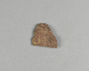
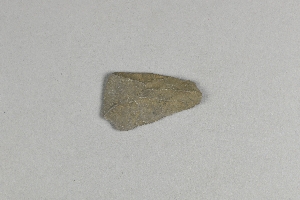
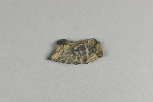
- chipped[83]
1 - 30 of 193 Records