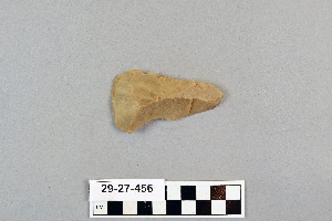
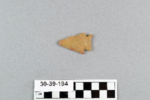
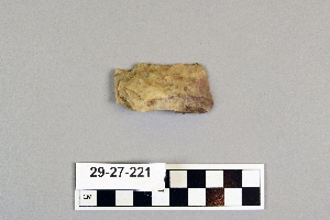
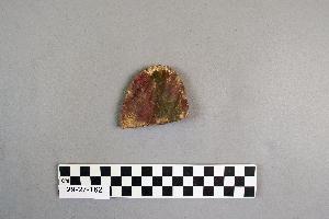
Search Collections
- Object[1,515]
- no[1,515]
- american[1,515]
- arrow[11]
- arrowhead[3]
- flake[1]
- flakes[1]
- knife[1,515]
- knife sheath[1]
- lance[11]
- point[23]
- projectile point[283]
- saw[1]
- scraper[39]
- spear point[1]
- abilene[11]
- alaska[32]
- albany county[4]
- albany region[4]
- alibates creek[33]
- anclota estuary[8]
- anderson lake[13]
- antelope creek[15]
- berks county[10]
- bivens ranch[5]
- blowout mountain[8]
- brownsville[18]
- bucks county[6]
- buffalo gap[9]
- burke county[4]
- california (state)[12]
- canadian river[112]
- cedar bay[6]
- chattanooga[4]
- chillicothe[11]
- clovis[7]
- cottonwood creek (texas)[33]
- cumberland county (tennessee)[6]
- deal[16]
- diamond (ohio)[13]
- east orland[11]
- east tennessee[286]
- eastern pennsylvania[5]
- eddy county[5]
- elgin[259]
- elm creek[17]
- ewing and bragdon site[23]
- farm of william holocher[4]
- fayette county (pennsylvania)[18]
- florida[17]
- frenchman's bay[23]
- georgia[7]
- gould ruin[11]
- grassy cove[6]
- guadalupe (california)[6]
- hancock county (maine)[34]
- handley ranch[11]
- indian hill[16]
- indiana[9]
- iredell county[22]
- kansas[4]
- kentucky[9]
- kings ruins[17]
- kraale[8]
- lancaster county (pennsylvania)[5]
- landergin[31]
- lehigh county[5]
- lendsey farm[11]
- logan (new mexico)[18]
- maine[34]
- marshall county[48]
- marshall county (west virginia)[35]
- mercer county[4]
- miami county (ohio)[11]
- michigan[9]
- monongahela river[18]
- morrisville[4]
- mount de chantal convent[5]
- near abilene[70]
- near englewood[4]
- new jersey[16]
- new mexico[47]
- new york[4]
- north carolina[36]
- ohio[157]
- ohio county[48]
- ohio county (west virginia)[40]
- ohio river valley[11]
- palmyra township[13]
- pennsylvania[119]
- pimatella ranch[6]
- pinellas county[8]
- pit house[4]
- point barrow[6]
- point hope[15]
- port washington[6]
- portage county[34]
- potter county (texas)[15]
- pricetown[9]
- quay county[18]
- ross county[14]
- san nicolas island[5]
- santa barbara county[6]
- site 8[13]
- smith county[6]
- sullivan county (indiana)[7]
- tennessee[34]
- texas[557]
- united states of america[1,412]
- unites states of america[34]
- west virginia[88]
- wheeling[40]
- wisconsin[7]
- wolf creek[12]
- wyatt farm[10]
- late archaic[11]
- maritime archaic[11]
- moorehead phase[11]
- algonguin[1]
- basket-maker[1]
- basketmaker[1]
- eskimo[19]
- inuit[3]
- norton[1]
- pecos cave dweller[2]
- prehistoric eskimo[11]
- pueblo[2]
- red paint people[11]
- zuni[1]
- "johnny-behind-the-deuce cave"[3]
- 0.75 mi. beyond bridge[4]
- 10 1/2" deep below 6 1/2" of ploughed area[1]
- 11" deep, 8" down in cr. shell[1]
- 11" from b.[1]
- 13 1/2" deep, in cr. shell and fire dirt;[1]
- 13" down in 16" band of shell over fire pit[1]
- 14" deep, heap 28" deep; 25" from c, 27" from 3[1]
- 14" from 7, 15" from c.[1]
- 15 1/2 from 7[1]
- 15" deep in cr. shell[1]
- 16 1/2" deep on top of ash and beach gravel and fine shell 5" deep[1]
- 16 1/2" from c, 19" from 1.[1]
- 16" from 3, 33 1/2" from c.[1]
- 17" deep in humus, beach gravel and fire dirt and shell, on top of basic clay[1]
- 17" deep, under ploughed area[1]
- 17" from d, 2" from 6[1]
- 18 1/4" from c.[1]
- 2 1/2" from 2[1]
- 2" from b, 13" from 4[1]
- 20" from c, 4 1/4" from 4[1]
- 21" down in 16" band of shell over fire pit[1]
- 22" deep in 1" of beach pebble below 2" of black ash at bottom of heap[1]
- 22" deep, under 17" of cr. shell, and 1" of b. gravel, in 1 1/2" of fine cr. shell and fire dirt[1]
- 22" from b, 6" from 6[1]
- 23" from c, 2 1/2" from 3.[1]
- 24" deep in bottom of cr. shell extending from top[1]
- 24" deep in whole and cr. shell 28" deep[1]
- 25" deep lying in fire dirt of hearth, beside hearth stone under 2" of pebble[1]
- 27 1/2" deep in 1 3/4" of beach gravel.[1]
- 27" deep below 2" stratum of beach gravel, in bl. fire dirt[1]
- 27" deep, heap 32" deep here over band of cr. shell[1]
- 3" deep over fire dirt 3 3/4" deep; 7" from 2, 14" from a.[1]
- 4 1/2" from b[1]
- 5 3/4" deep in bottom layer of beach gravel and shell[1]
- 5" from 3, 30" from b[1]
- 6" deep in whole and cr. shell; 1" from c. 16 1/2" from 1[1]
- 8" from 7[1]
- `3" deep. 2" down in 16" of whole and cr. shell; 17" from b, 6" from 10[1]
- above fire dirt and beach gravel, heap 31" deep;[1]
- basin site[1]
- below surface/above main floor of burnt house[2]
- creek bed of elm creek 7.5 mi. south of abilene[3]
- elm creek surface site[4]
- flying moose lodge boys camp (est. 1921)[11]
- found in neighborhood of elgin[1]
- from "blow-outs" near finley site, near eden[1]
- from brandywine (laubach) camp-site.[2]
- from lake bank 1 mi. s.e. of gravel pit near clovis, n.m.[1]
- from roadside gutter[1]
- from rock shelter[1]
- from ruin along ancient ditch[1]
- gravel pit[9]
- heap 28 1/2" deep[1]
- heap 28"[1]
- iye, c[1]
- jim armstrong farm[1]
- just above humus; 11" from 14, 26 1/2" from c.[1]
- mesa site[13]
- near mouth of elm creek[9]
- on 15, 23" from b[1]
- on c line, 5 1/2" from 3.[1]
- on line o, 21" from 15.[1]
- one foot down.[1]
- orange grove.[1]
- paint creek[9]
- pit house floor[4]
- rossen's ranch near lawn[3]
- rowland's farm[1]
- ruin along ancient ditch near englewood[3]
- sand dune surface site near nugent[1]
- shell ridges[1]
- shell ridges, near surface[1]
- shores of delaware river at morrisville, pa., and trenton, n.j.[4]
- site 48 (dewitt farm)[1]
- surface[27]
- surface find[5]
- surface near deal[13]
- surface site[24]
- surface site 12 miles so. of alamogordo[1]
- surface site in cotton field 1 mi. e. of lawn[2]
- surface site in cotton field mile e. of lawn[16]
- surface site near abilene[9]
- surface.[1]
- walled cave rocky arroyo seep 50-60 miles west of carlsbad[1]
- actual citation[18]
1 - 30 of 1,515 Records