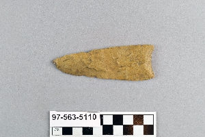
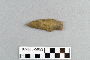
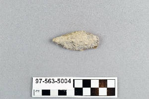
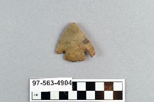
Search Collections
- Object[252]
- yes[252]
- no[252]
- albany county[10]
- anderson lake[10]
- arizona[2]
- arkansas[3]
- beck forest lake[4]
- berks county[7]
- bethlehem (pennsylvania)[1]
- blowout mountain[3]
- box canyon[1]
- bridger basin[1]
- brownsville[11]
- brunswick county[1]
- bucks county[20]
- carlsbad[1]
- cayuga county[1]
- chester county[2]
- chickies[2]
- clovis[19]
- colorado[2]
- delaware[2]
- delaware county (pennsylvania)[1]
- duboistown[2]
- east tennessee[3]
- eastern pennsylvania[1]
- eddy county[4]
- elm creek[2]
- fayette county (pennsylvania)[11]
- french creek[1]
- genesee valley[1]
- georgetown[18]
- gravel pit[4]
- gulf of mexico[1]
- haldeman's island[4]
- harding county[1]
- hayes county[4]
- indian island[1]
- kentucky[1]
- kerr county[1]
- kerrville[1]
- kimberton region[1]
- lancaster county (pennsylvania)[35]
- larger van meter mound[1]
- last chance canyon[2]
- lehigh county[1]
- lehigh river[1]
- lincoln national forest[2]
- little pine canyon[1]
- locust grove[19]
- lodge pole trail[1]
- loudonville[7]
- lumberton[8]
- lycoming county[2]
- maine[1]
- marietta (pennsylvania)[1]
- markham[1]
- marsh run[3]
- mercer county[2]
- mescal pit[1]
- missouri[2]
- monongahela river[11]
- muerto creek[1]
- near abilene[5]
- near bueyeros[1]
- near carlsbad[2]
- new jersey[12]
- new mexico[25]
- new paltz[1]
- new york[16]
- nueces county[1]
- nugent[1]
- ohio[2]
- oley[4]
- osage county[1]
- padre island[1]
- pechoqueolin creek[3]
- pennsylvania[104]
- penobscot county[1]
- penobscot reservation[1]
- philadelphia[1]
- philadelphia county[1]
- pike county (ohio)[1]
- pricetown[3]
- ralph thayer ranch[1]
- red river[3]
- saltville[1]
- san marcos (texas)[4]
- shattuck cave[1]
- sheeders[1]
- site 2[1]
- smyth county (virginia)[1]
- sussex county (delaware)[1]
- taylor county[1]
- texas[78]
- trenton[2]
- united states of america[233]
- utah[2]
- virginia[2]
- warren county (pennsylvania)[8]
- williamson county (texas)[24]
- witmer's farm[2]
- "johnny-behind-the-deuce cave"[1]
- blue bone-bearing sand on east side of gravel pit[1]
- burial [uncertain][1]
- cache [uncertain][1]
- creek bed of elm creek 7.5 mi. south of abilene[2]
- deep hearth on south side of erosion island[9]
- deep hearth on south side of erosion island... associated with extinct bison bones[1]
- east side of gravel pit[1]
- fishpond excavation[4]
- found in place at bottom of blue sand on east side of gravel pit[1]
- from brandywine (laubach) camp-site.[17]
- from rock shelter[1]
- habitation site[1]
- island in susquehanna river[1]
- lake 15 mi. west of gravel pit[1]
- large cave near pumping station, last chance canyon, west of carlsbad, n.m.[2]
- midden[1]
- mound[1]
- mouth of --- creek[1]
- near oldtown[1]
- philadelphia marshes[1]
- sand dune surface site near nugent[1]
- slaughter river[1]
- surface[1]
- surface site[3]
- chert[252]
- chipped[129]
- actual citation[12]
1 - 30 of 252 Records