Search Collections
- Object[1,972]
- no[1,972]
- adze[1]
- arrow[8]
- arrow shaft straightener[2]
- arrowhead[438]
- arrowhead fragment[6]
- axe[172]
- axe fragment[2]
- ball[4]
- bead[8]
- blade[14]
- bow drill[2]
- cast[2]
- chip[10]
- concretion[2]
- cores[8]
- cup[2]
- dart[33]
- dart point[7]
- disc[2]
- disk[2]
- drill[7]
- drill point[9]
- emblem[3]
- end scraper[5]
- fetish[31]
- flake[21]
- folsom point[3]
- folsom points[3]
- football[4]
- game board[2]
- game piece[4]
- grinding stone[14]
- grooved axe[6]
- grooved stone[2]
- groundstone[6]
- hafted axe[2]
- hammer[16]
- hammerstone[32]
- hand axe[2]
- hatchet[7]
- head whacker[2]
- hoe[2]
- implement[12]
- implement fragment[3]
- kachina doll[2]
- knife[40]
- knife blade[17]
- knife point[6]
- lithic[36]
- lithic tool[3]
- mallet[11]
- mallet head[7]
- mano[176]
- mano stone[88]
- maul[24]
- metate[30]
- metate fragment[4]
- mortar[34]
- necklace[9]
- nodule[2]
- notched axe[2]
- object[5]
- ornament[5]
- paint mortar[2]
- paint stone[2]
- pebble[21]
- pendant[27]
- pestle[16]
- pick[5]
- piki stone[2]
- pipe[13]
- pipe stem fragment[3]
- point[135]
- point butt[3]
- points[5]
- polishing stone[6]
- projectile point[26]
- rattle[3]
- ring[3]
- rock[9]
- rubbing stone[13]
- sandal last[2]
- sandstone[2]
- saw[6]
- scraper[85]
- sherd[2]
- spear[7]
- spear head[10]
- spear point[64]
- spearhead[10]
- stone[47]
- stone fragment[3]
- stones[2]
- tablet[4]
- tip[2]
- tool[4]
- tube[3]
- war club[26]
- war club head[2]
- whorl[2]
- "su" site near reserve[7]
- abilene[8]
- alibates creek[33]
- anderson lake[6]
- arizona[261]
- banquete creek[5]
- beck forest lake[9]
- bivens estate ranch[18]
- canadian river[13]
- canyon[27]
- cave[40]
- cave near col river[71]
- chaco canyon pueblo[5]
- cliff house[9]
- clovis[30]
- cochiti pueblo[4]
- colorado[356]
- colorado river[52]
- colorado river canyon[4]
- colorado river region[67]
- corpus christi[36]
- corpus christi area[30]
- curry county[4]
- deep canyon[5]
- eddy county[6]
- elgin island[6]
- first mesa[5]
- gravel pit[12]
- greater southwest[14]
- hano[7]
- kroenig ranch[10]
- laguna madre islands[6]
- lake canyon[16]
- landergin[5]
- larimer county[8]
- lendsey farm[11]
- lindenmeier site[8]
- live oak peninsula[57]
- logan (new mexico)[81]
- logan (texas)[34]
- loma pardo[6]
- lost canyon[5]
- maricopa county[5]
- mesa[10]
- navaho mountain[19]
- navajo reservation[21]
- near abilene[33]
- near clovis[6]
- near ft. collins[8]
- near phoenix[8]
- near salt river[6]
- neuces[9]
- new mexico[369]
- north america[10]
- nueces county[79]
- nueces dam[20]
- nugent ranch[8]
- oraibi[5]
- oso bay[6]
- petronillo creek[5]
- polard lake[10]
- pueblo bonito[5]
- pueblo mound[6]
- puerto bay[14]
- quay county[87]
- railroad mountain[5]
- rectangular pit house[8]
- red canyon[10]
- red fish point[5]
- red house[5]
- rincon[46]
- rio grande[11]
- rio grande region[23]
- rockport[14]
- salinas creek[11]
- salt river[13]
- san jose river[7]
- san jose river region[5]
- san patricio county[20]
- silver springs valley[5]
- site 1[6]
- site 10[10]
- site 4[7]
- site 5[6]
- site 8[5]
- southeast arizona[5]
- southeastern utah[671]
- southwest colorado[269]
- southwest united states[13]
- southwestern colorado[150]
- st. charles bay[11]
- texas[355]
- united states of america[700]
- upper rio grande river[16]
- utah[106]
- walpi[6]
- watrons[6]
- watrous[18]
- whitewater draw[14]
- zuni river[14]
- acoma[1]
- anasazi[2]
- ancestral pueblo[68]
- apache[20]
- athapaskan[1]
- basket maker[1]
- basket-maker[213]
- basketmaker[9]
- chiricahua apache[1]
- cliff dweller[515]
- cliff-dweller[1]
- cochise[15]
- cochiti[4]
- cochiti pueblo[2]
- comanche[9]
- folsom[8]
- hohokam[2]
- hopi[41]
- hopi-tewa[7]
- keres[2]
- keresan[2]
- laguna[2]
- laguna pueblo[1]
- mogollon[7]
- moki[3]
- navajo[11]
- papage[2]
- pecos cave dweller[3]
- prehistoric pueblo[1]
- pueblo[141]
- san juan[2]
- santa clara[1]
- taos[3]
- taos pueblo[1]
- tarahumare[1]
- tesuque[2]
- tewa (culture uncertain)[1]
- tewa (culture)[5]
- tusayan[1]
- ute[1]
- western apache[1]
- white mountain apache[3]
- zuni[40]
- "circle" area, 1d, depth 14 in.[1]
- "circle" area, 1d/a, depth 1 to 6 in.[1]
- "prehistoric cliff ruins".[1]
- "salt flat" uncertain[1]
- 2 mi. w. of gravel pit near clovis, n.m.[3]
- 40" level[1]
- 48" level[1]
- 60" level[1]
- 70 ft. no. of '37 excavation in west wall of gravel pit[1]
- 9 mi se of wilcox, branch of pluvial lake cochise[2]
- a - 4 - south; located 4' 6" from surface, 10" above speckled sand contact[1]
- a known comanche site[5]
- anderson lake, about 15 mi. s.e. of clovis, n.m.[1]
- anicent ruins[1]
- approximate 7' level near front of pit.[1]
- bottom level[1]
- bryans' station[1]
- buried site along highway 66, 5 miles west of san jon[1]
- burnt mound[3]
- c' - 9 - south[1]
- callo del oso[2]
- cave site[1]
- cave/cliff dwelling[3]
- centre line[3]
- cliff dwelling / cave[1]
- cliffhouse near red house[3]
- cliffhouse near red rock[1]
- colorado desert[1]
- depth of 18 in.[1]
- depth of 27 in.[1]
- dr. ray's site on clear fork of brazos river.[4]
- flat place in front of cave[2]
- found 3 miles northeast of tempe. (at ruins?)[1]
- found in cave on side of mesa.[1]
- found in excavated blue material[1]
- from cliffhouse near red house[1]
- from ruins 3 miles north east of tempe.[1]
- from ruins 3 miles northwest of tempe.[1]
- from ruins 8 miles north of phoenix.[1]
- from ruins within 10 miles of phoenix.[2]
- from surface of fork of brazos river.[1]
- gravel pit[2]
- located in situ 6" below brown sand, bluish clay contact, in the bluish clay associated with bison bones which occur throughout the blue at this location[1]
- mesa site[5]
- mescal pit in small canyon north of dark canyon near carlsbad, n.m.[2]
- mound[1]
- mounds near austin[1]
- near abilene[3]
- near chama river[1]
- near jettyto spring[2]
- near rio chama[1]
- near rio grande river[1]
- near the river[1]
- near upper rio grande river[3]
- near white river[2]
- old lake 2 mi. south of gravel pit near clovis, n.m.[1]
- old lake bed[1]
- paint creek[7]
- rectangullar pit house, 2d[4]
- rectangullar pit house, 2d, depth 10 in.[1]
- rectangullar pit house, 2d, depth 22 in.[1]
- rossen's ranch near lawn[2]
- ruins[2]
- ruins in arizona found 1872[1]
- sand "blowout" 20-25 miles northeast of carlsbad[1]
- sand site[3]
- sands near mammoth bones[1]
- shell mounds[17]
- site 40 or 41[1]
- site beside mesa near navaho mountain[1]
- small museum[1]
- surface[14]
- surface around gravel pit near clovis, n.m.[3]
- surface finds from site of j. w. carruthers ranch.[2]
- surface near deal[1]
- surface site[1]
- surface site in cotton field mile e. of lawn[1]
- surface site near abilene[2]
- surface, lendsey farm, near abilene.[3]
- tubarevantes?[1]
- vicinity of keams canyon[1]
- agate[2]
- amethyst[1]
- andesite[1]
- animal bone[2]
- animal tooth[1]
- barite[9]
- basalt[10]
- bivalve shell[1]
- brass[1]
- breccia[1]
- buckskin[2]
- calcite[10]
- ceramic[3]
- chalcedony[29]
- charcoal[1]
- chert[21]
- clay[8]
- concretion[2]
- conglomerate[1]
- coral[3]
- cow hair[1]
- cow tail[1]
- dacite[3]
- diorite[3]
- fabric[2]
- feather[4]
- fiber[12]
- fur[1]
- gabbro[1]
- glass[15]
- gourd[1]
- granite[2]
- granodiorite[1]
- gypsum[7]
- hair[12]
- hawk feathers[1]
- hide[19]
- horse hair[8]
- jasper[4]
- leather[7]
- limestone[3]
- malachite[1]
- mudstone[5]
- obsidian[2]
- paint[2]
- pigment[17]
- plant fiber[2]
- plaster[2]
- pumice[5]
- quartz[3]
- quartzite[6]
- rawhide[7]
- rhyolite[2]
- sandstone[7]
- scoria[5]
- seed[1]
- shale[11]
- shell[18]
- siltstone[3]
- silver[4]
- sinew[15]
- skin[4]
- slate[6]
- soil[1]
- stone[1,972]
- string[1]
- thread[1]
- turquoise[14]
- volcanic stone[2]
- wood[45]
- yarn[2]
- yucca[13]
- actual citation[165]
- general reference[1]
1 - 32 of 1,972 Records
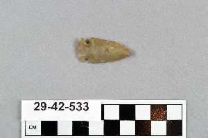
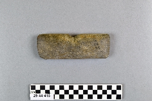
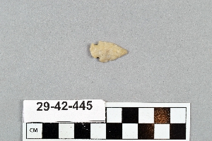
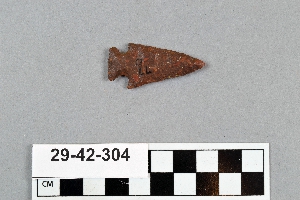
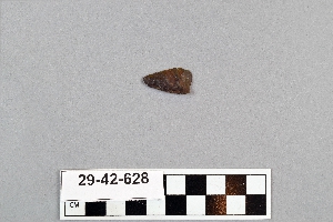
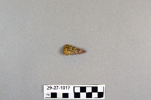
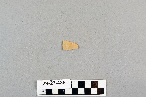
1 - 32 of 1,972 Records


