Search Collections
- Object[168]
- yes[168]
- no[168]
- american[168]
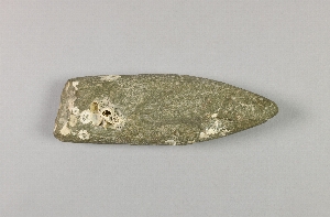
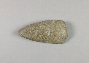
- adze[3]
- adze blade[1]
- adze point[1]
- arrowhead[1]
- awl[8]
- blade[2]
- boat part[1]
- button[2]
- china fragment[1]
- china fragments[1]
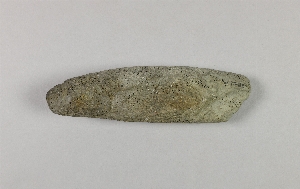
- chisel[2]
- copper[1]
- dart head[3]
- dart point[2]
- die[1]
- figure four trap[1]
- fish hook[3]
- flake[1]
- fragment[1]
- game stick[11]
- harpoon[1]
- harpoon head[4]
- harpoon line[1]
- kayak paddle[1]
- knife[2]
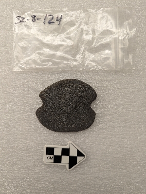
- labret[8]
- lamp[6]
- lance blade[1]
- lance point[1]
- mask[1]
- mask part[10]
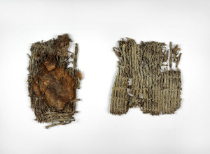
- matting[2]
- model[1]
- mortar[2]
- needle[8]
- needle case[3]
- nose ornament[1]
- nose pin[2]
- object[1]
- paddle[1]
- peg[1]
- pestle[2]
- pin[1]
- point[2]
- pottery fragment[20]
- pottery fragments[11]
- pump[1]
- ring[5]
- rod[2]
- sherd[11]
- sherds[1]
- sling shot handle[1]
- snuff mortar[1]
- socket piece[1]
- spear head[1]
- spirit mask[1]
- splitting adze[1]
- stone[1]
- thimble[1]
- throwing stone[1]
- toggle[1]
- tongs[2]
- tooth pendant[1]
- toy[1]
- tube[1]
- ulo[1]
- ulu[1]
- ulu blade[2]
- wedge[1]
- adam's place[4]
- alaganik[1]
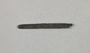
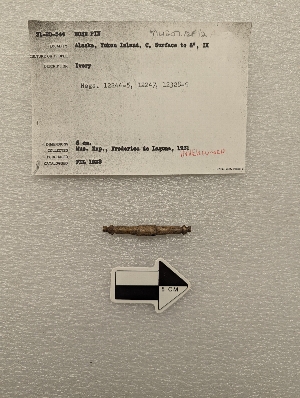
- alaska[166]
- anvik[6]
- anvik point[6]
- anvik river[8]
- aurora (alaska)[1]
- big cave[1]
- bonasila[3]
- chenega village[4]
- chistochina[1]
- cook inlet[17]
- copper river[2]
- copper river delta[1]
- copper river valley[1]
- cordova[4]
- cottonwood creek (alaska)[5]
- daxatkanada fort[3]
- diyaguna'et[1]
- eleven-mile village[2]
- ellamar[1]
- fox farm[2]
- frank fox's place[5]
- halibut cove[5]
- hawkins island[1]
- heisson[2]
- holy cross[5]
- indian island[1]
- ishmailoff island[5]
- kachemak bay[15]
- kaiyuh slough[7]
- kaltag[3]
- kashim[1]
- kateel[4]
- khotol river[7]
- knight island[5]
- kootznahoo inlet[3]
- koyukuk river[4]
- lost river[1]
- lower yukon river valley[26]
- macarthy district[1]
- middle yukon valley[8]
- mummy island[7]
- nunaktuk island[1]
- nunivak island[11]
- old fish camp[7]
- old town[4]
- palu:tat[3]
- palugvik village[1]
- point whitshed radio station[3]
- prince william sound[35]
- qngaqesle island[1]
- rock shelter[1]
- seldovia[1]
- sheep bay[1]
- tanana (alaska)[4]
- tanana mission[4]
- united states of america[143]
- washington (u. s. state)[2]
- yakutat bay[6]
- yukon island[55]
- chugach[18]
- chugach eskimo[4]
- eskimo[43]
- eyak[12]
- indian[4]
- inuit[1]
- kachemak bay culture iii[34]
- kachemak bay culture sub-iii[7]
- modern indian[3]
- prehistoric eskimo[53]
- yakutat (culture)[2]
- yukon[14]
- arctic culture area[168]
- 1 k 5' 6", ii[1]
- 2 f, 5', vii[1]
- 2 g, 3' 6" - 4', vii or viii[1]
- 2 j[1]
- 2 l 6', ii[1]
- 2 l 7', ii[1]
- 2'3" - 2'9"[3]
- 2'4" - 2'10"[1]
- 2'6" - 3' (?)[1]
- 2'9" - 2'3"[1]
- 2d, 6" -1', viii (ix)[1]
- 2e, 1' - 1'6", viii (ix?)[1]
- 3 g, (h) surface-6"[1]
- 3 h[6]
- 3 j[1]
- 3 j, 1'3" - 1'9"[1]
- 3 j, 1'3"-1'9"[1]
- 3' - 3'6"[1]
- 3'3" - 3'9"[1]
- 3-6" below surface[2]
- 4 h[7]
- 4 h, 3'6" - 4'[1]
- 4 j[1]
- 4 k[1]
- 4 k 3'4" - 3'9"[3]
- 4 k, 1'6"-2'3"[1]
- 4 k, 3'3" - 3'9"[4]
- 4 k.[1]
- 4' - 4'6"[4]
- 4'- 4'6"[1]
- 4'2" e and 7" n of sw corner of square at one edge of hearth #2[1]
- 4'6" - 5'[1]
- 4'9" - 5'3"[2]
- 5 h[1]
- 5 h, 9' 1-" - 1-' 4", layer 2[1]
- 5 j[2]
- 5 j, 10' 6" - 11', layer 1[1]
- 5'9" - 6'6"[1]
- 6'3" - 6'9"[2]
- 6'6" - 7'[1]
- 7' 5" - 7' 11"[1]
- 8'9" - 9'3"[1]
- 8-10" below surface[2]
- 9 ' below surface[1]
- a site on lost river near yakutat. from river[1]
- all from midden in front of recent house ruin.[1]
- at bottom of midden.[1]
- b2e 11"[1]
- bank on e. side of stream mouth and beach[5]
- beach[2]
- beach below big cave.[1]
- beach below small cave[1]
- beach on south side of northeast point[1]
- beach on the south side of northeast point[1]
- beach on the south side of the northeast point.[1]
- beach.[1]
- bottom layer 21-27 inches[1]
- c, 1' - 1' 6", ix[1]
- c, surface to 6", ix[1]
- c1e 6-12"[1]
- c2e 6-12"[1]
- e, 4'9" - 5'6", vi[1]
- found on beach below small cave[2]
- fox pen[1]
- from hill behind seldovia house[1]
- g, 2'6" - 3', vi[1]
- h, 10' 6" -12', i[1]
- h, ca. 10', i[1]
- house 1 - fill[1]
- house 12[4]
- house 4[3]
- house 8[4]
- house 9 fill[1]
- house pit[2]
- house pit 1 - fill[1]
- in midden rubbish.[1]
- j. 1' 6" - 2'[1]
- k 1' 6"-2'[1]
- l. surface - 1' 6"[2]
- layer (7 or?) 6[1]
- layer 5- a[1]
- layer 6[1]
- layer 6 or 5-c[2]
- layer 6 or 7[2]
- layer 6?[1]
- layer 7[3]
- layer 7 or 9[1]
- layer 7 or 9?[1]
- layer 7?[2]
- layer 8[6]
- layer 8, 7? or 6[2]
- layer 8?[1]
- layer 9[9]
- layer 9?[4]
- mound b near house 1[1]
- muller's garden and path to the beach.[3]
- new midden[1]
- on floor of house?[1]
- philip amarus farm (20 miles northeast of vancouver, washington)[2]
- slope of terrace #2, at house #1[3]
- animal bone[1]
- antler[9]
- basalt[2]
- bird bone[7]
- bone[28]
- caribou skin[1]
- ceramic[38]
- china[1]
- clay[10]
- copper[3]
- cormorant bone[2]
- cotton[2]
- feather[10]
- fish bone[4]
- fur[1]
- granite[2]
- grass[2]
- graywacke[1]
- greenstone[5]
- gypsum[1]
- hair[7]
- iron[3]
- ivory[8]
- lava stone[1]
- limestone[3]
- mammal bone[1]
- marble (stone)[2]
- metal[1]
- ochre[10]
- paint[11]
- sea lion tooth[1]
- sealskin[1]
- sinew[12]
- slate[7]
- soot[10]
- stone[12]
- whale bone[2]
- wood[33]
- wool[1]
1 - 32 of 168 Records
1 - 32 of 168 Records