Search Collections
- Object[3,444]
- no[3,444]
- american[3,444]
- arrow point[25]
- arrow point fragment[1]
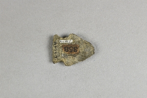
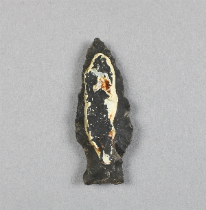
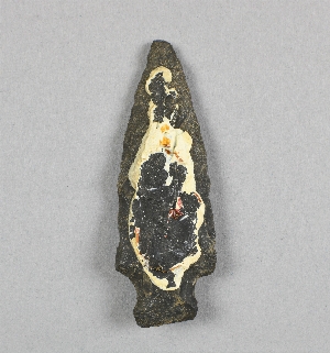
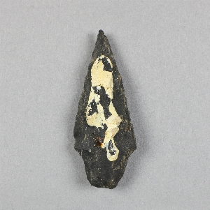
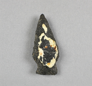
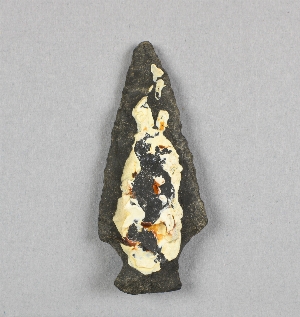
- arrowhead[569]
- arrowhead imitation[17]
- axe[1]
- banner stone[1]
- bannerstone[117]
- bannerstone fragment[1]
- bead[2]
- blade[142]
- bone[1]
- buckle[1]
- bullet[1]
- button[1]
- cast[1]
- celt[3]
- ceremonial object[22]
- club[1]
- club head[8]
- cutlery[1]
- dagger[3]
- drill[9]
- flake[2]
- flint[1]
- furniture[1]
- glass[1]
- gorget[103]
- gorget fragment[2]
- hardware[1]
- head axe[1]
- implement[5]
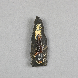
- knife[747]
- lance head[6]
- lancehead[2]
- lock[1]
- microblade[1]
- nail[1]
- object[2]
- pin[1]
- pipe[2]
- pipe fragment[1]
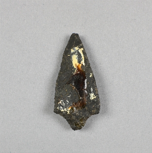
- point[831]
- point fragment[7]
- pottery[1]
- projectile point[710]
- projectile point fragment[4]
- scraper[12]
- scraper knife[1]
- shell[1]
- spear[1]
- spear spud[1]
- spearhead[171]
- spike[1]
- stone[1]
- thimble[1]
- toilet article[1]
- tomahawk[1]
- tomahawk head[1]
- tool[1]
- toy[1]
- war club blade[9]
- whetstone[1]
- window glass[1]
- allegheny river[14]
- bainbridge (pennsylvania)[10]
- berks county[257]
- blennerhasset island[16]
- bordentown[7]
- boyertown[224]
- bristol (pennsylvania)[13]
- brown county (ohio)[11]
- bucks county[93]
- buena vista (ohio)[7]
- burlington county[170]
- burlington island[12]
- cayuga county[41]
- cecil county[10]
- chester county[8]
- chickies[27]
- chillicothe[43]
- clermont county[6]
- clinton county[89]
- columbia (pennsylvania)[11]
- delaware[14]
- delaware county (pennsylvania)[16]
- delaware valley[41]
- delaware water gap[358]
- diamond (ohio)[51]
- district of columbia[71]
- duke (north carolina)[14]
- east hanover[46]
- eastern united states[48]
- flint ridge[36]
- fort ancient region[7]
- gloucester county[6]
- hamilton[18]
- hamilton square[18]
- hammonton[5]
- hansell farm[21]
- hummel's wharf[12]
- illinois[42]
- indiana[41]
- irvine[14]
- keith manour[9]
- kent county (maryland)[8]
- lancaster county (pennsylvania)[45]
- lehigh county[26]
- licking county[23]
- lock haven[88]
- long level[6]
- lumberton[10]
- markham[13]
- marquette county[10]
- marshall county (west virginia)[459]
- maryland[24]
- mercer county[227]
- monroe county (pennsylvania)[332]
- montgomery county (pennsylvania)[12]
- moorestown[81]
- morgantown road[18]
- near wheeling[83]
- new jersey[529]
- new york[67]
- north america[48]
- north carolina[14]
- northampton county[6]
- northumberland county[20]
- ohio[607]
- ohio county (west virginia)[336]
- palmyra township[51]
- pennsylvania[1,374]
- philadelphia[33]
- philadelphia county[34]
- pohopoco creek[25]
- point pleasant[13]
- portage county[146]
- rancocas creek[62]
- reading (pennsylvania)[14]
- riegelsville[7]
- rock hall[8]
- rock retreat[14]
- ross county[45]
- schuylkill county[8]
- scioto county[7]
- seneca falls[10]
- snyder county[18]
- sullivan county (indiana)[34]
- susquehanna river[13]
- susquehanna river valley[34]
- susquehanna valley[229]
- trenton[207]
- united states of america[3,124]
- unites states of america[146]
- warren county (new jersey)[29]
- warren county (ohio)[12]
- warren county (pennsylvania)[14]
- west virginia[513]
- wheeling[382]
- wheeling quadrangle[87]
- wisconsin[10]
- wood county[16]
- york[48]
- york county (pennsylvania)[68]
- 18th century[1]
- early archaic[1]
- historic[1]
- prehistoric[1]
- algonquin[72]
- historic[1]
- iroquois[33]
- late archaic[1]
- paleo-indian[1]
- northeast culture area[3,444]
- southeast culture area[61]
- "bottom level"[30]
- "lowest level"[24]
- "riverside"[3]
- abbott farm[1]
- abel cunningham farm[7]
- banks of laurie's mill pond[7]
- barne's farm[1]
- blockley field[1]
- crispin (?) farm mound[1]
- farm about 3 mi. above lock haven on south bank of west brnach of susquehanne river, surface.[2]
- farmland[1]
- field near town[1]
- flint quarry[1]
- frank moran's farm, surface[4]
- from around spring on top of hill near durham jasper quarry[1]
- from brandywine (laubach) camp-site.[2]
- from meadows below trenton.[7]
- from roadside gutter[18]
- from surface of field.[2]
- from surface of leibhart-peters farm.[3]
- from two camp sites on old cammann property.`[1]
- garden[1]
- golf links of the philadelphia country club[1]
- great mound[1]
- hanover neck[46]
- hays stewart farm, operation ii, surface[9]
- hereford?[7]
- independence square[1]
- indian village site on old keith manour[9]
- laurie's mill pond[2]
- lofland and gooden farms on either side of cor marsh ditch[1]
- mckinney's farm, mouth of mcelhatten creek, south isde of west branch of susquehanna river, 4 mi. below lock haven. surface[2]
- monro farm, operation i, pit #26, depth 10 in[1]
- monro farm, operation i, pit #26, depth 7-8 in[1]
- monro farm, operation i, pit #26, depth 8 in[1]
- mound[4]
- mound near creek, "bottom level"[1]
- mound near rancocas creek[10]
- mound near rancocas creek; "bottom level"[1]
- mound near rancocas creek; "intermediate level"[7]
- mr. snider's garden[1]
- near pine grove[1]
- operation iii[1]
- operation iii, pit # e and f, -3[1]
- pine station[2]
- pine station, quiggle farm, operation iii, pit no. e and f, -3. depth, surface to 14 in[1]
- pine station, quiggle farm, operation iii, pit no. g and h, -1 and -2. depth not recorded.[2]
- pine station, quiggle farm, operation iii, surface.[4]
- quiggle farm[2]
- richmond[1]
- river bank[1]
- sand dune in meadow[1]
- shaw's farm, mouth of pine creek, below lock haen on west branch pf susquehanna river, surface[12]
- squankum[3]
- surface[22]
- surface of field[2]
- surface, neighborhood generally[4]
- swatara furnace[1]
- upper creek[1]
- van campen's island[2]
- vicinity, surface[43]
- village site and quarry[8]
- zimmerman's farm[1]
- carved[2]
- chipped[1,497]
- drilled[1]
- flaked[1]
- grooved[3]
- ground[24]
- ground stone[1]
- groundstone[17]
- inscribed[1]
- perforated[2]
- unfinished[6]
- actual citation[541]
1 - 30 of 3,444 Records
1 - 30 of 3,444 Records