The eastern margin of the Classical “Old Empire” Maya area runs through the Crown Colony of British Honduras, between the Caribbean Sea and the Peten district of Guatemala. I spent fifteen weeks in the spring of 1950 there, the prime objective being to find a site suitable for a proposed “housemound project.” I was alone, and equipped for only minor sampling by excavation.
“Housemound” is an incomplete label for the project we have in mind, though the major emphasis would be on digging out ruins of dwellings. The ancient Maya are not interesting to us because they lived in houses but because of the extraordinary hierarchic society and culture which they developed. This included an intricate calendrical- astronomical system of determining fate, a special priestly caste to predict supernatural dangers and provide ritual protection against them, and elaborate architectural complexes as stage-settings for the specified ceremonies. These ceremonial centers were numerous and vary greatly in size. At many of them, priests or ritual scenes were the subjects of painted or sculptured art of a high order, especially on stone monuments. Last, but not least, records were kept by means of hieroglyphic writing.
Up to the present, nearly all archaeological effort has been directed toward enriching our knowledge of these spectacular elements of the culture as revealed in the ceremonial centers. The proposal that we should study ancient Maya houses does not imply a diminishing interest in such things, but rather a belief that it is time to broaden our factual base so as to be better able to explain them. The idea is to study some ceremonial center together with the area which sustained it economically and which was served by it.
\Ne ought to have some idea of how people of each class lived when not on dress parade. What was the total population that supported a ceremonial center of such-and-such a size and complexity, and which grew by accretion in such-and-such a length of time? How much arable land was available? To what extent was high status in the hierarchy reflected in personal living standards? We shall never get complete answers to such questions by archaeological methods, but neither do we know how far such methods might take us in these directions until we try them out on the whole area of an ancient community.
The ideal end-product of such a program would be complete knowledge of all surviving elements of all buildings, graves, refuse dumps, and so on, both in the center and in the sustaining area. That is an impracticable ideal, but one could get closest to it if one tackled the smallest possible center and area consistent with the presence of the hierarchic elements which really motivate the whole idea. As another important desideratum, the selected site should be close to modern “civilization,” to keep clown costs.
CAHAL PECH
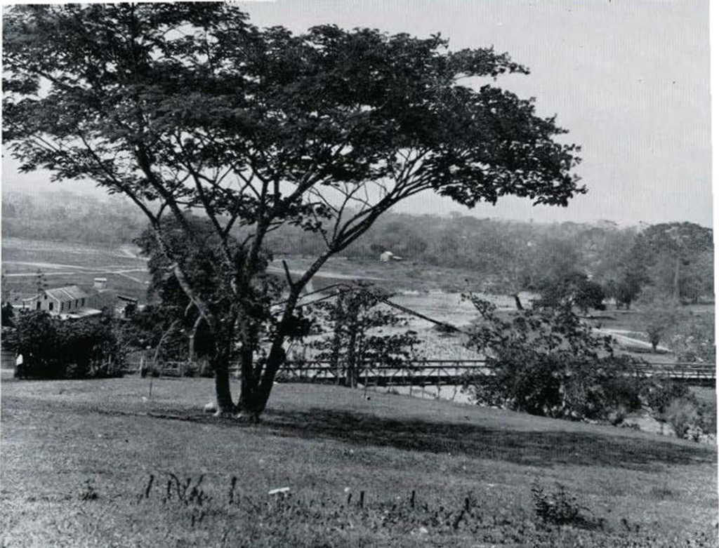
Cahal Pech is a site with an unpropitious Maya name meaning “Place of the Ticks,” but it seems to meet the requirements perfectly. This ceremonial center measures only about 150 by 250 yards, yet includes pyramid temples, palaces, and a ball court. Five stelae and an altar (plain) show presence of the stela cult. Some major buildings were roofed with the Maya vault, some apparently not. There was gradual architectural growth, the occupation probably running through the entire Classical Period, and we have ceramic hints of a longer occupation. Though previously unknown to archaeologists, it is only about a mile from the suspension bridge at El Cayo (Plate X, Fig. 1). Finally, it is on the lands of Mr. Henry Melhado of Belize, an extremely kind gentleman who permits us to dig it.
Most of my time went to exploratory digging here. I was taken to this site by A. Hamilton Anderson, District Commissioner at El Cayo, and the outstanding amateur archaeologist of the Colony. His more than generous help, backed by an enlightened policy of his governmental superiors at the capital, was invaluable throughout the season. He had other things to show me, and time was found for a modicum of attention to the purely hierarchic aspect at two other sites.
BENQUE VIEJO (Xunan Tunich)
The town of Benque Viejo is about six miles southwest of El Cayo and Cahal Pech. We use its name, which means “Old (river) Bank,” for a well-known ruin which is actually best reached from Socotz, the town of my chief Maya workmen and loyal friends, Jacinto Cunil and Ascención Alfaro. Anderson keeps the Benque Viejo ruins “bushed” for the benefit of the public. The highest mound has been labeled “Structure A6,” on the east side of which he recently rediscovered remains of sculpture in stucco. He dug just enough to show that well- preserved portions exist below the surface, then waited for a professional archaeologist to turn up. He uses the name Xunan Tunich for this site, as do the Maya inhabitants of Socotz. It means “Stone Lady” and reflects a local legend.
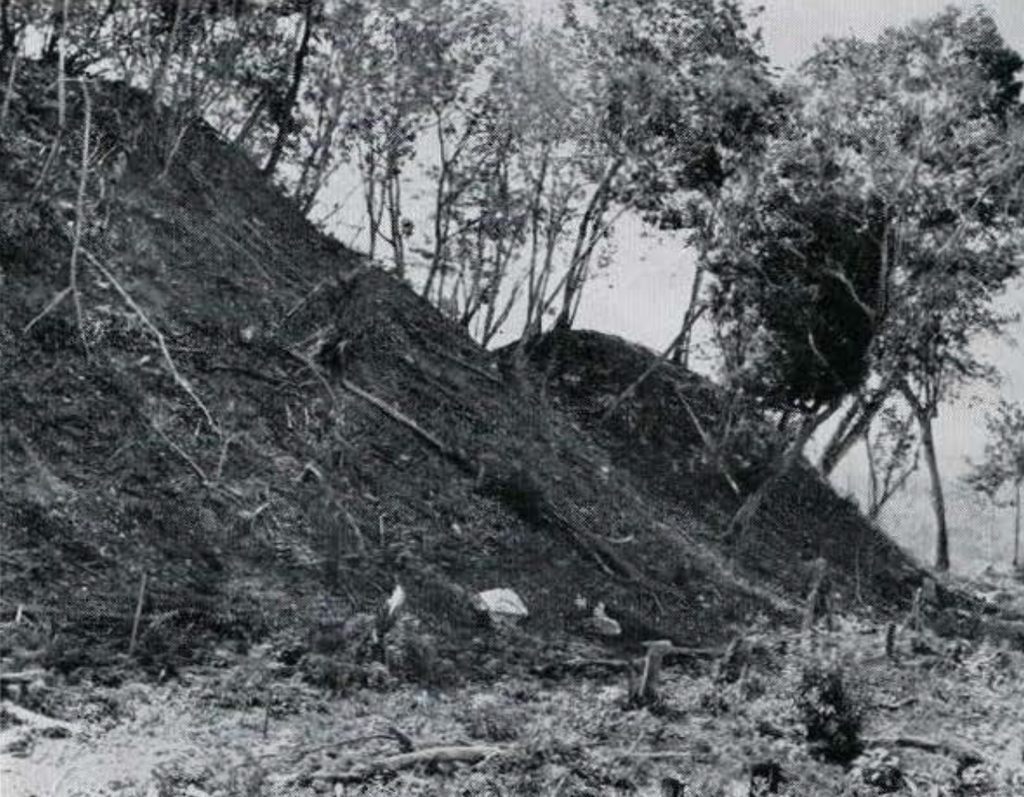
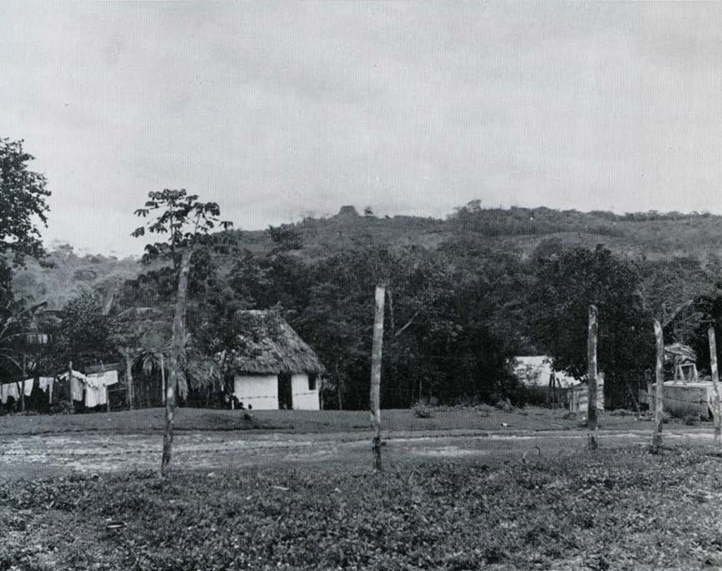
On Plate XI, Fig. 1, the mound in question appears on the horizon, across the Mopan river from the camera, which is in Benque Viejo Town, looking east. This view shows the local countryside much as it must have looked in late pre-Conquest times. Then, as now, the ceremonial centers were in ruins, but people were living in houses much like that in the foreground, while cutting and burning for corn fields kept the forest in check. Plate XV, Fig. 4 (the last) shows the same mound at close range, looking north. Being nearly square, it looks like a temple pyramid, but the ruined building on the top is a many-roomed “palace.” More or less hidden in late debris on all four slopes are ruins of an earlier palace. I call the upper and later one “Structure A6-lst,” the lower and earlier one “Structure A6-2nd.” The stucco sculpture was on the east side of the earlier palace.
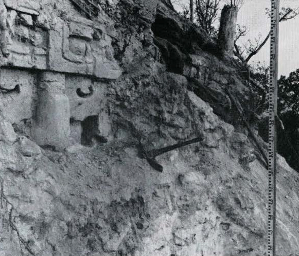
Here late-period masonry terracing buried most of the sculptured upper zone of the early-period building under a thick protecting mass of lime-concrete. Twelve clays were spent here, following Anderson’s lead into a sizable portion of this ancient concrete. Plate XI, Fig. 2 shows some of the earlier plaster sculpture emerging from it.
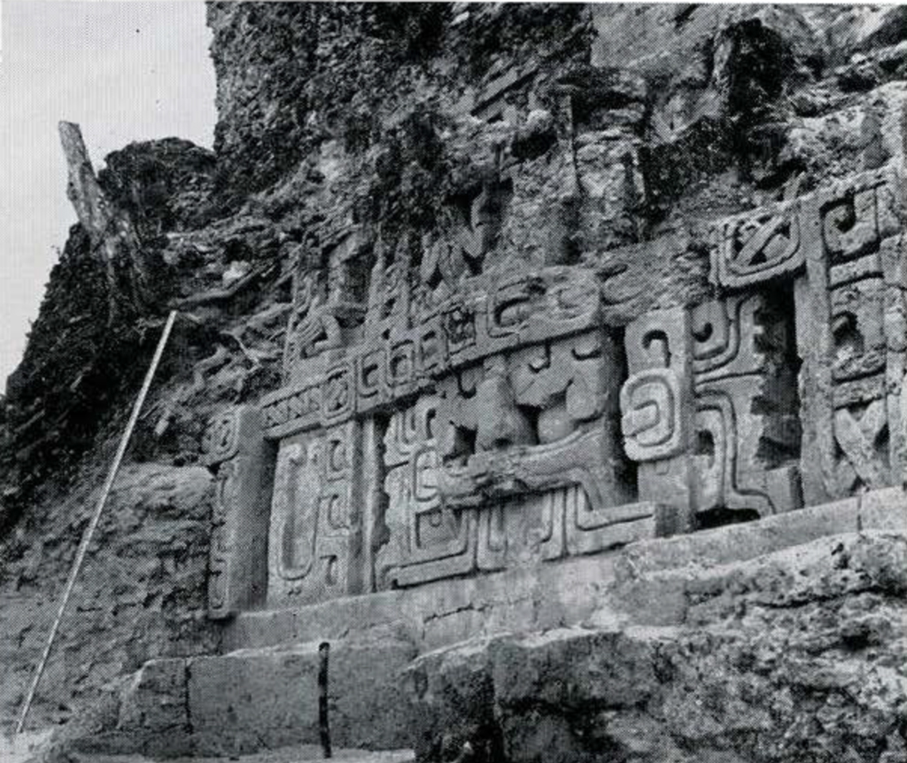
For a proper appreciation of this ancient work of art, we need restoration drawings showing the relation of the design to the whole building. As this is written, Mr. Paul Beidler, the well-known architect of Easton, is at work for us, thoroughly recording what was found. He will provide better data than I was able to gather in the few days available before the rains caught me. In the meantime I shall let Figs. 1 and 2 of Plate XII more or less speak for themselves.
The grotesque deity mask is in the lower of two principal bands, and rests on a cornice-like “medial molding.” The plain vertical wall of the building, with a doorway below the mask, is hidden behind our dump. The height of the two bands of sculpture and a hard-to-see minor upper one is 3.10 meters (10.17 feet).
The sculpture to be seen in Fig. 1, Plate XIII, is the largest satisfactorily preserved example of modeling in plaster on any known Maya free-standing building. Yet it is only about a third of what would be revealed by complete excavation on this east side. There is little doubt that these sculptured bands ran clear around the other (now fallen) sides. The total area covered must have been over 2500 square feet. This at a rather small provincial-looking “Class 4” site!
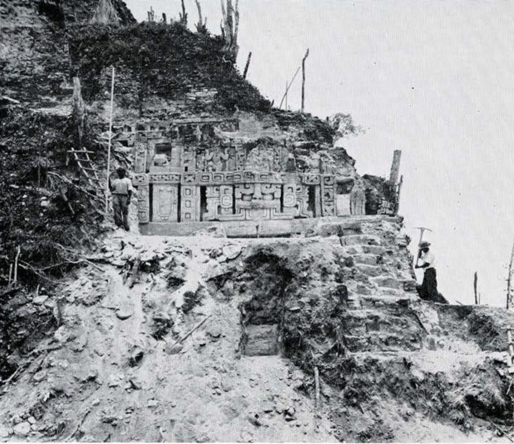
Image Number: 241185
CARACOL
Like Cahal Pech, the Benque Viejo ruins are very close to permanent roads and towns. The third site at which I worked provided strong contrast in this regard. Caracol lies near the southwestern corner of the Cayo District among uninhabited limestone hills, blanketed by tropical rain forest. No one comes here except woodcutters and chicle bleeders, and it was discovered by Rosa Mai, an Indian mahogany cutter. At that time-1938-Mr. Anderson was in charge of the Jubilee Library at Belize. To investigate, on behalf of the government, he and Mr. H. B. Jex of the Forest Department made the then difficult journey and spent three clays at the new ruins.
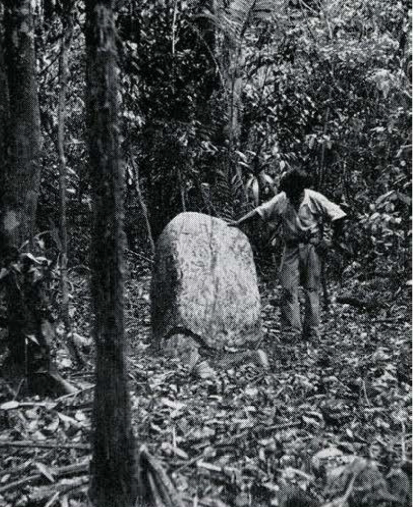
At that time he saw eight stone monuments (or what are now known to be fragments of monuments), including three carved ones-a standing but nearly buried stela, and two ovoid flat altars at the surface. He noted many large and small mounds, and portions of standing walls and vaults in two of them. In one of these there were three wooden lintel beams, well preserved and still in place, and he excavated this doorway. Getting a sample of this ancient wood for “Carbon 14” elating was my prime reason for going to this place, but naturally I planned to excavate the carved stela, hoping for an inscription.
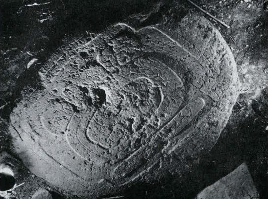
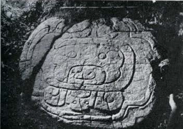
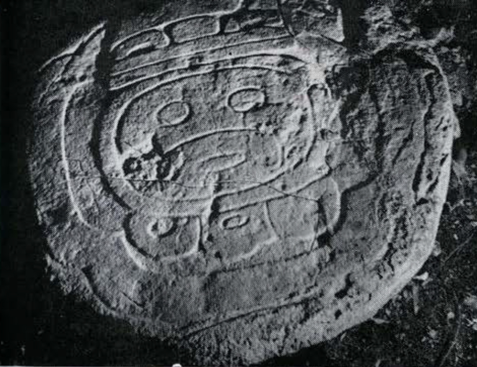
The big altars were also very intriguing. Each was known to be carved to show a gigantic stylized face. This is the hieroglyph meaning Ahau, and Ahau is the name of the last day of a 20-day “week” of named clays close to the heart of the ancient magico-religious calendar system. If symbols meaning “Saturday” had been carved on stones measuring up to two meters in diameter, and if Saturday were considered lucky or the reverse, by an official church, we would have a rough analogy in terms of our own calendar. Nothing like these enormous Ahau-glyphs had been found before, though plain and carved altars are common enough.
Two weeks were allowed for the job. Anderson not only guided me to his finds but remained to help excavate. So much more was found that I stayed till the food gave out, another week. The site is a large and important one architecturally. Mapping, excavating, and photographing monuments took up most of our time, so we do not yet know just how large it is. It can be said that there are at least five large courts of major ceremonial buildings, including temples, palaces, and a ball court. There are at least three groups of small mounds perched on the tops of high hills. At the bases of hills a great deal of land has been leveled by broad terracing. Vestiges of two raised ceremonial roads suggest existence of major architectural groups as yet unseen. In reaching those containing the known monuments, we passed through a mile and a half of this sort of thing. On our recommendation, six square miles have been set aside as an archaeological reserve by the government. While this allowance may be over-generous, Caracol is probably a “Class 2” site, and undoubtedly it is the largest yet found in the Colony.
The list of monuments grew from eight to thirty-two during our stay, this without much systematic search for more. Some are complete, some extremely fragmentary, some rather well preserved, some in advanced stages of erosion. All are of limestone except Stelae 4 and 15. Those are of grey slate which probably was brought from some distance.
Of the 32 known pieces, 22 were carved, two may have been carved, and eight were certainly, or probably, plain. If designs and inscriptions were painted on these latter, weathering has destroyed them completely. The surely carved group consists of 13 stelae, seven altars, and two unclassified forms. Twelve of these units are considered worth preservation by removal, either for aesthetic or scientific reasons, or both.
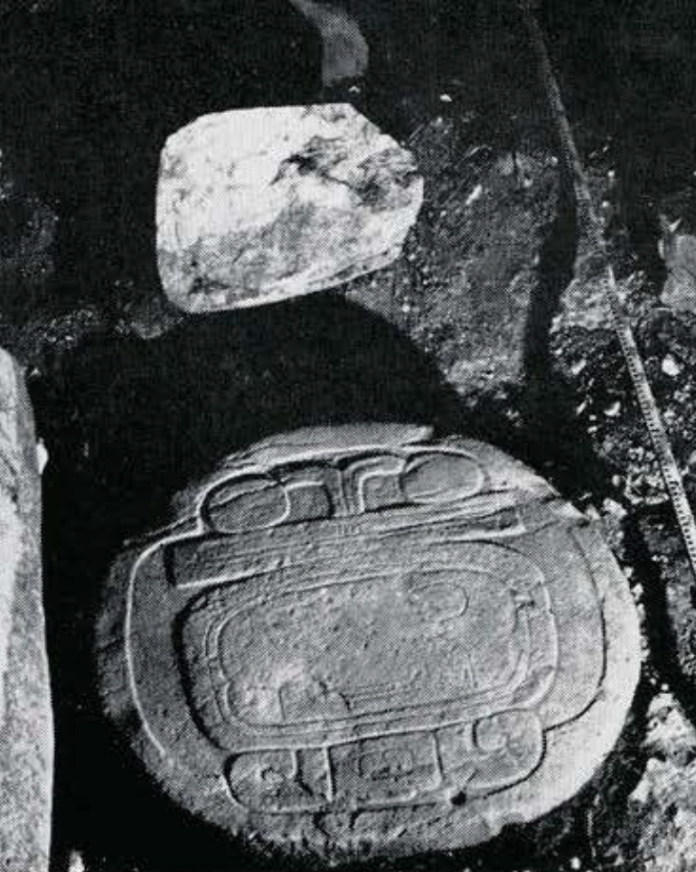
Nine of the carved monuments can be elated in the Maya “Long Count” calendar with certainty or near-certainty, and a tenth can be dated within limits, as in the tabulation below. The dating of seven of these, the altars, is actually given in “Short Count” style. This is a unique thing for Classical Maya monuments-a discovery of considerable theoretical and practical value. Plates XIII, Figs. 1-3 and XIV, 3-4 have been selected to demonstrate the existence of this method of elating at Caracol. This requires some reasoning which a reader may skip by turning to page 32, third paragraph.
Our 1950 work raised the number of known altars carved with Ahau faces from two to seven and-an important addition-showed that each face is associated with a number less than 14. The numbers are written in the ancient Maya “bar-dot” style, in which each dot counts as 1, and each bar as 5. Ornamental elements are not counted, so that above the face in Fig. 1 of Plate XV, we have two bars and one dot, the whole reading “11 Ahau.” In Figs. 3 of Plate XIII, 4 of Plate XIV and 2 of Plate XV, we have 5 Ahau, 2 Ahau, and 7 Ahau respectively. The Maya, unlike ourselves, ran more than one week at the same time. These combinations of numbers and names are “week-dates.” The varying numbers state varying positions in a week of 13 days, which were numbered from Day 1 to Day 13. Numbered days of this shorter week had been selected on some principle which required each of them to coincide with the last day of the longer week of named clays. We know this because they are all combined with Ahau.
Certain consequences follow inevitably from the simultaneous use of these two weeks and the habit of combining the current position in each. Though the day number repeats every 13 days, and the day name repeats every 20 days, the same combination repeats only every 260 days. As a matter of mechanical necessity, the day 5 Ahau of Altar 1 could be either 180 days later, or 80 days earlier than the day 7 Ahau of Altar 7; but it may also have been earlier or later by those numbers of days plus any multiple of 260 days. The problem is to show why the 7 Ahau altar elate is 180 plus 27×260 days (i.e. a total of 7200 days) earlier than the 5 Ahau altar date.
We suspect that this is so at once because we know that when the Spaniards conquered the Maya of northern Yucatan in the 16th century, those Indians were counting time by various measures, among them a sort of artificial year of 360 days called tun. These were numbered, and twenty of them made a katun of 7200 clays. For a vague analogy the katun may be compared to our decade, though it was nearly twice as long, and in those late times was not counted with numbers. Each katun was distinguished from the one before and after it by the week-date on which it ended. This week-date determined the fate of the whole katun, and was a natural name for it. The mechanics are such that a Katun 7 Ahau was followed by a Katun 5 Ahau and a Katun 3 Ahau came next, and so on. Thus we read in a 17th century Maya manuscript that “Katun 7 Ahau is the third katun . . . Understanding is lost, wisdom is lost . . . Katun 5 Ahau is the fourth katun . . . Men and women have few children … (while in Katun 3 Ahau) There are rains of little profit . . . there is fighting; there is a year of locusts . . .”
The name of the katun always contains the day-name Ahau, but from katun to katun the day-number drops by 2 until, after 13 katuns (260 tuns or “years”) it repeats, starting another cycle. The complete cycle of katun-naming day-numbers (each being the day-number which comes up with day-name Ahau at the end of a katun) runs 13-11-9-7-5-3-1-12-10-8-6-4-2. Each number told the priest where in his books he should look for the prophecy of the particular katun concerned. Presumably, as the series of katun names began to repeat after 260 “years,” the series of their differing fates began to repeat. The comparative shortness of this period has led to the term “Short Count” as a label for dating in terms of this katun cycle.
It has been suspected but never proved that Short Count dating coexisted with the better known “Long Count” in the ancient period of the Classical Maya monuments. In this latter system the count proceeds from a fixed mythological point of time more than 3000 years in the past; hence the term “Long Count.” This system also involves tuns and katuns ending on days Ahau, but katuns, as well as tuns, are counted with numbers, and twenties of katuns form a still higher unit, which we call baktun (meaning 400 tuns).
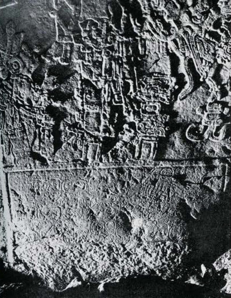
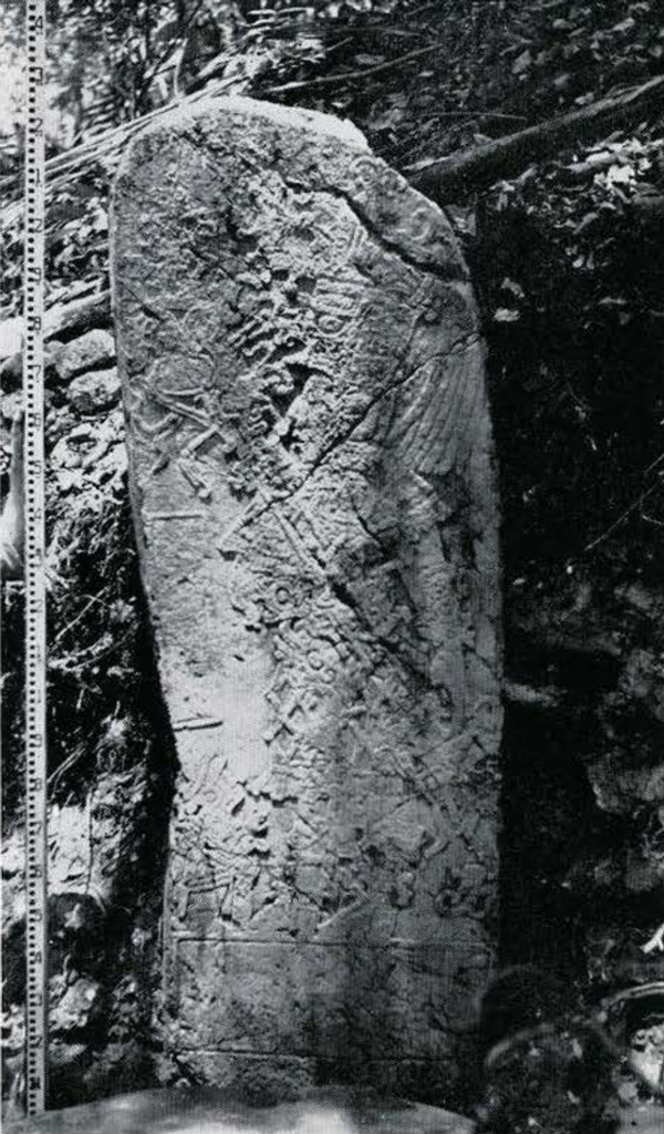
The Long Count date was recorded on stone by numbers and glyphs forming “Initial Series,” so called because they normally begin the inscription. One of these appears, none too clearly, on Plate XIV, Fig. 1. With perfect lighting all signs and numbers would appear clearly. We transcribe them as 9.8.0.0.0 5 Ahau 3 Chen, which means that as of this date 9 twenties of katuns and 8 more katuns had elapsed since the chosen starting point, but no additional tuns, twenties of days or days single days had passed. So this puts us at the end of a katun. We are also told that the week-date was 5 Ahau, and that the year-date was the 3d of the month called Chen. A day later the record would have been 9.8.0.0.1 6 Imix 4 Chen. In like manner, the week and year dates would have been given for any other clay not at a katun-end. Hence, so far as we can tell from the stela alone, the record of 5 Ahau may be a routine statement. We do not know for sure that this 5 Ahau named the katun. That is already distinguished from all others by numbers-it is the 8th katun which has ended after the 9th baktun ended, counting from the same point of time in the past which was used as the base for nearly all such counts.
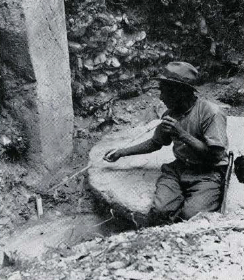
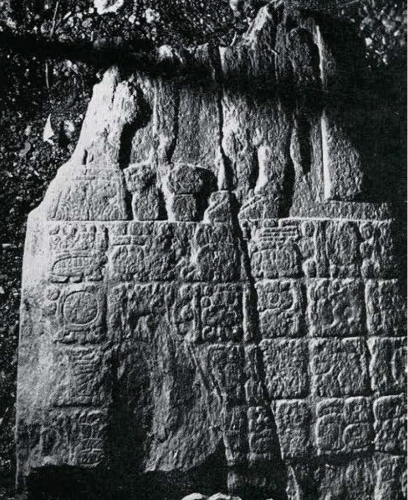
However, let us look at Plate XIII, Figs. 1-3. They show that Altar I was placed directly in front of Stela 1, and excavation shows that they were in use together. We must explain why it is the particular week-date on the stela, 5 Ahau, which we find at gigantic scale on this particular altar. We do not find the glyph for “katun” on this or the other altars, but then neither do we always find the word “katun” before the katun name in the post-Conquest Maya writings. The use of the Short, as well as the Long Count, at Caracol is an adequate explanation of the altar, and I know of no other. The altar, as well as the stela, is then a “katun-marker,” carved to commemorate the passage of one of these periods, in this case Katun 8. The other similar altars must then also be katun-markers since they are a unique feature and all presumably have a single explanation.
It is fortunate that we have Long and Short Count markers for one particular katun, since a katun name of the Short Count repeats every 13 katuns. Thus, arithmetically speaking, our 2 Ahau altar might refer to the katun of that name ending 8 katuns after our 5 Ahau katun, or to another of that name ending 5 katuns before our 5 Ahau katun. Since we know from the stela that our 5 Ahau is at 9.8.0.0.0, these possibilities can be translated into Long Count terms-9.16.0.0.0 2 Ahau or 9.3.0.0.0 2 Ahau. Stylistic details, such as the pinching-in at the sides of the faces on both altars, enable us to choose the earlier Long Count position with assurance, though we did not expect so early an occupation at this site.
The stela of the 2 Ahau altar is illegible, but by means of the altar we can date its carving-a priest with “ceremonial bar”-as at 9.3.0.0.0. The same general design appears a hundred years later, on Stela 1 (Plate XIII, Fig. 2).
Museum Object Number: 51-54-4
There was originally a slate stela behind the 11 Ahau altar, and very likely the slate fragments of Stela 15 are from this stela. It was broken up by the Maya and the fragments buried in fill when the 7 Ahau altar was placed. The Initial Series is in very bad shape, but, along with most of the supplementary moon series, it can be reconstructed with assurance. It was 9.4.16.13.3 4 Akbal 16 Pop, Glyph G2, Moon Age 7 or 8, Moon No. “O,” Glyph X2. Glyph A probably was present but scaled off. The inscription consisted of at least 74 blocks, some of these with two glyphs, but little more can be made out. Very likely a “contemporary” date was among them. This may have been at 9.5.0.0.0, the katun undoubtedly marked by the 11 Ahau altar. In any case, in view of the quite early Initial Series of Stela 15, the 9.3.0.0.0 position for the 2 Ahau altar imposes no strain on our credulity.
Erosion leaves some doubt as to readings of two altars not illustrated, but almost certainly they account for Katuns 13 Ahau and 12 Ahau between them. The damage is such as to raise doubt as to which is which. However, differences in size and position at the site seem to justify the assignments in the tabulated list. Otherwise it is felt that further knowledge will not require drastic changes in the latter. Digging out the buried base of Stela 3 (Plate XIV, Fig. 2) may add a more precise dating for that monument.
Curiously, the 9.3.0.0.0 position of our Short Count 2 Ahau katun is precisely one baktun (400 “years”) before the presumed contemporary date of the only previously known monument which implied coexistence of Long and Short Counts. That is the famous Initial Series lintel at Chichen Itza, and the evidence for a Short Count on it involves acceptance of a special “New Method” of reading dates in that region proposed by J. Eric S. Thompson. Our altars go far toward validating his method and readings.
They also provide satisfactory instead of spotty evidence for the theory that habitual marking of the ends of time periods was first applied to the katun. They argue for a single fatalistic attitude toward this katun-period from first to last, and hence for an unbroken count of the katuns themselves, though the Long Count of them ceased to be recorded on stone at the end of the Classical Period. Thus, they tend to raise one’s hope for eventual settlement of the argument as to how to correlate the Long Count dates with European dates.
The 11 Ahau and 9 Ahau altars were stone tables on legs, but apparently the floor level was raised so that eventually these pieces appeared as great slabs lying on the concrete floor, or perhaps partly imbedded in it. We are fairly sure that this was the actual and original situation with the 7 Ahau altar, which seems to have lacked legs. In all cases the large altars have kept the forest from disturbing the floor material below them. Excavating here should produce maximum results in correlating ceramic types and ceremonial deposits with precise Long Count dates. Incomplete but restorable portions of two handsome jars, with thorny oyster shells from the Pacific, were found below the 7 Ahau altar. Yet they were broken and disturbed by some unknown cause. Perhaps one should not count unhatched chickens.
Museum Object Number: 51-54-8
Some years Caracol was not so isolated as when we went in. A logging road reached the edge of the ruins, and a “pass” for trucks led directly over the early 2 Ahau altar. Fortunately it was covered by a few inches of soil. Once the best logs were out, the network of temporary roads and passes began to wash out, and bush moved in again. But while we were there an operator, Mr. L. M. Sylvestre, returned for smaller trees. It seemed strange on the return journey to ride our mules without ducking branches on a road which had been smoothed by bulldozers. Anderson had already guided to the ruins a second party consisting of His Excellency the Governor, Sir Ronald H. Garvey, Lady Garvey, and the Private Secretary, Major C. V. C. Herbert. They came from the coast at Belize to the edge of the site by car, and returned the same day. For a year or two more it will be comparatively easy and cheap to rescue Caracol monuments by removing them. Then the big machines will leave and the roads will disappear for a generation.
Considering this fact, together with the inadvisability of starting a long-term program like the housemound project during such unsettled conditions as have developed since the spring of 1950, it has been decided to postpone the latter and to return to Caracol in 1951. I hope to be there before this is printed, to find more monuments and to bring out at least a fair sample of them.
L. S., JR.
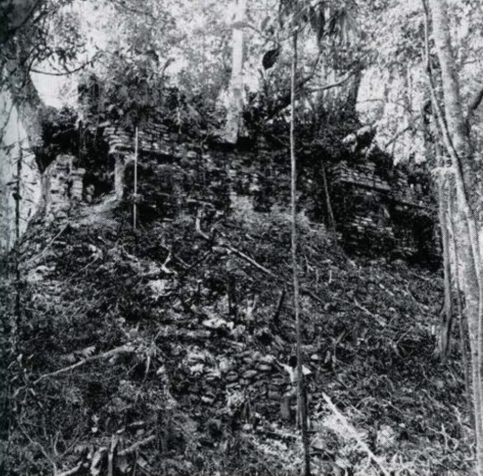
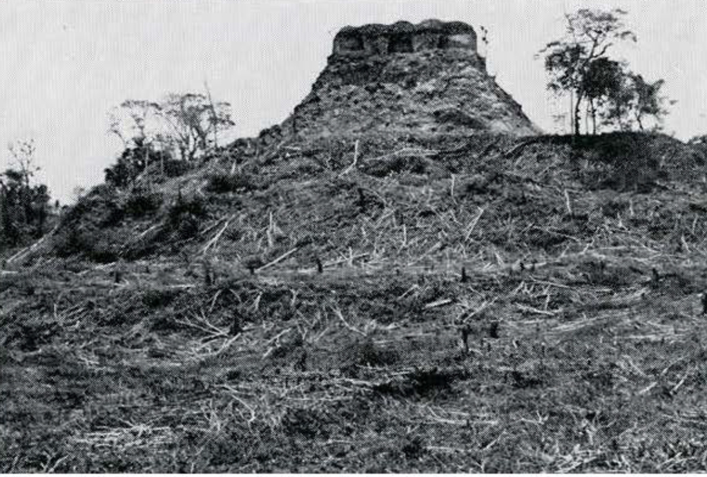
Image Number: 241184

