Site Conservation at Gordion
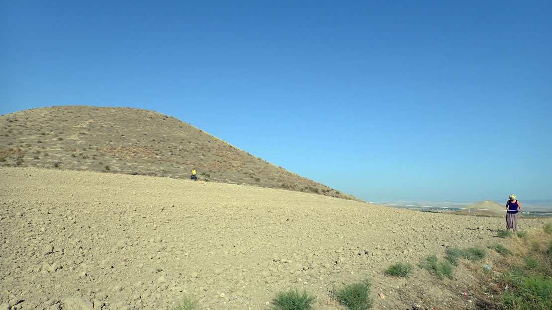
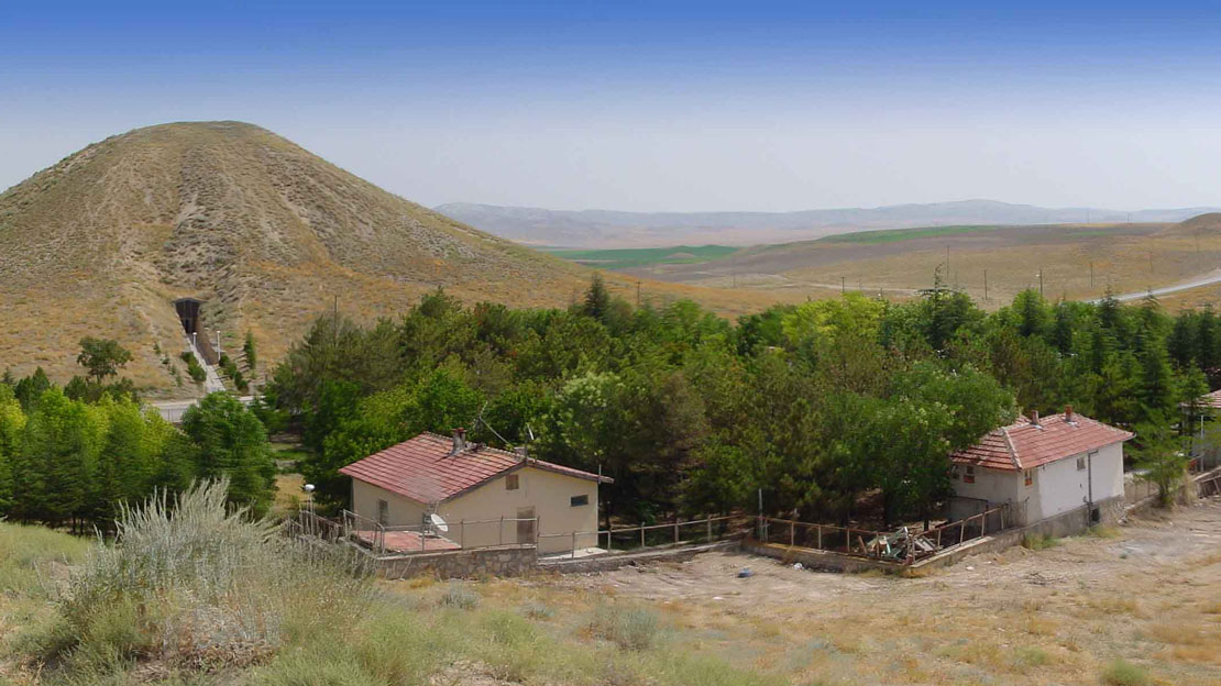
Large sections of Gordion are registered as a first degree protection zone according to Turkish Antiquities Law, a status that attests to the site’s five–millennia–long settlement history. In addition Gordion is being considered by Turkish authorities for nomination to UNESCO as a World Heritage Site. Despite the monumental remains revealed by extensive archaeological excavations, its location in a unique and irreplaceable landscape, and its remarkably rich history, Gordion has failed to capture the imagination of the local population. While only an hour away from Ankara, few visitors make the journey to the site. This lack of visitors is the result of a number of different problems. Chief amongst them is the absence of proper facilities and public interpretive media, a situation compounded by the fact that the visible remains at the site do not present their best, the consequence of piecemeal site conservation work throughout the years. The “Gordion experience” thus falls short of its potential. Furthermore, agricultural development in the region has prompted changes in the character of the rural settlement that threaten large portions of the site, in particular many of the tumuli, one the most prominent features of the site’s landscape.
A number of new initiatives in recent years have sought to address these issues. Since 1998, site conservation has been a key priority of the Gordion Archaeological Project, and starting in 2006 a team of specialists directed by Frank Matero from the University of Pennsylvania School of Design (Penn Design) has been working on site, developing new approaches to the conservation, stabilization and presentation of the Citadel Mound and its architecture. Another initiative, the Conservation Management Plan Project (CMPP), a 5-year program, was launched in 2007 as a joint effort between Penn Design, the University of Pennsylvania Museum of Archaeology and Anthropology (Penn Museum), and the Faculty of Architecture of the Middle East Technical University (METU) in Ankara. In 2009 these institutions were joined by the Scientific and Technological Research Council of Turkey (TÜBITAK) which endorsed and partially funded the program.
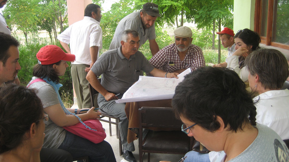
The project’s general goal is to preserve and promote the extraordinary archaeological and cultural resources of Gordion and its ancient and modern environs through the documentation of the cultural landscape and the definition of sustainable conservation practices for the site. Work towards this goal is being carried out by a multi-disciplinary team of specialists that includes Professors Evin Erder and Nimet Özgönül of the Graduate Program in Restoration at METU; Dr. Ayşe Gürsan-Salzmann, archaeologist/ethnographer at the Penn Museum, and Assistant Director of the Gordion Archaeological Project; Dr. Naomi Miller, archaeobotanist at the Penn Museum; Yaşar Irak, cartographic engineer at Irak Mühendislik in Polatlı District; Mecit Vural of the Department of Biology at Gazi University, Ankara; students from METU and Penn Design; and members of the Gordion Archaeological Project. The program also seeks to integrate the local residents into the conservation and presentation of Gordion, especially by means of educational and cooperative activities. Most closely involved are the inhabitants of Yassıhöyük, the modern village at Gordion comprised of 80 households—totaling nearly 400 people. Most of these people are members of a farming-herding community, which has been studied since the 1990s by Gürsan-Salzmann as part of a detailed ethnographic survey of village economies.
The geographical scope of the CMPP incorporates the area within a 30 km radius from Yassıhöyük village. The key priorities of the project are the conservation of the tumuli at Gordion and its environs, and in particular to protect these from the damaging effects of modern agricultural activity, especially plowing and the irrigating of nearby land. This could be achieved by compensating landowners with alternate lands and/or funds, administered by the local District offices and the Ministry of Culture; the survey, documentation, and evaluation of Yassıhöyük’s architecture, as well as the socio-economic statuses and the historical, socio-cultural, and ecological values of its inhabitants (later to be extended to other villages within the project’s area, namely, Çekirdeksiz, Kıranharmanı, Sazılar, Şabanözü, and Beylikköprü); and, lastly, the development of educational programs to increase local awareness of the range of cultural resources in the area, and the provision of information and training to enable local people to present the site and its environs to the general public.
Between 2007 and 2010 the team has documented and mapped landscape features of cultural value within the survey area including tumuli, ancient settlement mounds (höyüks), villages, cemeteries, transportation routes old and modern, natural caves traditionally frequented by locals and shepherds, a century–old mosque, mudbrick and timber architecture, and an inscribed Late Roman tombstone. The buildings and open spaces in the aforementioned six villages have been planned and documented and standardized questionnaires have been distributed to a sample of each village’s population in order to document the socio-economic status of households and the villagers’ intellectual and emotional associations with Gordion.
In 2012, policies will be articulated and proposed to the Mayor’s offices of the Polatlı District, and to the Ministry of Culture and Tourism. Also, in 2012–2013 the Conservation Management Plan for Gordion and its environs will be presented to all stakeholders, the Penn Museum, Penn Design, Polatlı District, the Ministry of Culture, the Antiquities Department, and the local village communities. This plan will address priorities for future research at the site, current plans for the development of improved visitor facilities, and educational tools to enable local villagers to act as guides to the site and the museum. One of the planned initiatives which was launched in 2011 consists of the formation of a cooperative, run by the local women, which facilitates their involvement in the production of handicrafts and foodstuffs from their own garden crops for sale to visitors. Another initiative is centred on the preparation of printed pamphlets and audio-visual materials for the local museum, and clear signage for the visitors’ circuit at the site. These materials are being developed jointly by members of the Gordion Archaeological Project and education experts from the Museum of Anatolian Civilizations in Ankara, and aim to enhance public comprehension of Gordion and its importance as an integral part of the modern village and its environment.
Further Reading
- Gürsan-Salzmann, A. 2005. “Ethnography Lessons for Past Agro-Pastoral Systems in the Sakarya-Porsuk Valleys,” in The Archaeology of Midas and the Phrygians. Recent Work at Gordion, ed. L. Kealhofer, Philadelphia, pp. 172–190.
- Gürsan-Salzmann, A. and E. Erder. 2010. “A Conservation Management Plan for Preserving Gordion and its Environs,” Expedition 52.1, pp. 4–7.
- Keller, M. and Frank G. Matero (eds.) 2011. Gordion Awakened, Conserving a Phrygian Landscape. Penn Design and Penn Museum, Philadelphia.
- Penn Design Architectural Conservation Laboratory